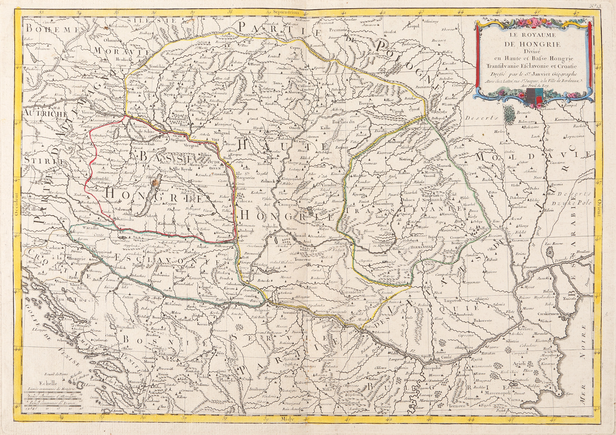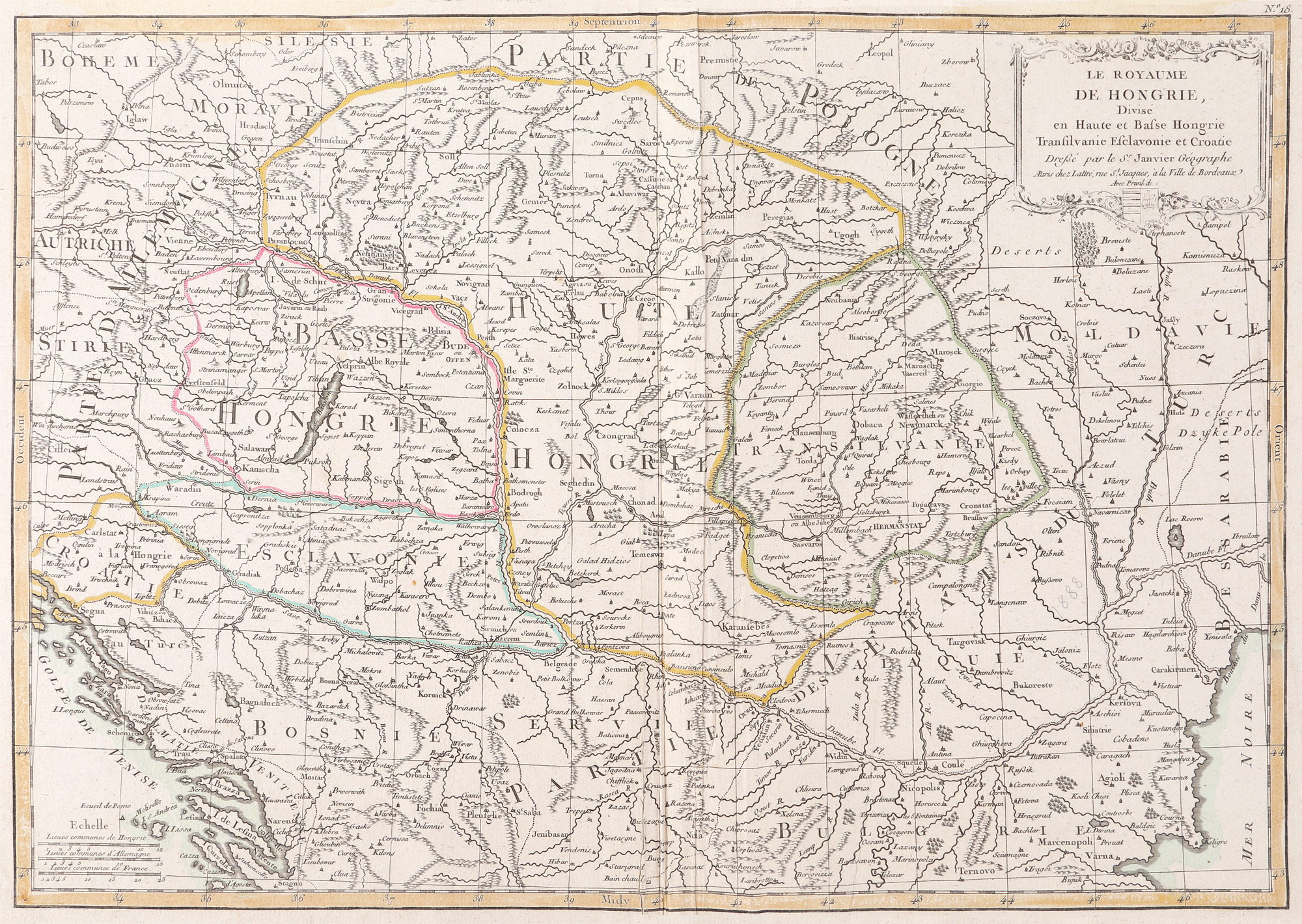
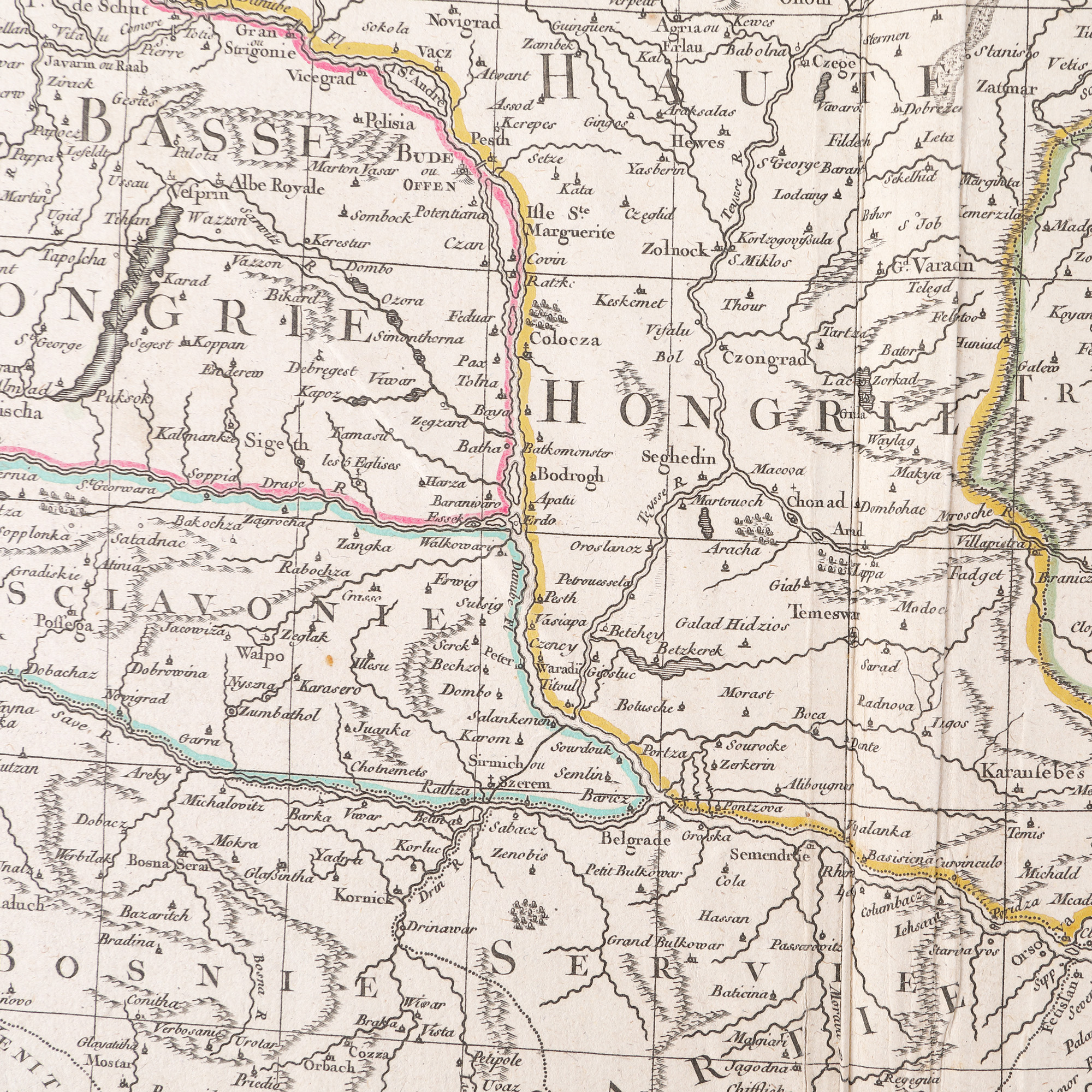
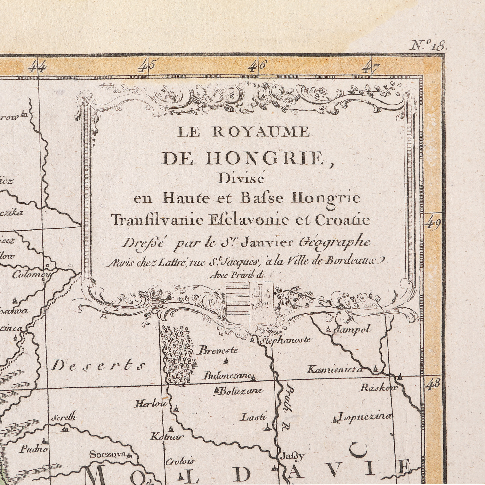
320. "Kingdom of Hungary divided into Upper and Lower Hungary map, Transylvania, Esclavonia and Croatia" by Jean Janvier, 1770
Prodajna cijena
EUR 300
Sesija
Pet., 31 ožujka 2023 12:00
Dimenzije
width 51 cm, height 36 cm
Opis
copper engraving, hand-coloured laid paper
DODATNE INFORMACIJE
Za pojašnjenja u vezi s postupkom licitiranja, troškovima kupnje, uvjetima jamstva, plaćanja i preuzimanja osvojenog lota preporučujemo da pažljivo pročitate/ponovno pročitate Pravilnik o licitiranju.
Za dodatne informacije o lotu i aukciji kontaktirajte Odjel umjetničkih savjetnika.
Detalii
DODATNE INFORMACIJE
Za pojašnjenja u vezi s postupkom licitiranja, troškovima kupnje, uvjetima jamstva, plaćanja i preuzimanja osvojenog lota preporučujemo da pažljivo pročitate/ponovno pročitate Pravilnik o licitiranju.
Za dodatne informacije o lotu i aukciji kontaktirajte Odjel umjetničkih savjetnika.
Dimenzije
width 51 cm, height 36 cm
Opis
copper engraving, hand-coloured laid paper
Alternativni lotovi
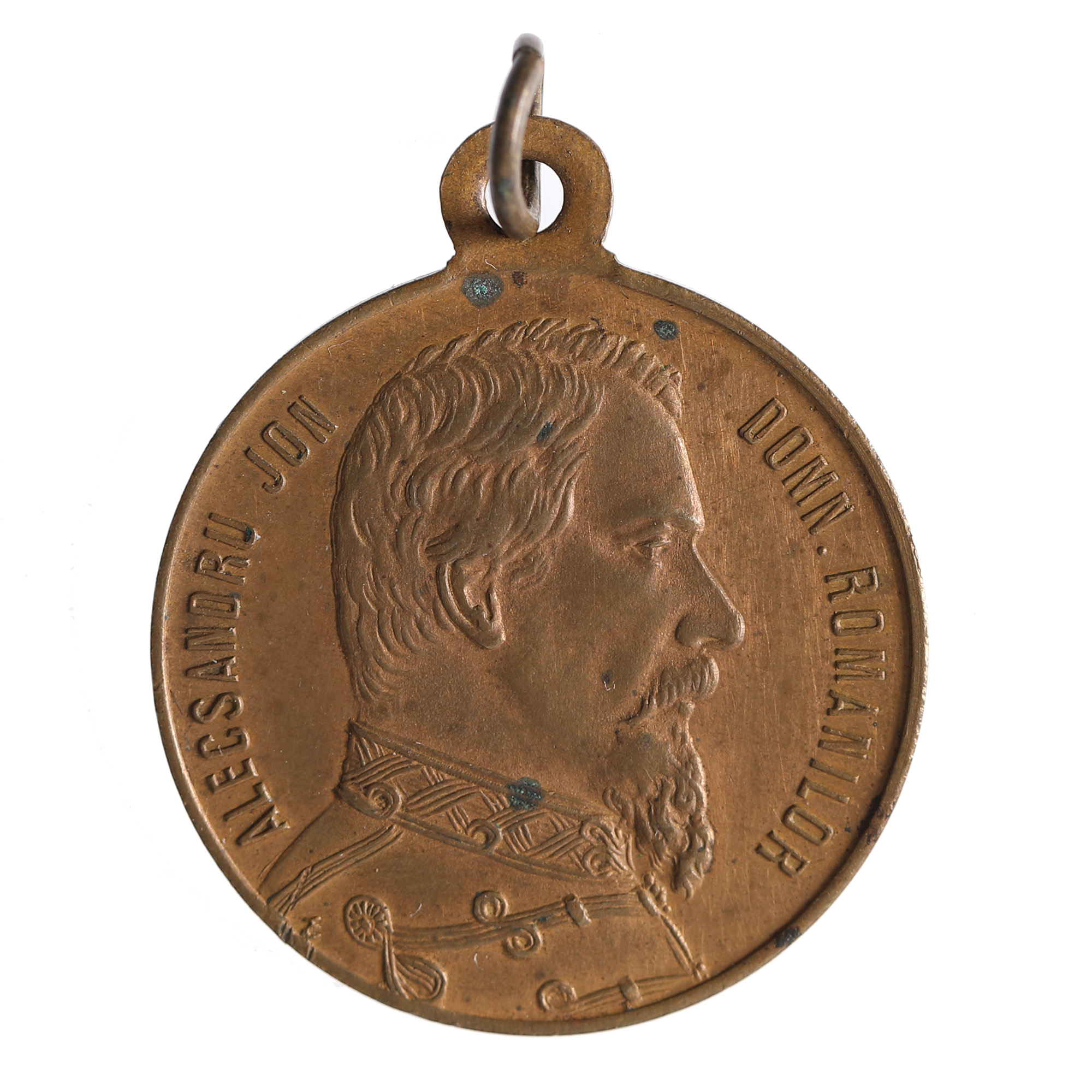
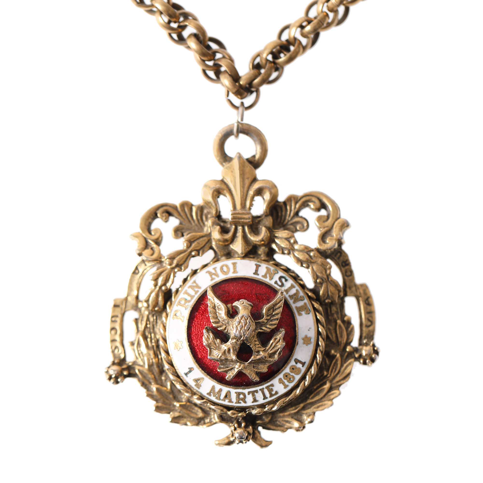
201. “Cuza Vodă" medal, issued on the occasion of the burial of the reigning prince in Ruginoasa in 1873
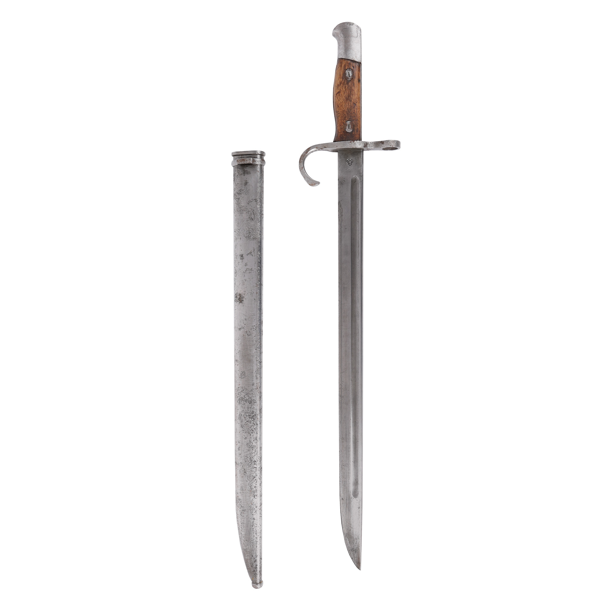
179. Arisaka rifle bayonet, with scabbard, model 30, Japan, first half of the 20th century.