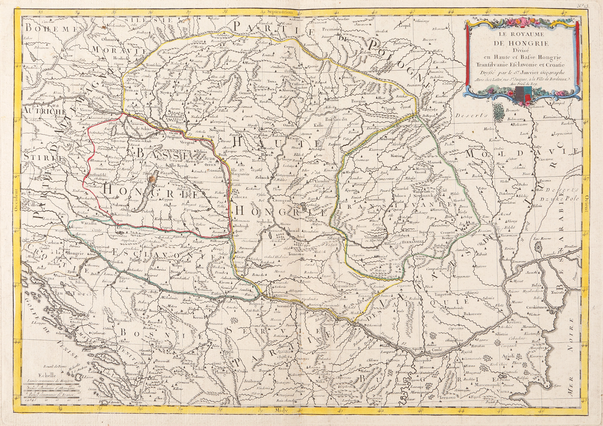
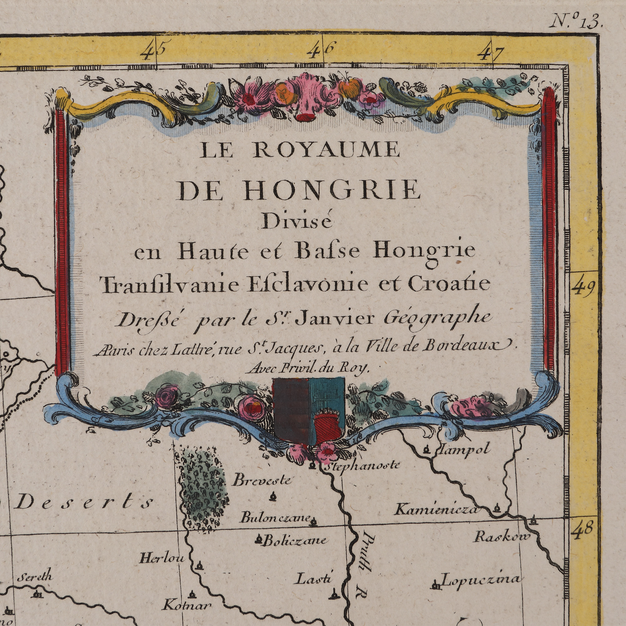
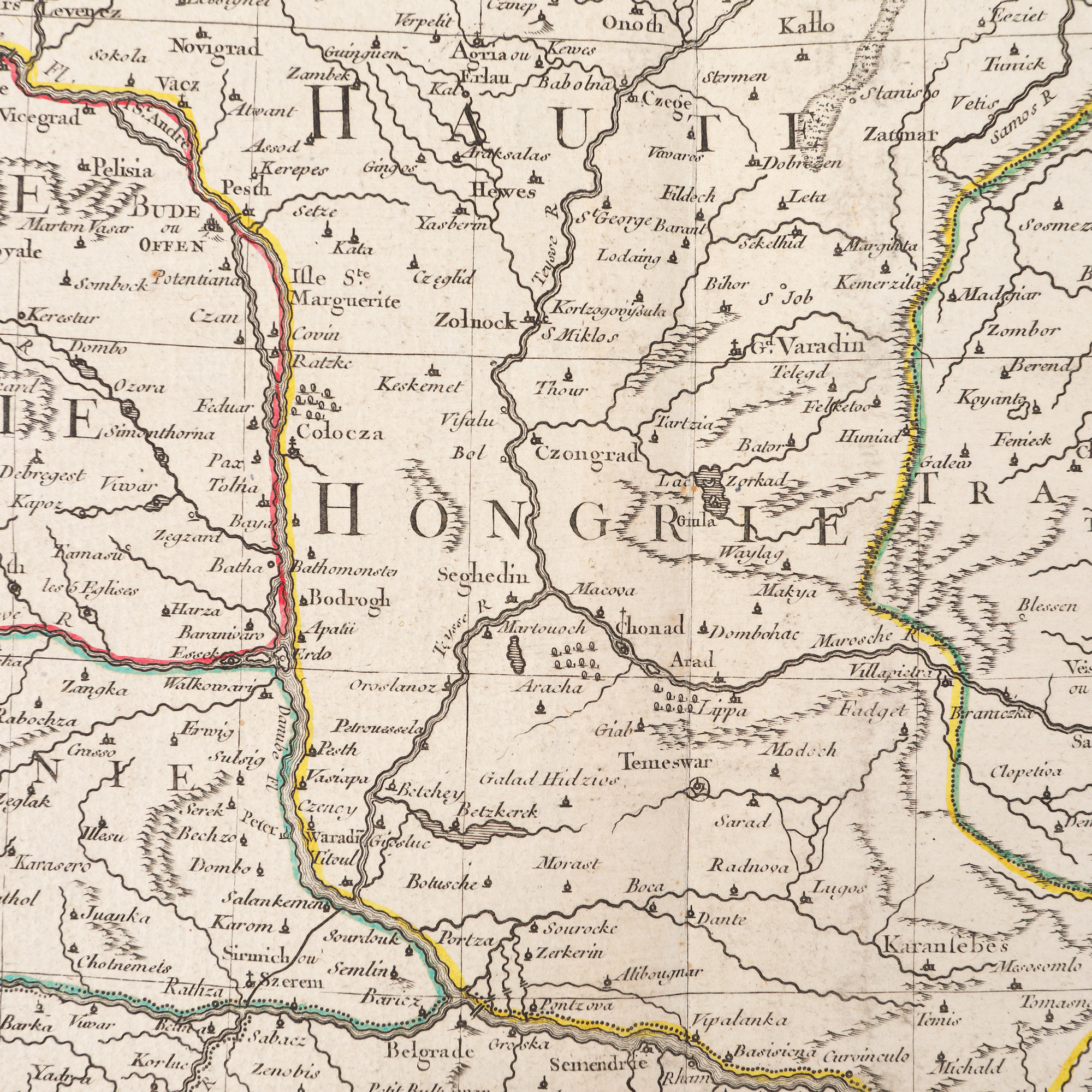
302. "Kingdom of Hungary divided into Upper and Lower Hungary, Transylvania, Esclavonia and Croatia" map by Jean Janvier, Paris, ca. 1780
Prodajna cijena
EUR 225
Sesija
Pet., 31 ožujka 2023 12:00
Dimenzije
width 38.5 cm, height 54 cm
Opis
copper engraving, hand-coloured laid paper
DODATNE INFORMACIJE
Za pojašnjenja u vezi s postupkom licitiranja, troškovima kupnje, uvjetima jamstva, plaćanja i preuzimanja osvojenog lota preporučujemo da pažljivo pročitate/ponovno pročitate Pravilnik o licitiranju.
Za dodatne informacije o lotu i aukciji kontaktirajte Odjel umjetničkih savjetnika.
Detalii
DODATNE INFORMACIJE
Za pojašnjenja u vezi s postupkom licitiranja, troškovima kupnje, uvjetima jamstva, plaćanja i preuzimanja osvojenog lota preporučujemo da pažljivo pročitate/ponovno pročitate Pravilnik o licitiranju.
Za dodatne informacije o lotu i aukciji kontaktirajte Odjel umjetničkih savjetnika.
Dimenzije
width 38.5 cm, height 54 cm
Opis
copper engraving, hand-coloured laid paper
Alternativni lotovi
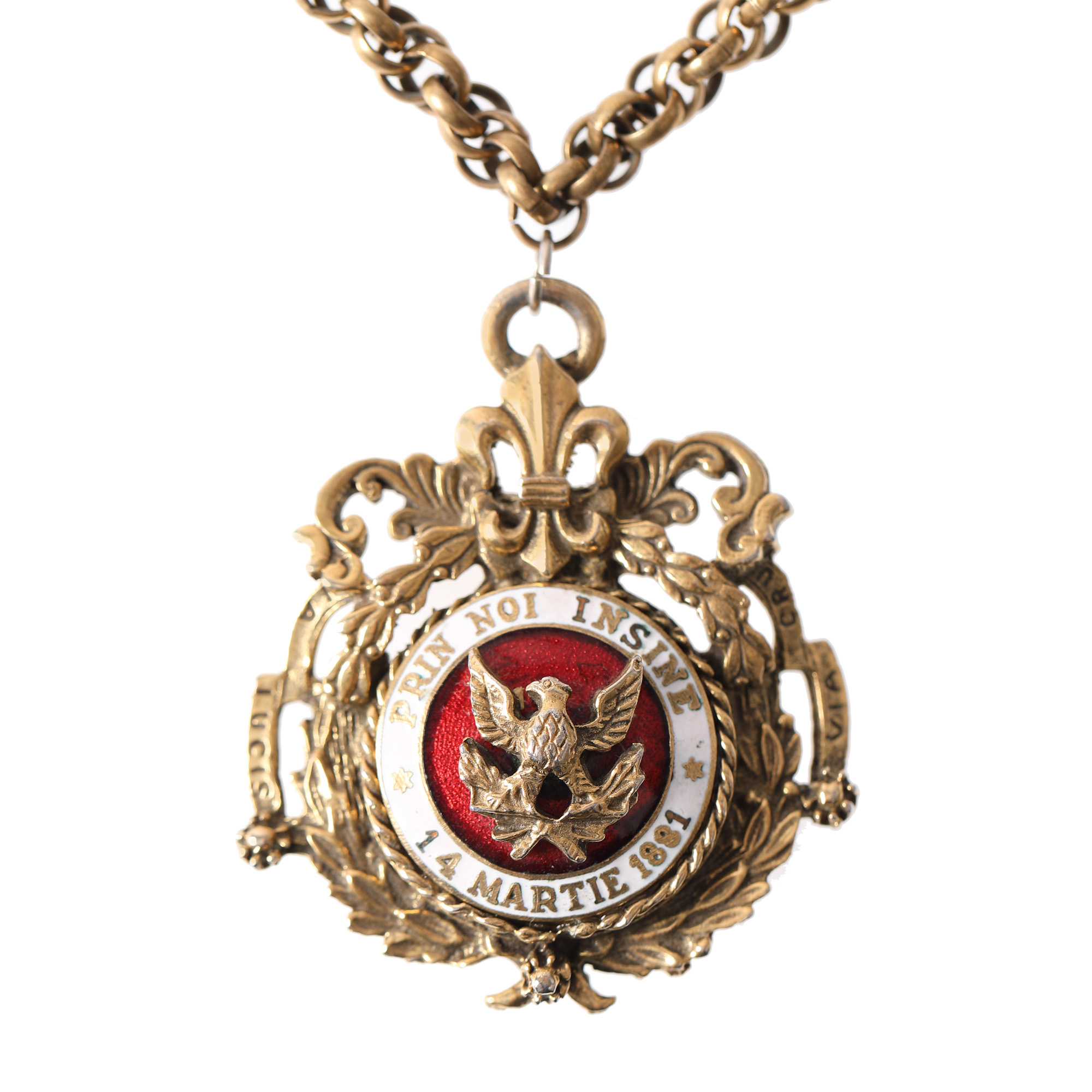
193. Pendant "By ourselves", March 14, 1881, marks the moment of the proclamation of the Kingdom of Romania