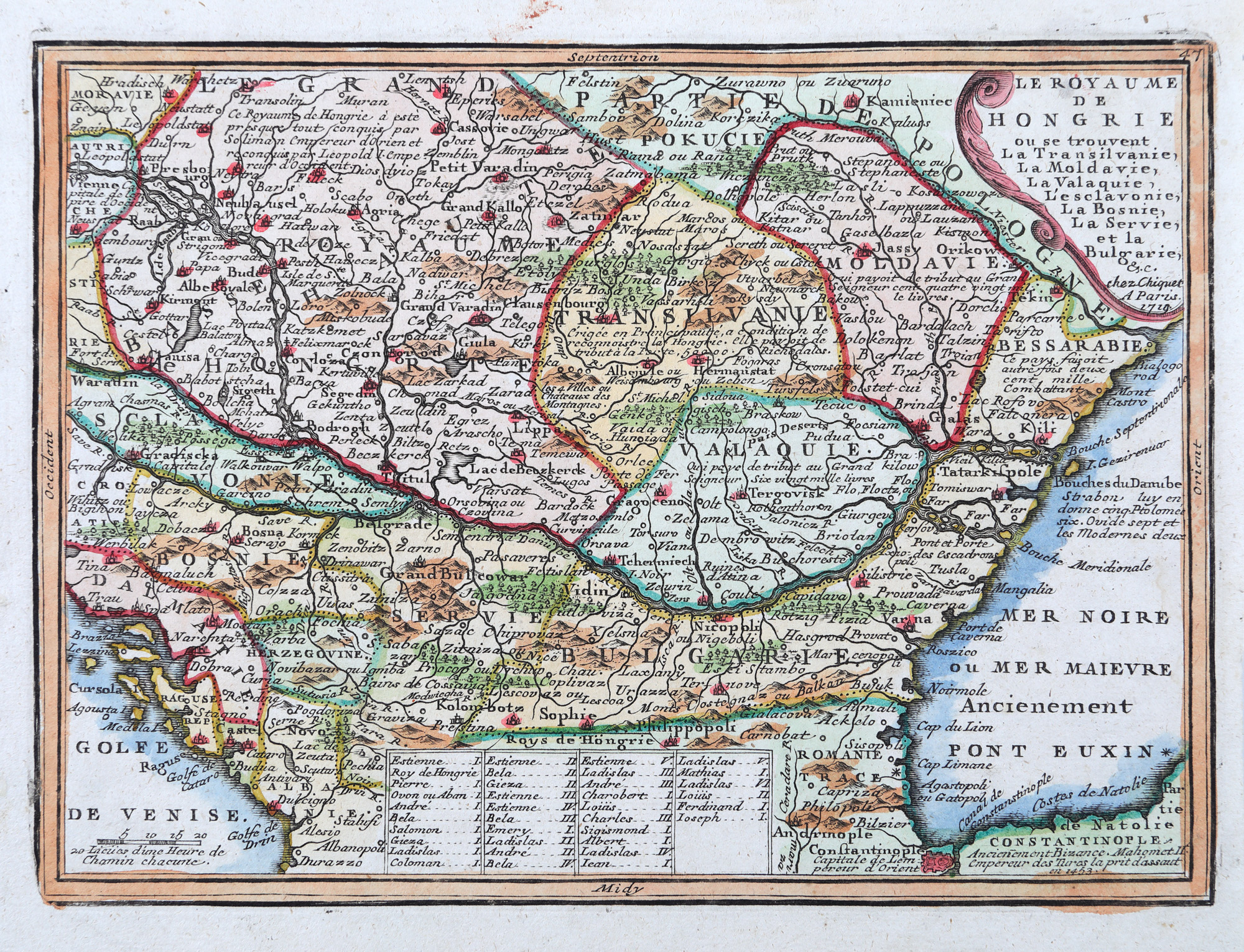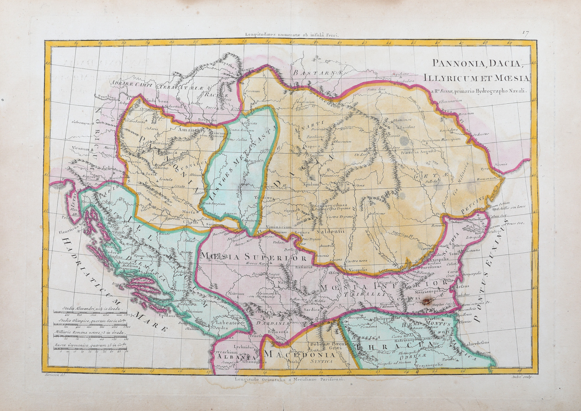
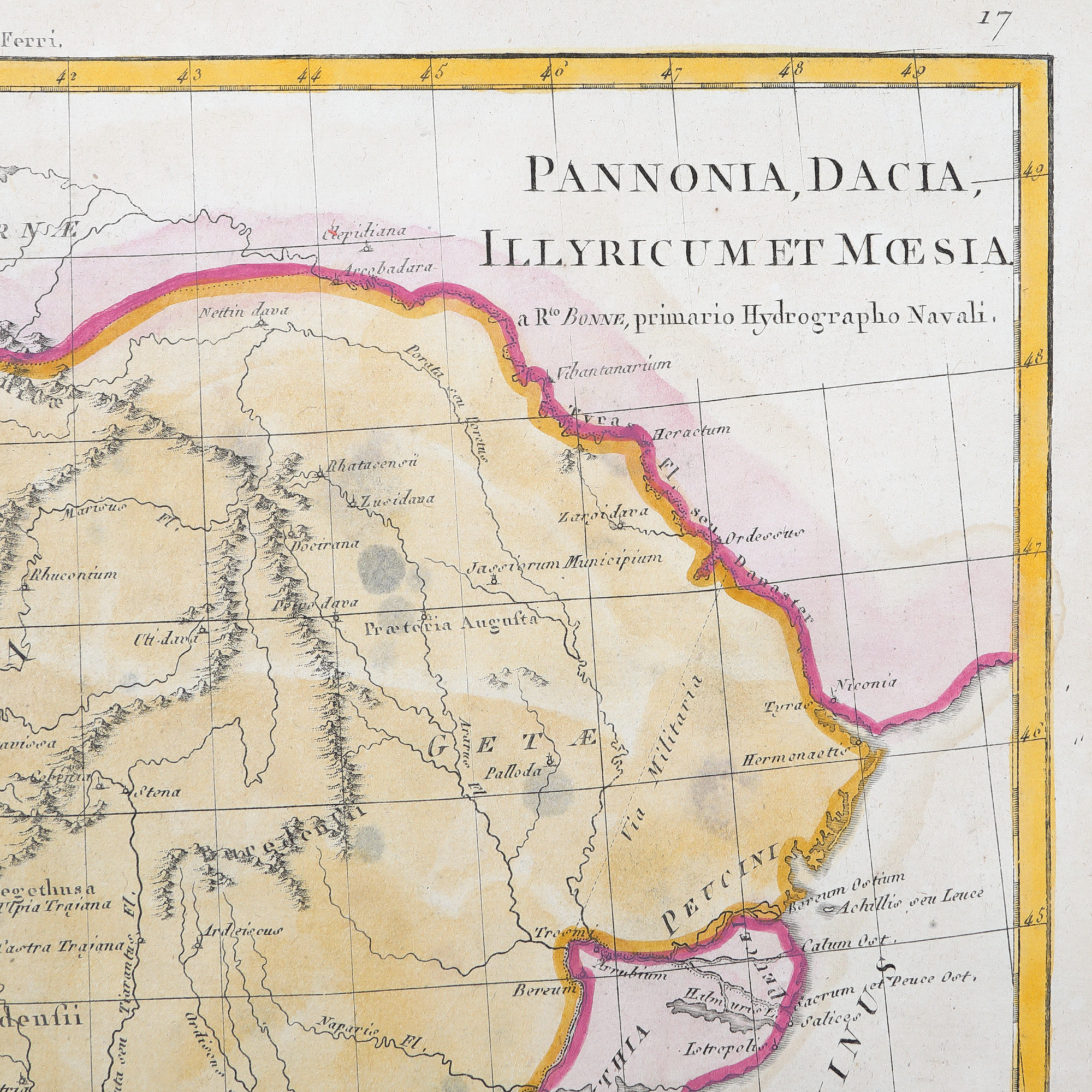
140. "Map 'Pannonia, Dacia, Iliria, and Moesia', by Rigobert Bonne, Paris, 1787"
Starting price
EUR 200
Sold
EUR 250
Session
Thu, 3 October 2024 19:00
Dimensions
custom 42 X 31 cm
Description
copper engraving, striped paper, manually colored
ADDITIONAL INFORMATION
For clarifications regarding the bidding procedure, hammer price costs, guarantee, payment, and collection terms for the winning lot, we recommend carefully reading/re-reading the Bidding Regulations.
For additional information regarding the lot and the auction, please contact the Art Consultants Department.
Detalii
ADDITIONAL INFORMATION
For clarifications regarding the bidding procedure, hammer price costs, guarantee, payment, and collection terms for the winning lot, we recommend carefully reading/re-reading the Bidding Regulations.
For additional information regarding the lot and the auction, please contact the Art Consultants Department.
Dimensions
custom 42 X 31 cm
Description
copper engraving, striped paper, manually colored
Similar lots
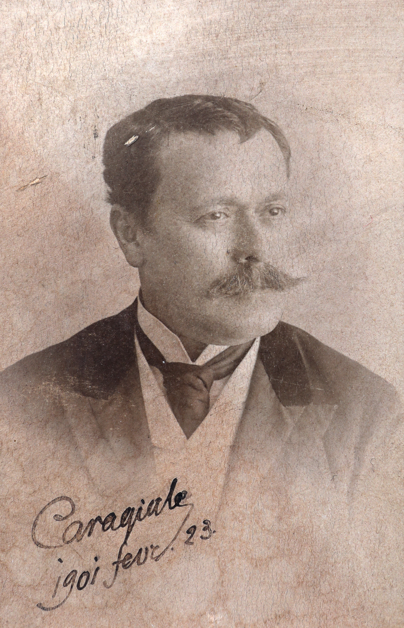
152. Photograph depicting the famous playwright Ion Luca Caragiale, February 23, 1901, with the handwritten signature of the writer, extreme rarity
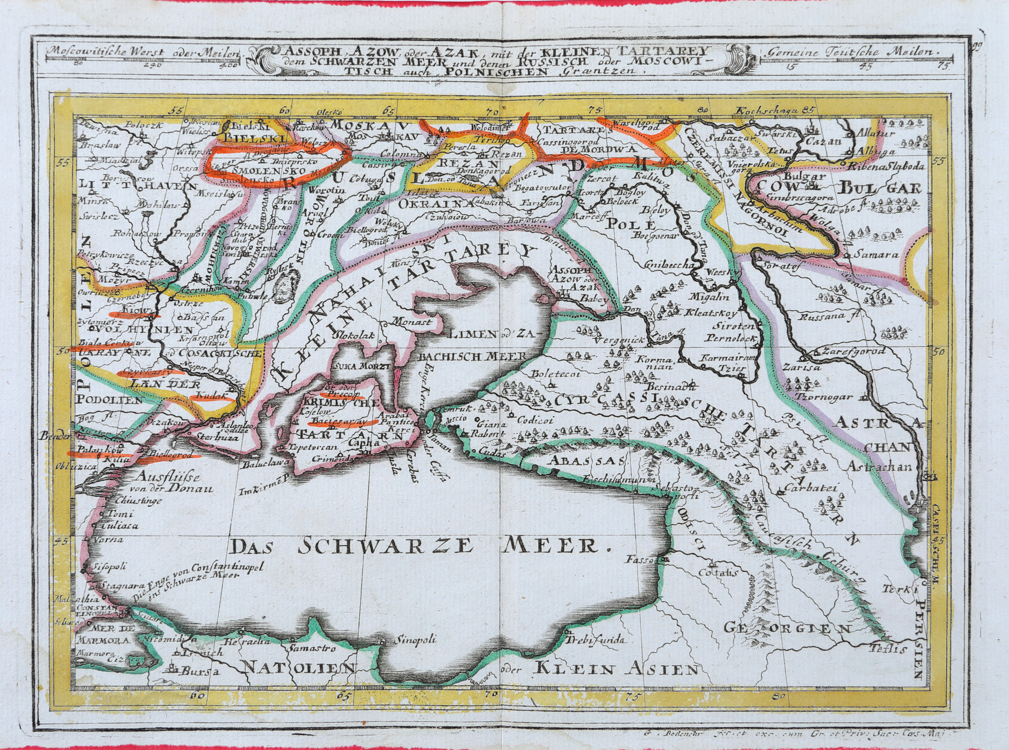
144. "Map 'Black Sea Basin', by Gabriel Bodenehr, Augsburg, cca. 1720"