


The photos of the lot are informative and indicative, and cannot provide a highly detailed view of the object from all angles. We recommend a careful physical inspection of the lot before bidding.
The photos of the lot are informative and indicative, and cannot provide a highly detailed view of the object from all angles. We recommend a careful physical inspection of the lot before bidding.
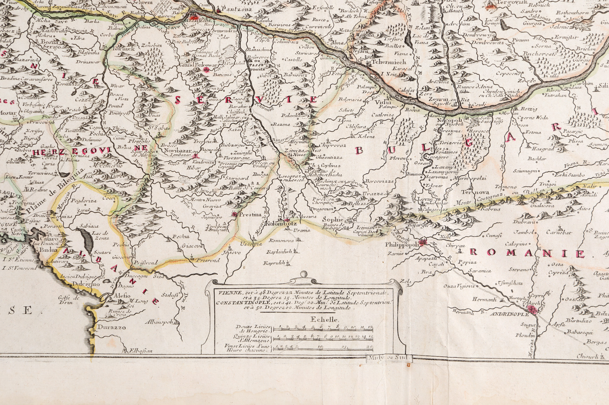
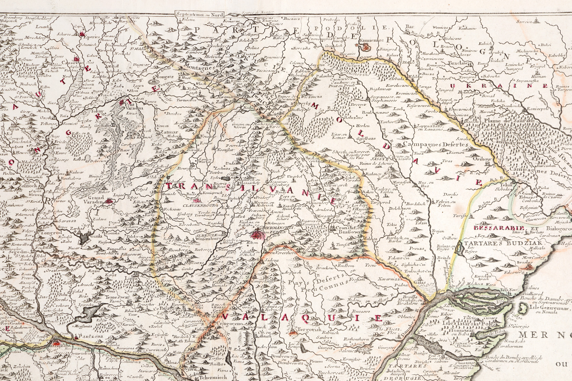
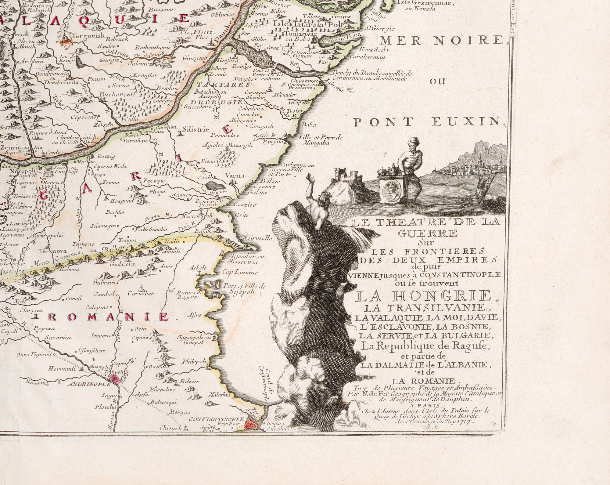
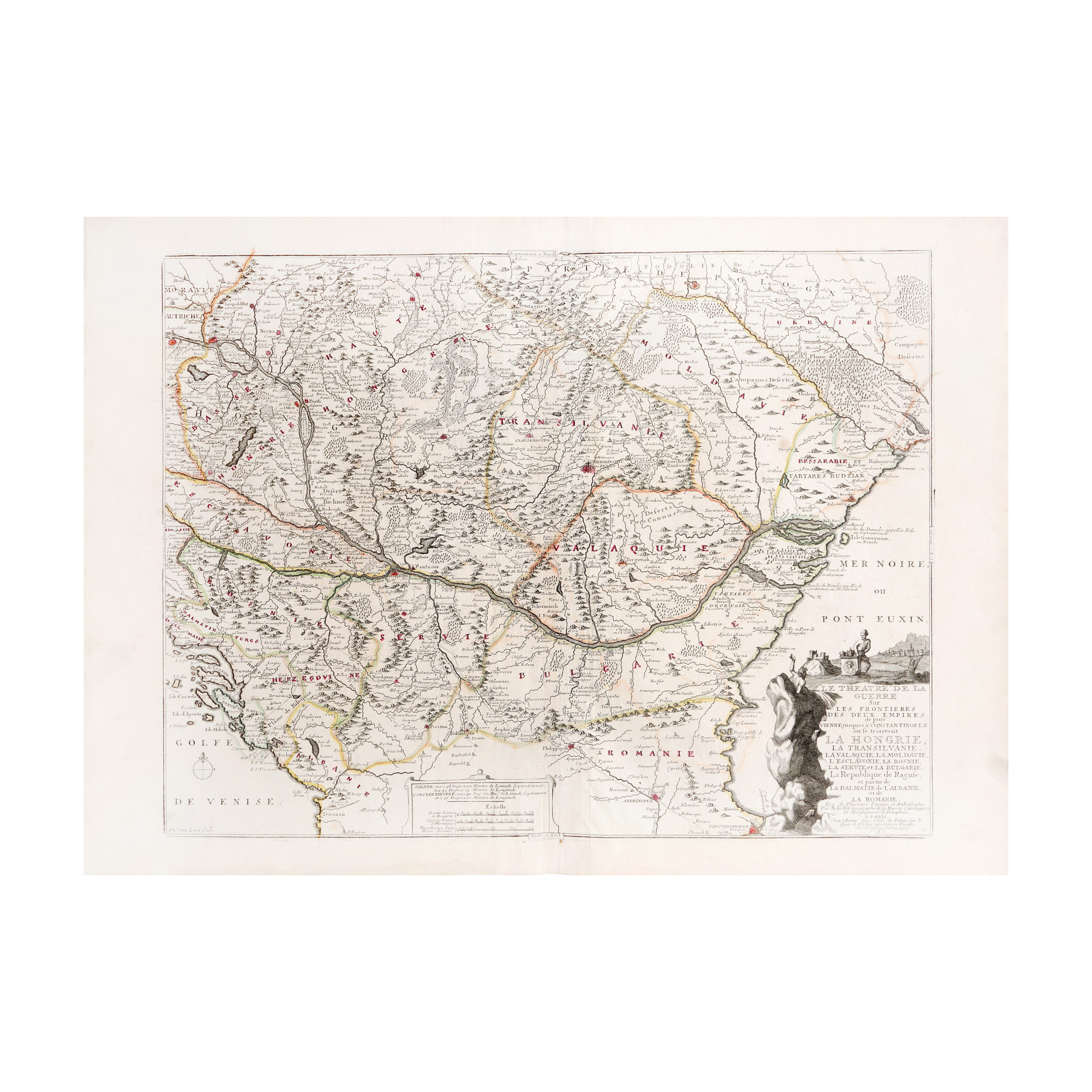
110. "Map of Operations in the Balkans after the Siege of Vienna" by Nicolas de Fer, Paris, 1717
Starting price
Pretul de pornire si cel estimat nu sunt preturi de vanzare efective
EUR 250
Sold
Pretul de pornire si cel estimat nu sunt preturi de vanzare efective
EUR 400
Session
Tue, 17 September 2024 19:00
Brought to you by
The French geographer and cartographer Nicolas de Fer (1646-1720), whose father Antoine was himself a geographer and map merchant, took over the family business in 1687 and turned it into a flourishing enterprise. Upon his death, his sons-in-law Jacques-François Bénard and Guillaume Danet continued the enterprise. Nicolas de Fer's map, engraved by the engraver Herman van Loon whose name appears in the lower left corner, represents the course of the Danube, with Hungary, Transylvania, and Bulgaria. Also featured are parts of eastern Moravia, northwestern Austria, and the Venetian Gulf. Bessarabia is present, along with the shores of the Black Sea, the mouths of the Danube, and Constantinople. Hand-colored copper engraving after printing.
Dimensions
custom 63.2 x 48 cm
Description
copper engraving, striated paper, hand colored
ADDITIONAL INFORMATION
For clarifications regarding the bidding procedure, hammer price costs, guarantee, payment, and collection terms for the winning lot, we recommend carefully reading/re-reading the Bidding Regulations.
For additional information regarding the lot and the auction, please contact the Art Consultants Department.
Detalii
The French geographer and cartographer Nicolas de Fer (1646-1720), whose father Antoine was himself a geographer and map merchant, took over the family business in 1687 and turned it into a flourishing enterprise. Upon his death, his sons-in-law Jacques-François Bénard and Guillaume Danet continued the enterprise. Nicolas de Fer's map, engraved by the engraver Herman van Loon whose name appears in the lower left corner, represents the course of the Danube, with Hungary, Transylvania, and Bulgaria. Also featured are parts of eastern Moravia, northwestern Austria, and the Venetian Gulf. Bessarabia is present, along with the shores of the Black Sea, the mouths of the Danube, and Constantinople. Hand-colored copper engraving after printing.
ADDITIONAL INFORMATION
For clarifications regarding the bidding procedure, hammer price costs, guarantee, payment, and collection terms for the winning lot, we recommend carefully reading/re-reading the Bidding Regulations.
For additional information regarding the lot and the auction, please contact the Art Consultants Department.
Dimensions
custom 63.2 x 48 cm
Description
copper engraving, striated paper, hand colored
Brought to you by
Similar lots
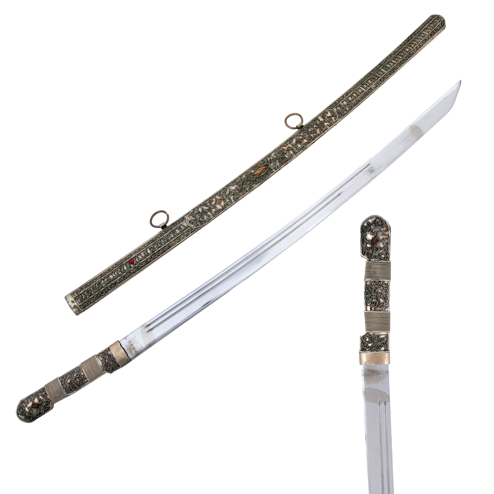
142. Gala sword, with scabbard richly decorated with adjoining filigree, Caucasus Region, early 20th century.
Starting price
EUR 700
Sold
EUR 900
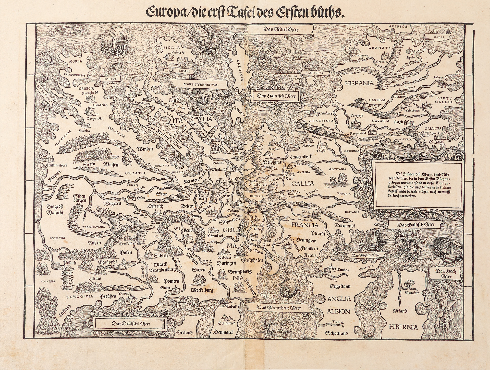
118. The first map "Europe", by Johann Stumpf, Zurich, 1562, rare collectible piece
Starting price
EUR 700
Sold
EUR 2.250