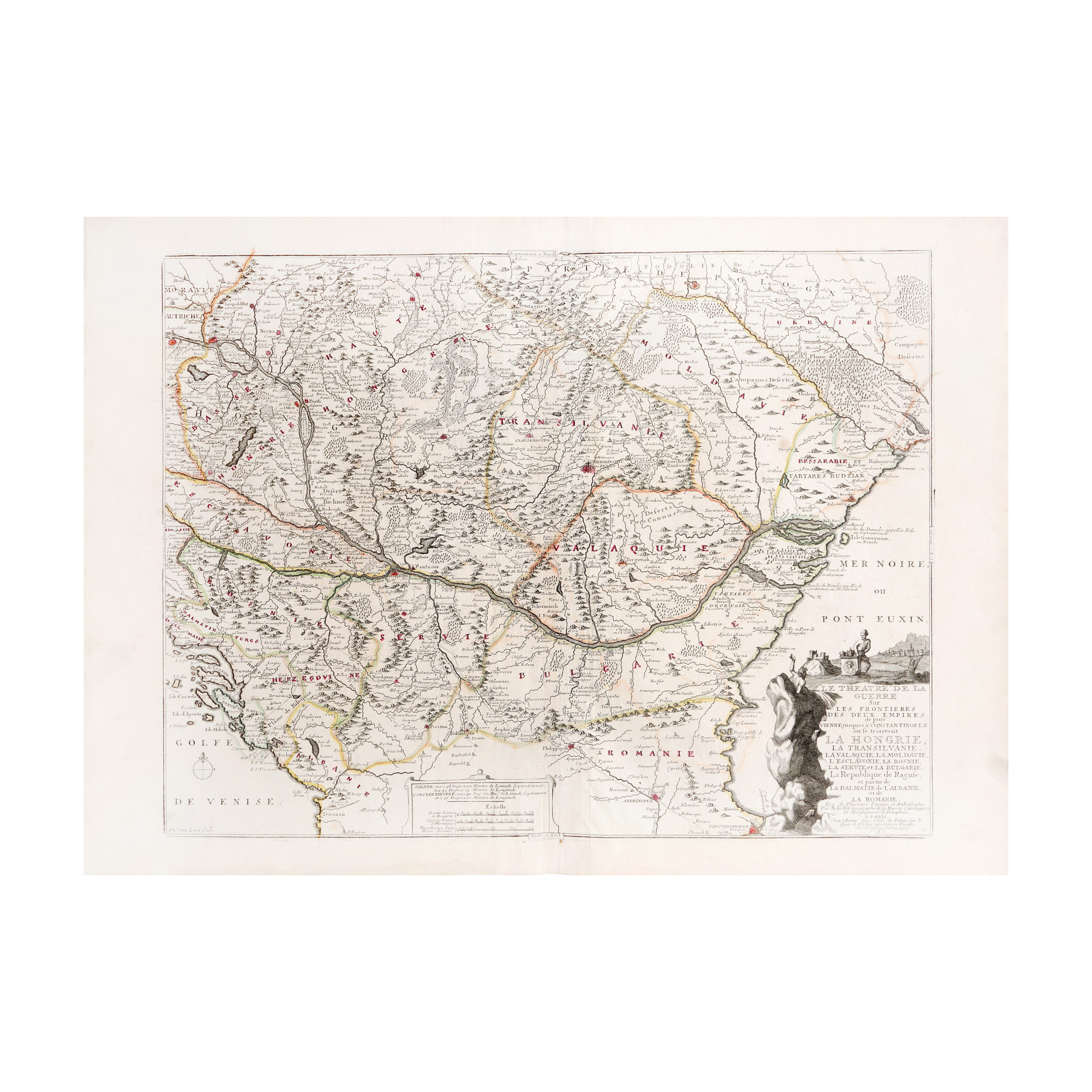
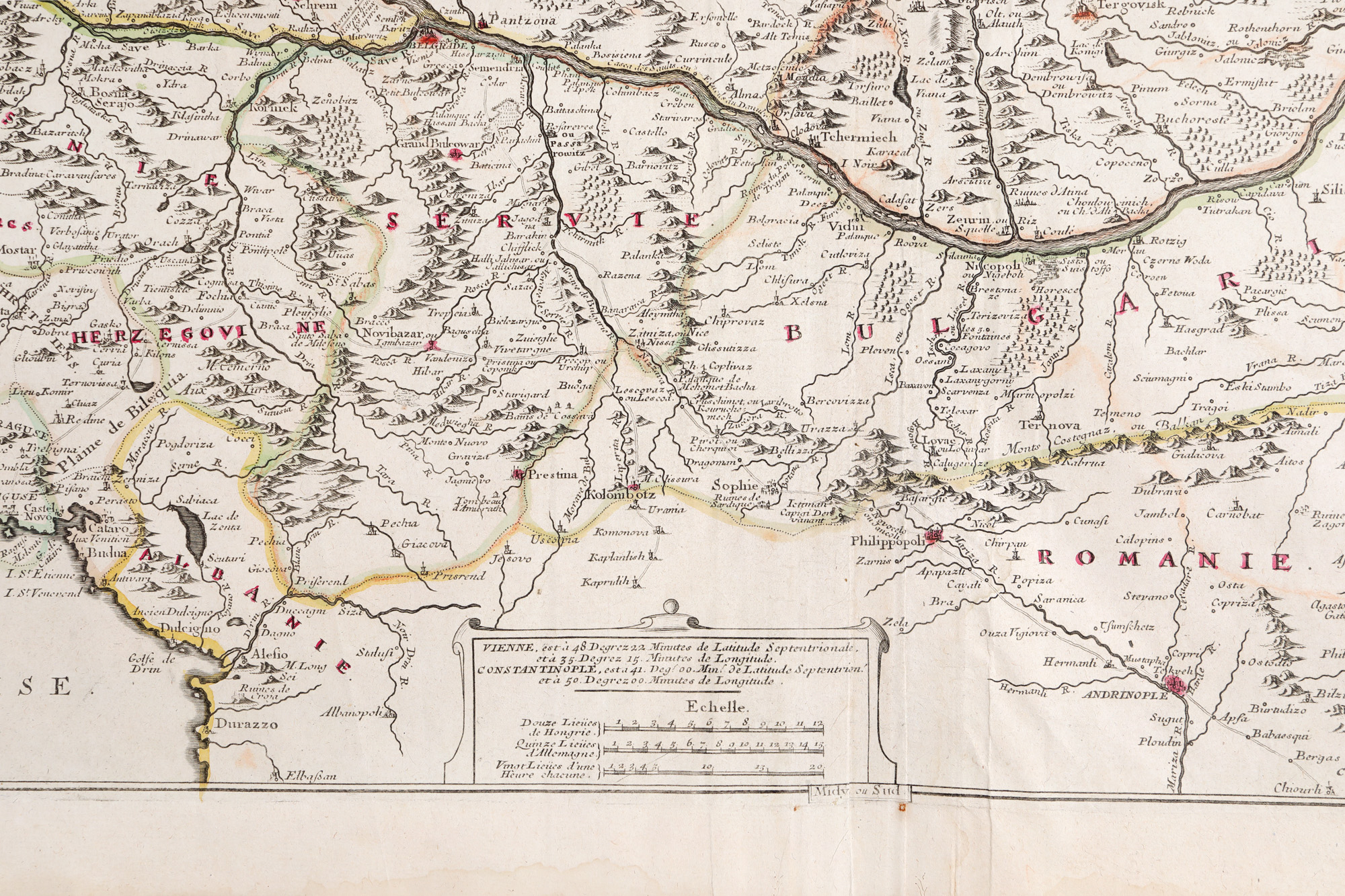
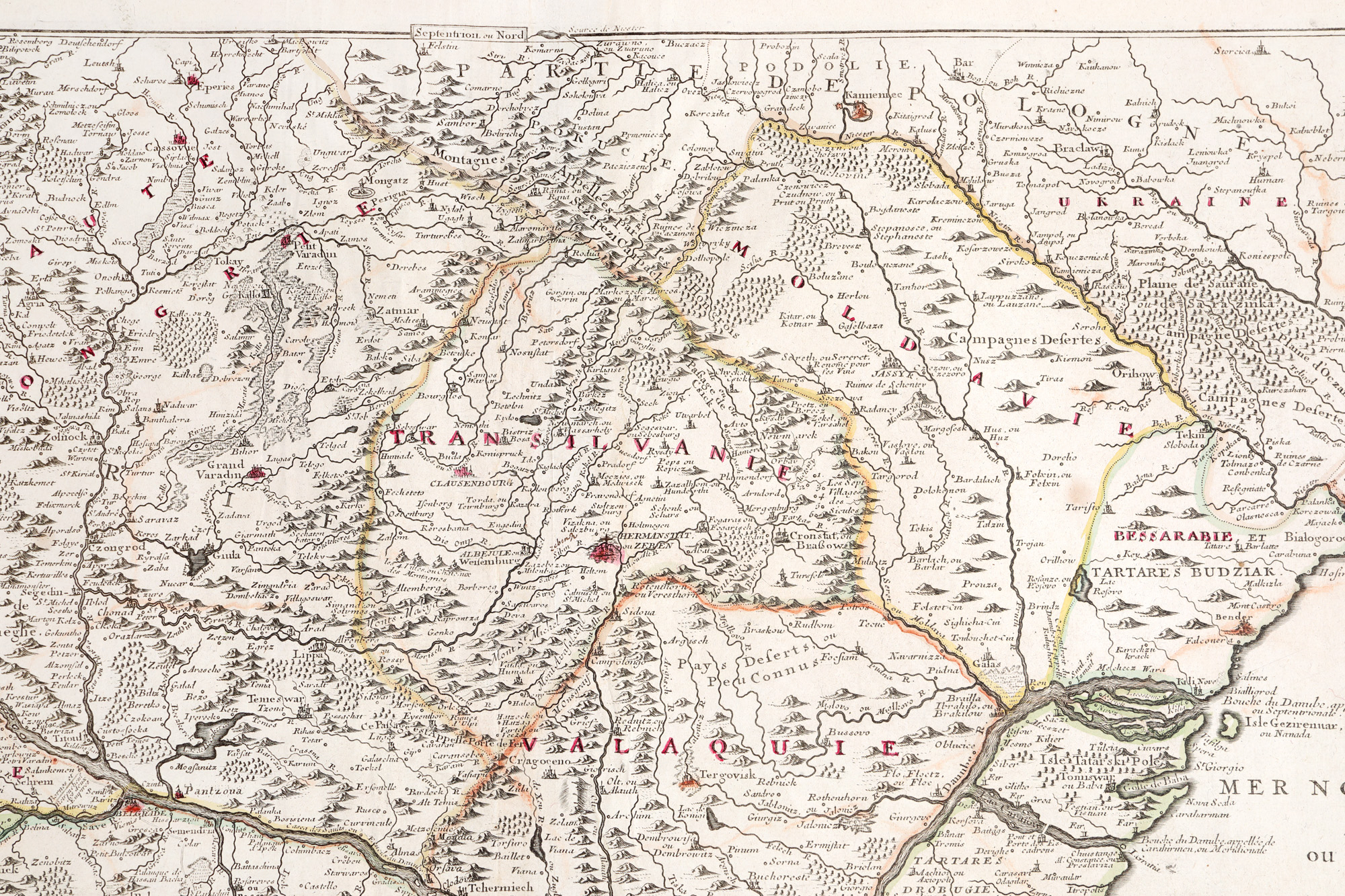
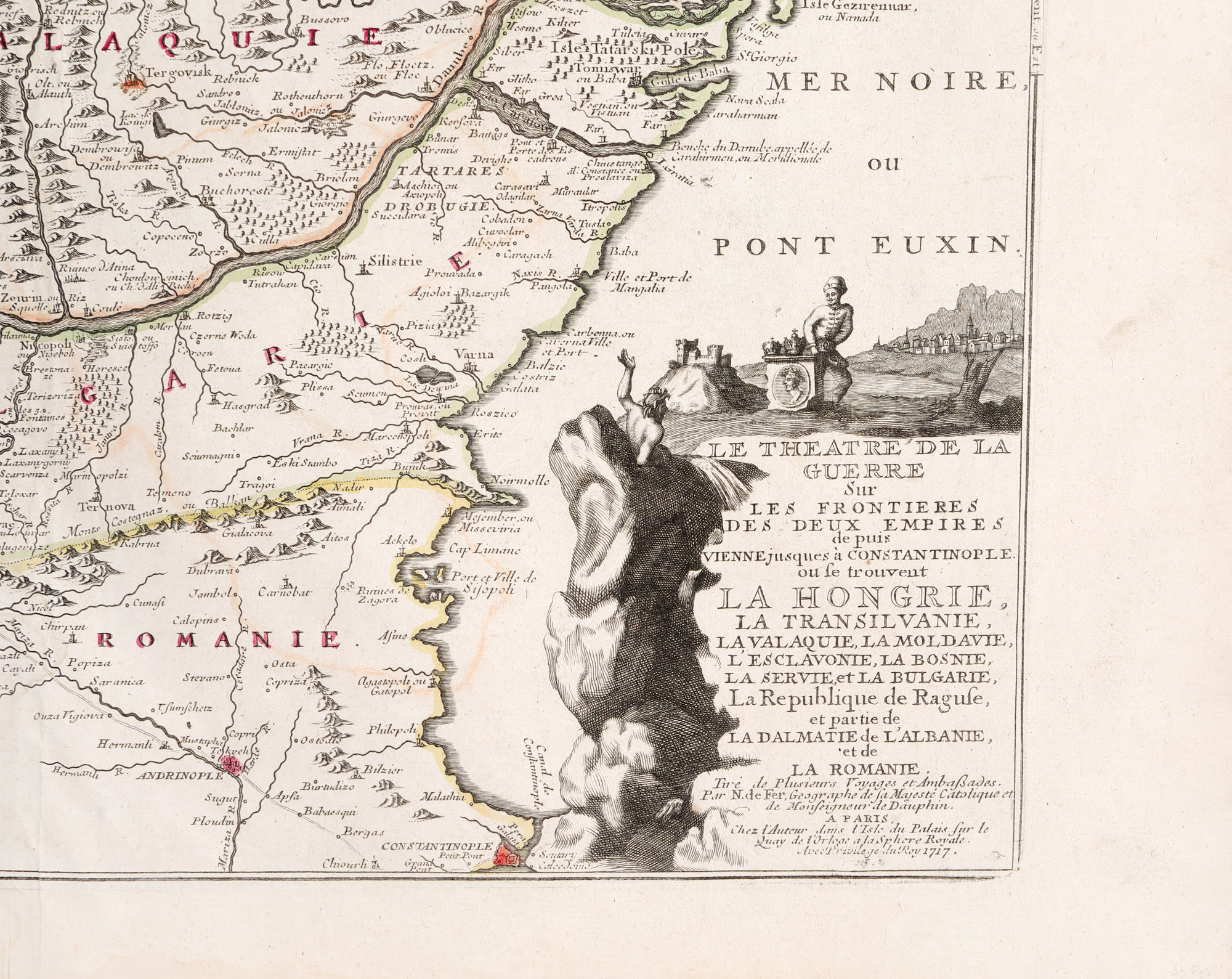
110. "Map of Operations in the Balkans after the Siege of Vienna" by Nicolas de Fer, Paris, 1717
Početna cijena
EUR 250
Prodano
EUR 400
Sesija
Uto., 17 rujna 2024 19:00
Opis
copper engraving, striated paper, hand colored
DODATNE INFORMACIJE
Za pojašnjenja u vezi s postupkom licitiranja, troškovima kupnje, uvjetima jamstva, plaćanja i preuzimanja osvojenog lota preporučujemo da pažljivo pročitate/ponovno pročitate Pravilnik o licitiranju.
Za dodatne informacije o lotu i aukciji kontaktirajte Odjel umjetničkih savjetnika.
Detalii
DODATNE INFORMACIJE
Za pojašnjenja u vezi s postupkom licitiranja, troškovima kupnje, uvjetima jamstva, plaćanja i preuzimanja osvojenog lota preporučujemo da pažljivo pročitate/ponovno pročitate Pravilnik o licitiranju.
Za dodatne informacije o lotu i aukciji kontaktirajte Odjel umjetničkih savjetnika.
Opis
copper engraving, striated paper, hand colored
Alternativni lotovi
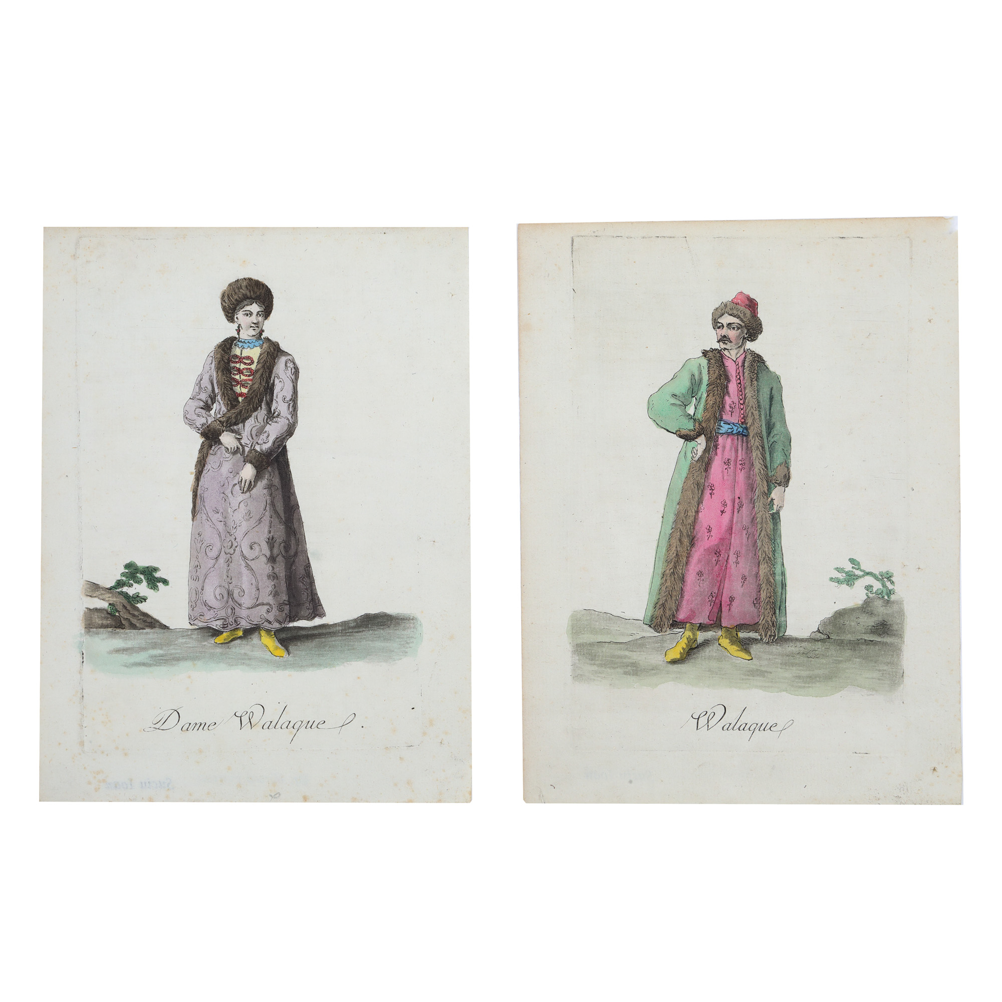
111. Pair of engravings illustrating a boyar and a boyar woman from Wallachia, end of the 18th century - beginning of the 19th century

127. Shashka Saber, 1927 model, cavalry, with scabbard, U.S.S.R., first half of the 20th century