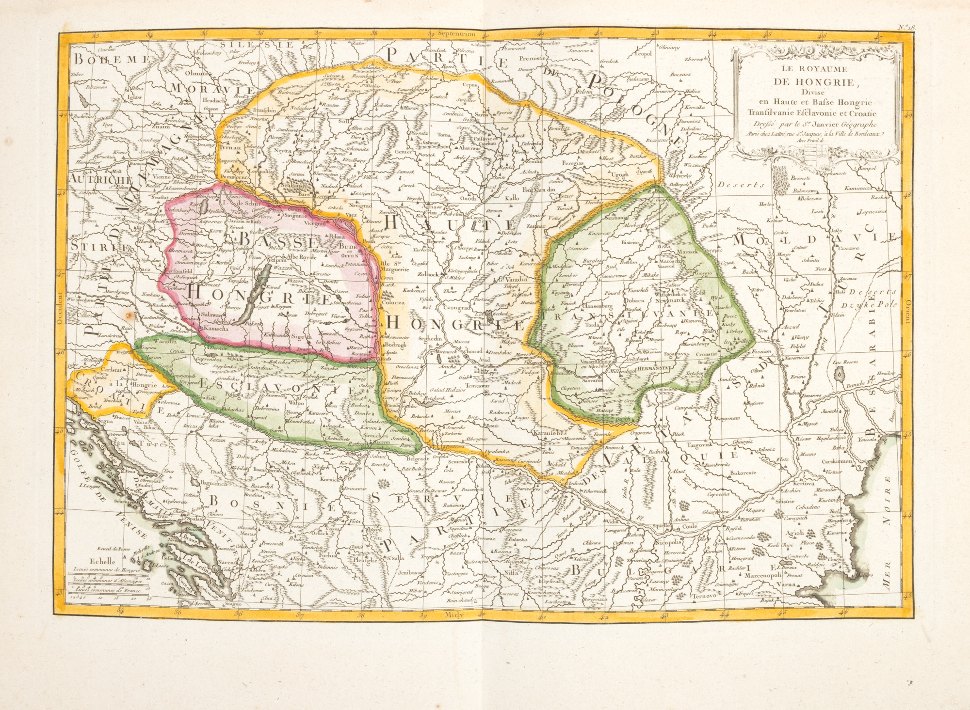
239. Map "Kingdom of Hungary divided into Upper and Lower Hungary, Transylvania, Sclavonia and Croatia", by Jean Janvier, Paris, 1783
Prodajna cijena
EUR 225
Sesija
Uto., 24 lipnja 2025 18:00
Opis
copper engraving, striped paper, hand-colored
DODATNE INFORMACIJE
Za pojašnjenja u vezi s postupkom licitiranja, troškovima kupnje, uvjetima jamstva, plaćanja i preuzimanja osvojenog lota preporučujemo da pažljivo pročitate/ponovno pročitate Pravilnik o licitiranju.
Za dodatne informacije o lotu i aukciji kontaktirajte Odjel umjetničkih savjetnika.
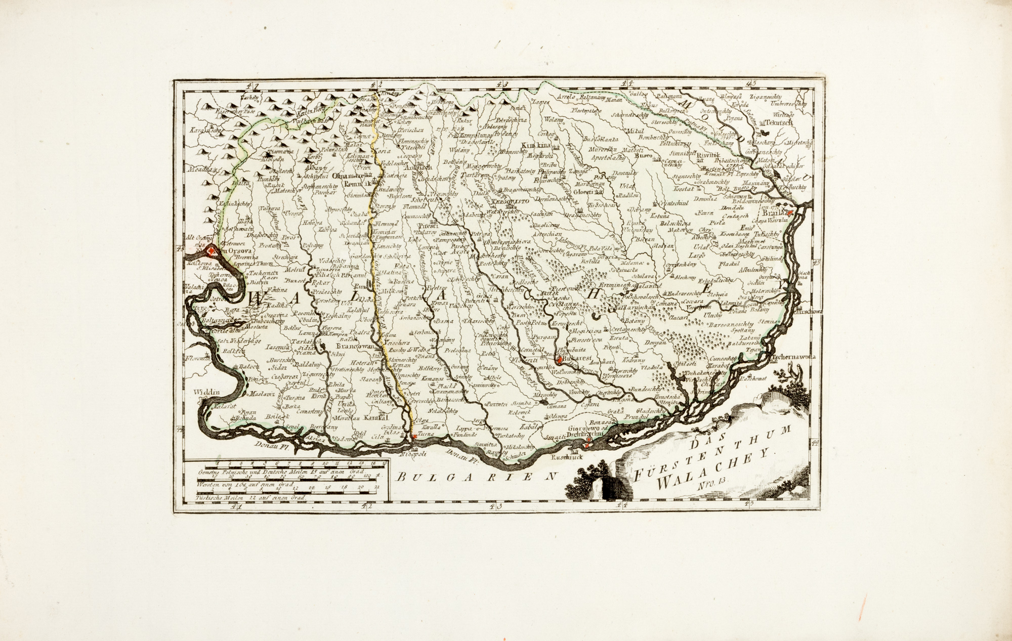
Detalii
DODATNE INFORMACIJE
Za pojašnjenja u vezi s postupkom licitiranja, troškovima kupnje, uvjetima jamstva, plaćanja i preuzimanja osvojenog lota preporučujemo da pažljivo pročitate/ponovno pročitate Pravilnik o licitiranju.
Za dodatne informacije o lotu i aukciji kontaktirajte Odjel umjetničkih savjetnika.
Opis
copper engraving, striped paper, hand-colored
Alternativni lotovi
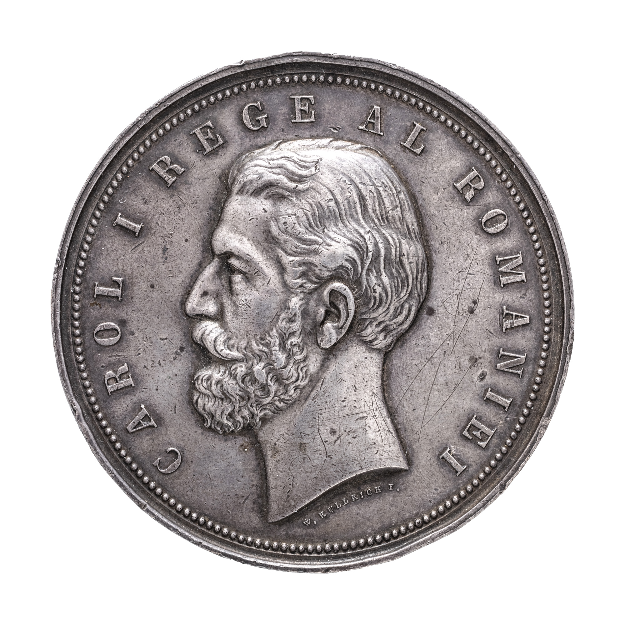
123. "Medal of the Agriculture and Industry Contest", engraver Wilhelm Kurllich, 1881, silver
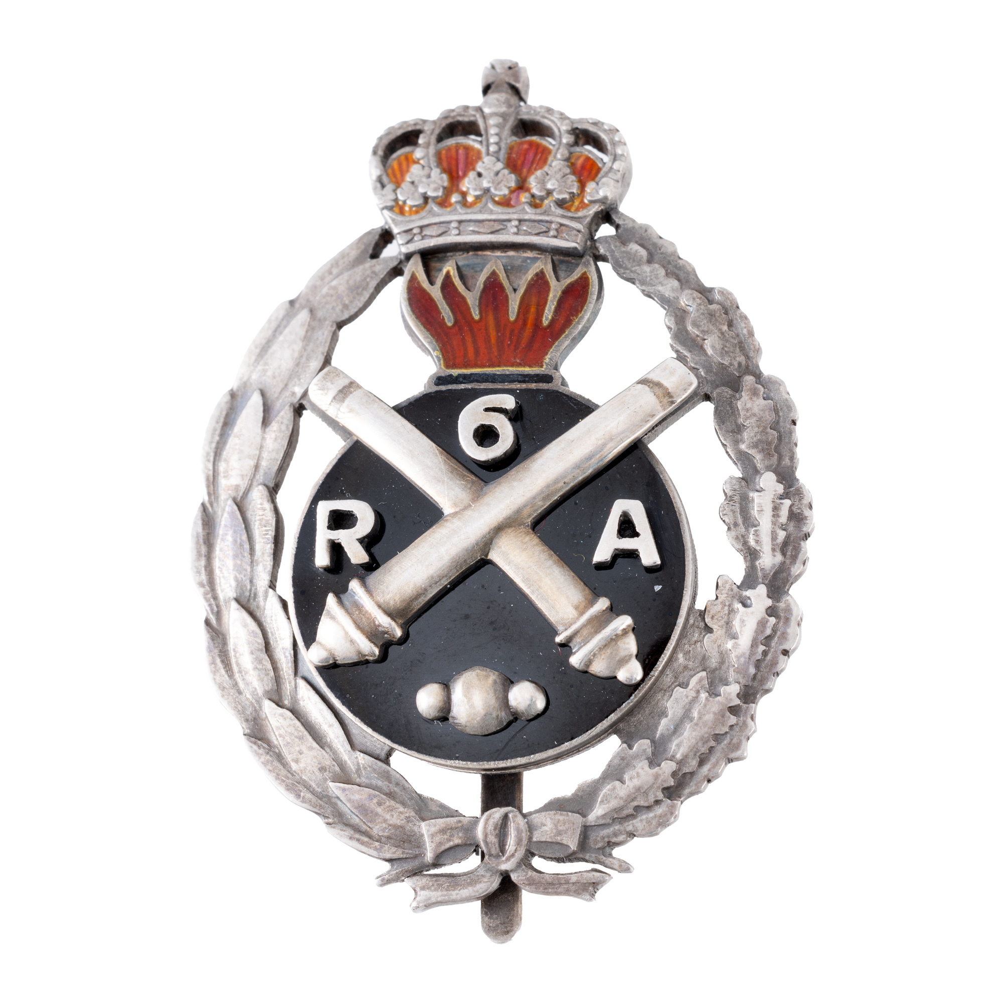
146. Badge, 7 years of service, for officers, 6th Artillery Regiment Pitești, silver, interwar period
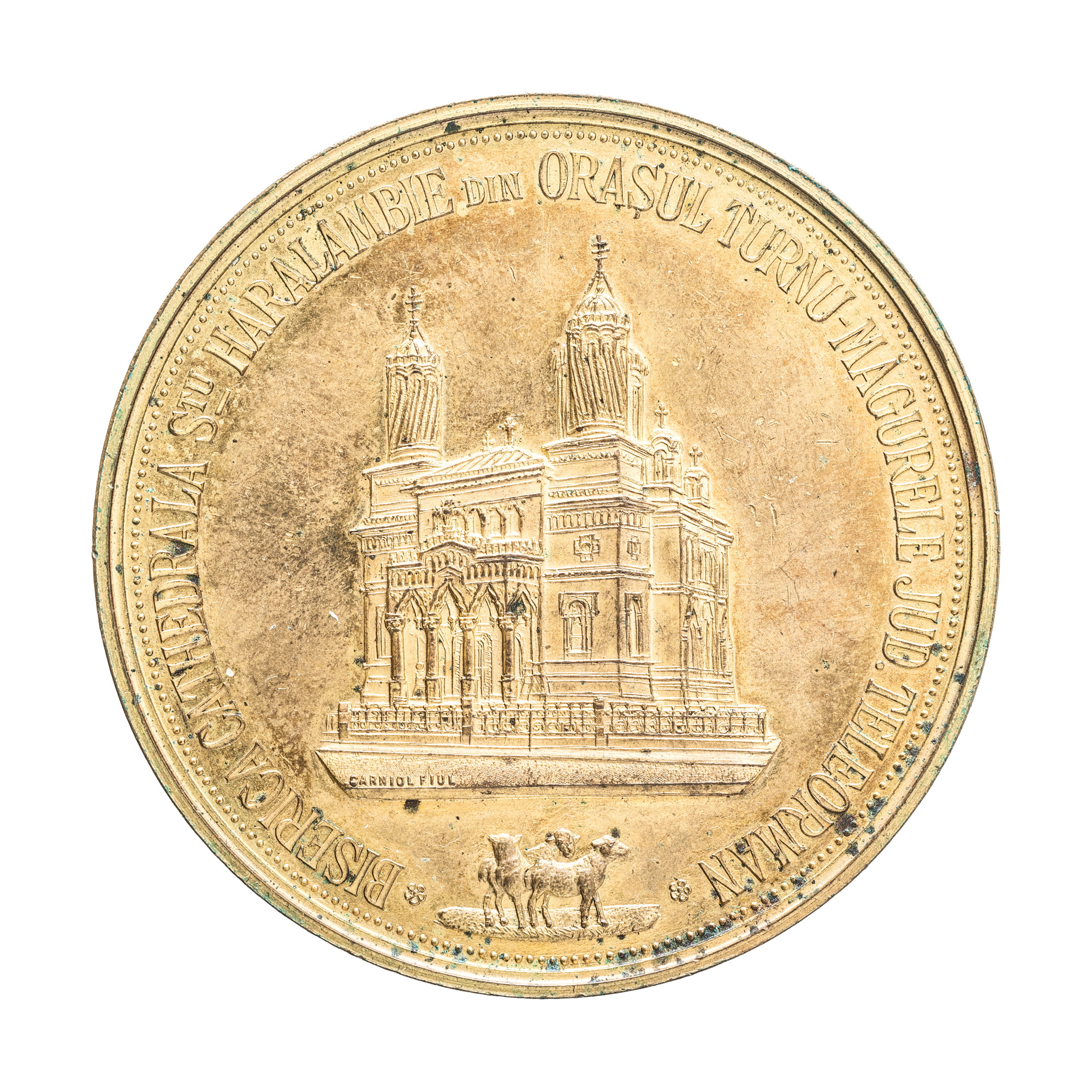
168. Medal "Saint Haralambie Cathedral Church, Turnu-Măgurele", engraver Mauriciu Carniol son, 1905