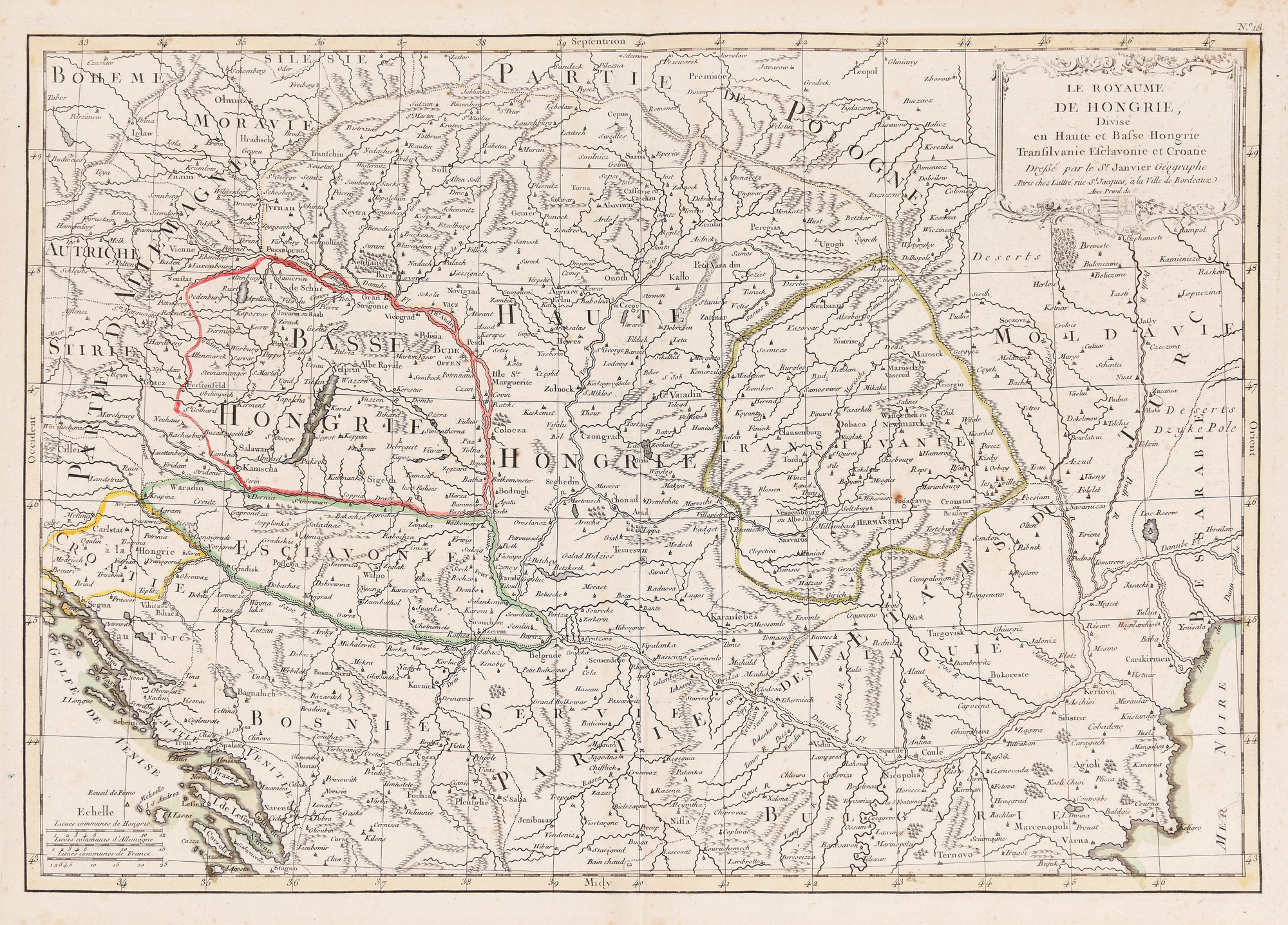
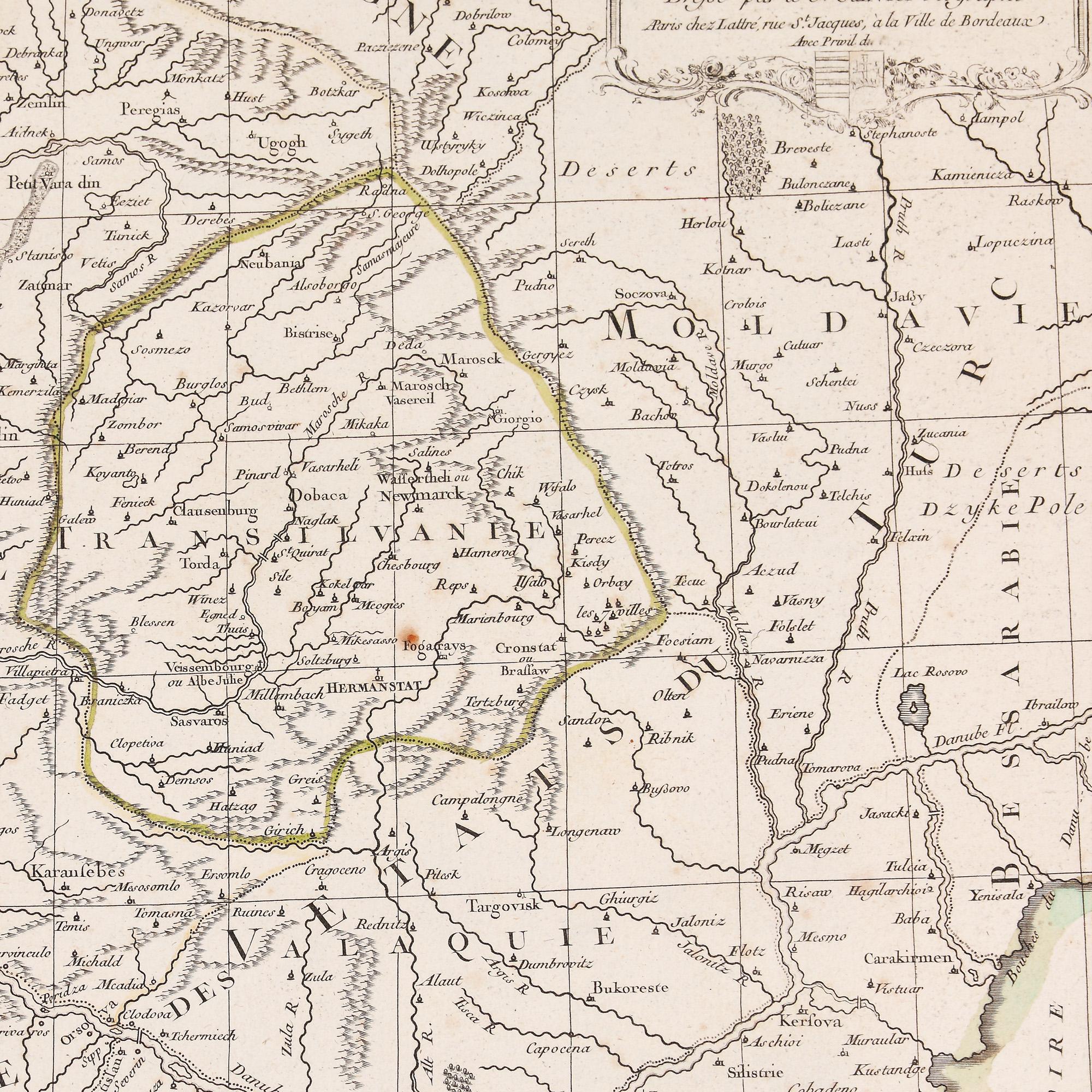
245. "Kingdom of Hungary" map, by Robert Janvier, approx. 1770
Početna cijena
EUR 100
Prodano
EUR 400
Sesija
Uto., 19 srpnja 2022 19:00
Dimenzije
width 44.5 cm, height 31 cm
Opis
metal engraving, striped paper
DODATNE INFORMACIJE
Za pojašnjenja u vezi s postupkom licitiranja, troškovima kupnje, uvjetima jamstva, plaćanja i preuzimanja osvojenog lota preporučujemo da pažljivo pročitate/ponovno pročitate Pravilnik o licitiranju.
Za dodatne informacije o lotu i aukciji kontaktirajte Odjel umjetničkih savjetnika.
Detalii
DODATNE INFORMACIJE
Za pojašnjenja u vezi s postupkom licitiranja, troškovima kupnje, uvjetima jamstva, plaćanja i preuzimanja osvojenog lota preporučujemo da pažljivo pročitate/ponovno pročitate Pravilnik o licitiranju.
Za dodatne informacije o lotu i aukciji kontaktirajte Odjel umjetničkih savjetnika.
Dimenzije
width 44.5 cm, height 31 cm
Opis
metal engraving, striped paper
Alternativni lotovi
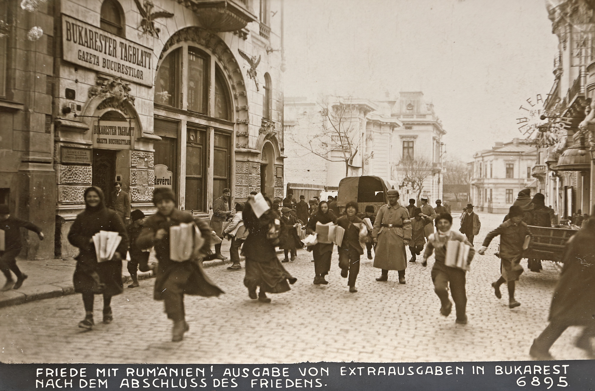
175. Children with the newspaper on the morning of the signing of the Peace Treaty, photograph, Bucharest, 1918