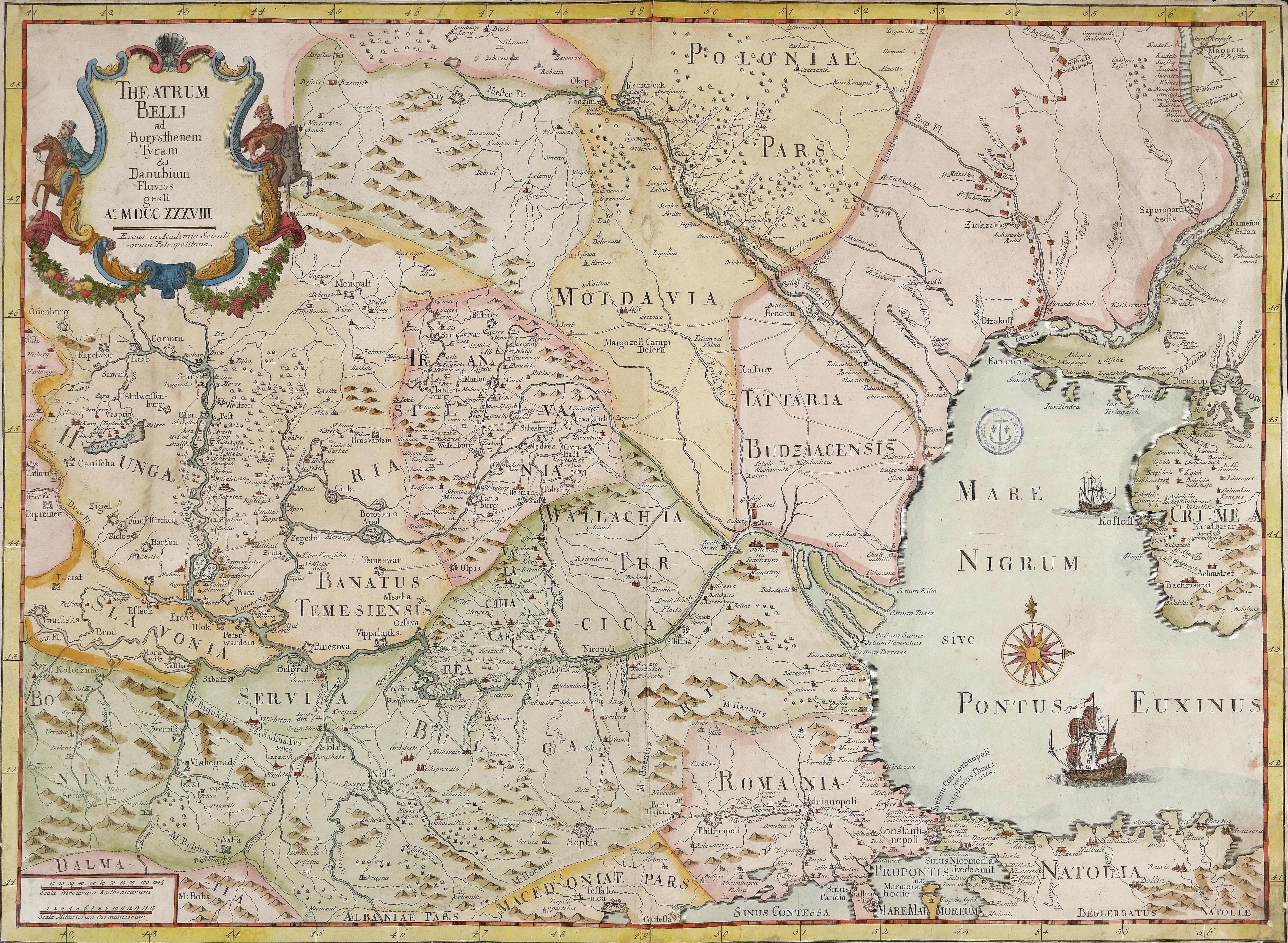
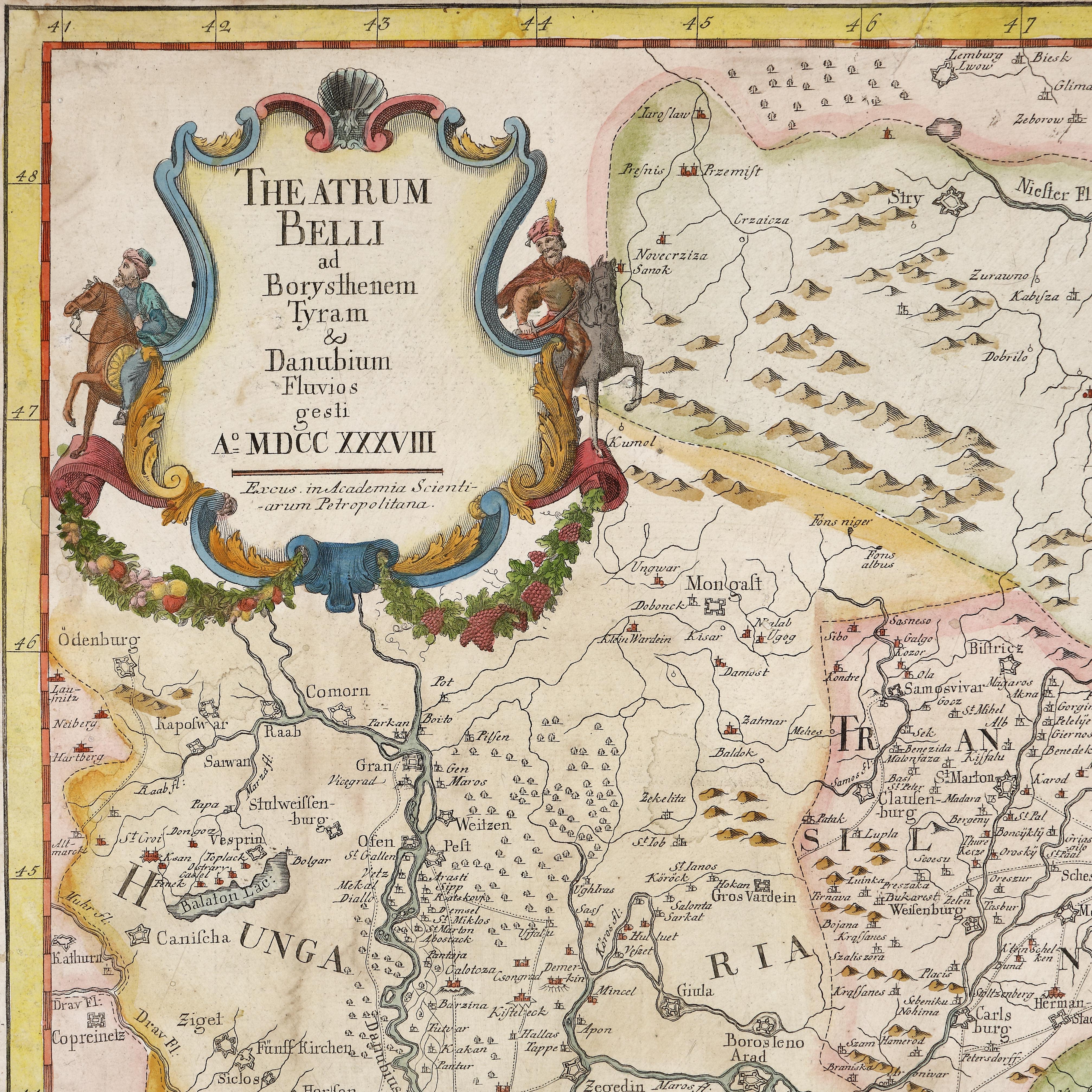
21. Map "The Russo-Turkish War of 1735-1739", by Joseph-Nicolas Delisle, Saint Petersburg, 1738, rare collectible item
Prodajna cijena
EUR 2.040
Sesija
Uto., 5 travnja 2022 19:00
Dimenzije
width 65.5 cm, height 48 cm
Opis
copper engraving, laid paper, hand-coloured
DODATNE INFORMACIJE
Za pojašnjenja u vezi s postupkom licitiranja, troškovima kupnje, uvjetima jamstva, plaćanja i preuzimanja osvojenog lota preporučujemo da pažljivo pročitate/ponovno pročitate Pravilnik o licitiranju.
Za dodatne informacije o lotu i aukciji kontaktirajte Odjel umjetničkih savjetnika.
Detalii
DODATNE INFORMACIJE
Za pojašnjenja u vezi s postupkom licitiranja, troškovima kupnje, uvjetima jamstva, plaćanja i preuzimanja osvojenog lota preporučujemo da pažljivo pročitate/ponovno pročitate Pravilnik o licitiranju.
Za dodatne informacije o lotu i aukciji kontaktirajte Odjel umjetničkih savjetnika.
Dimenzije
width 65.5 cm, height 48 cm
Opis
copper engraving, laid paper, hand-coloured
Alternativni lotovi
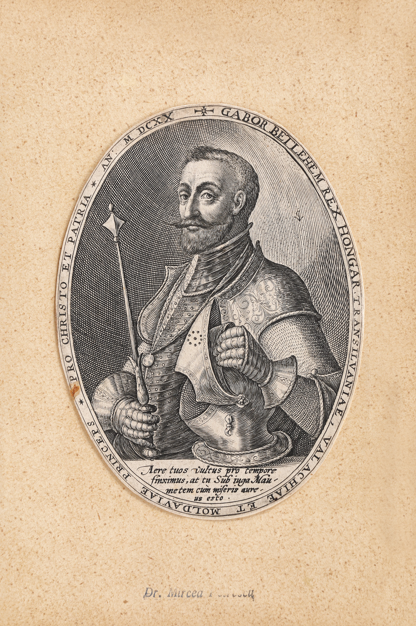
30. "Gabriel Bethlen", by Crispijn van de Passe the Elder, Antwerp, 1595, part of the collection of Dr. Mircea and Artemiza Petrescu
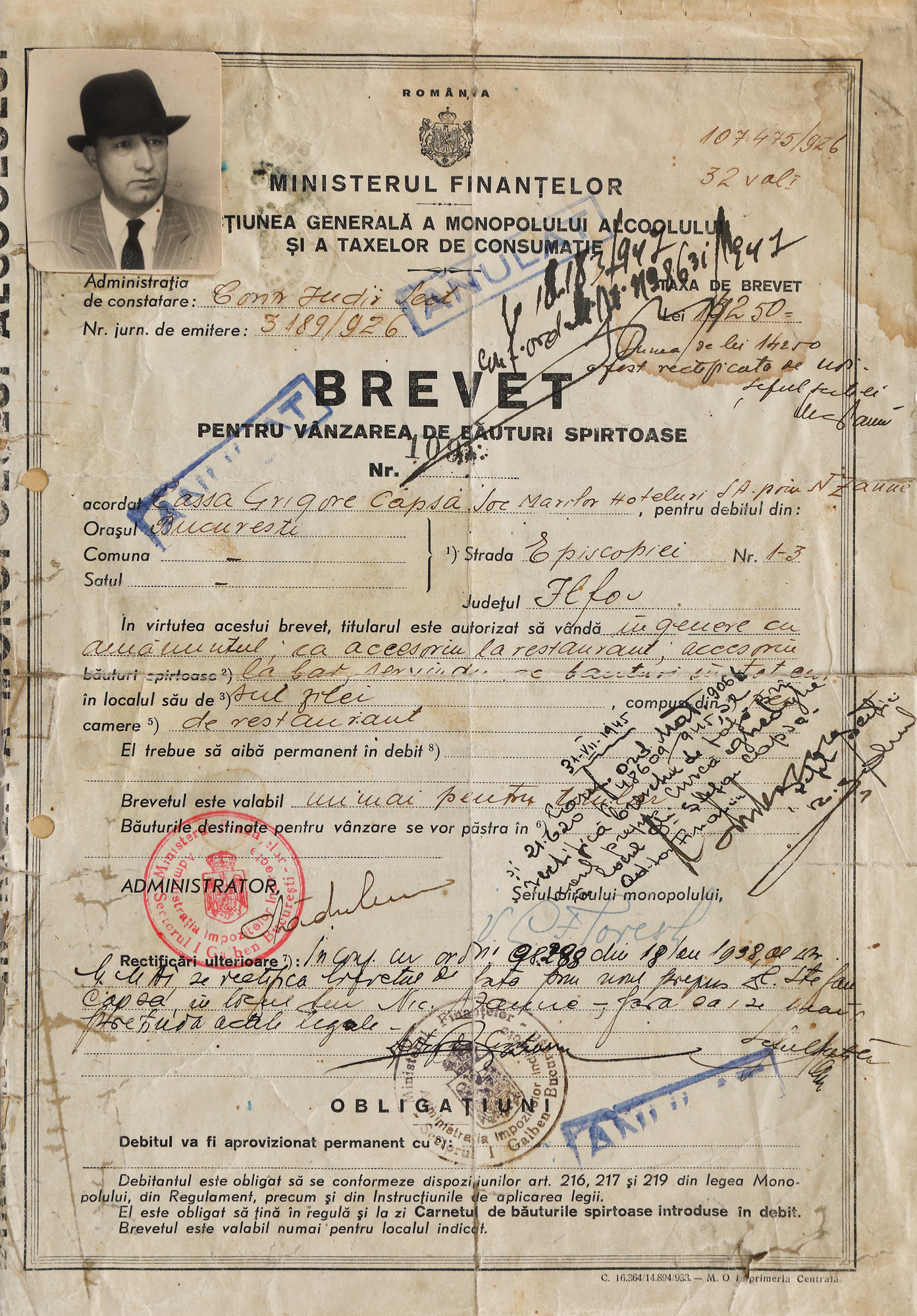
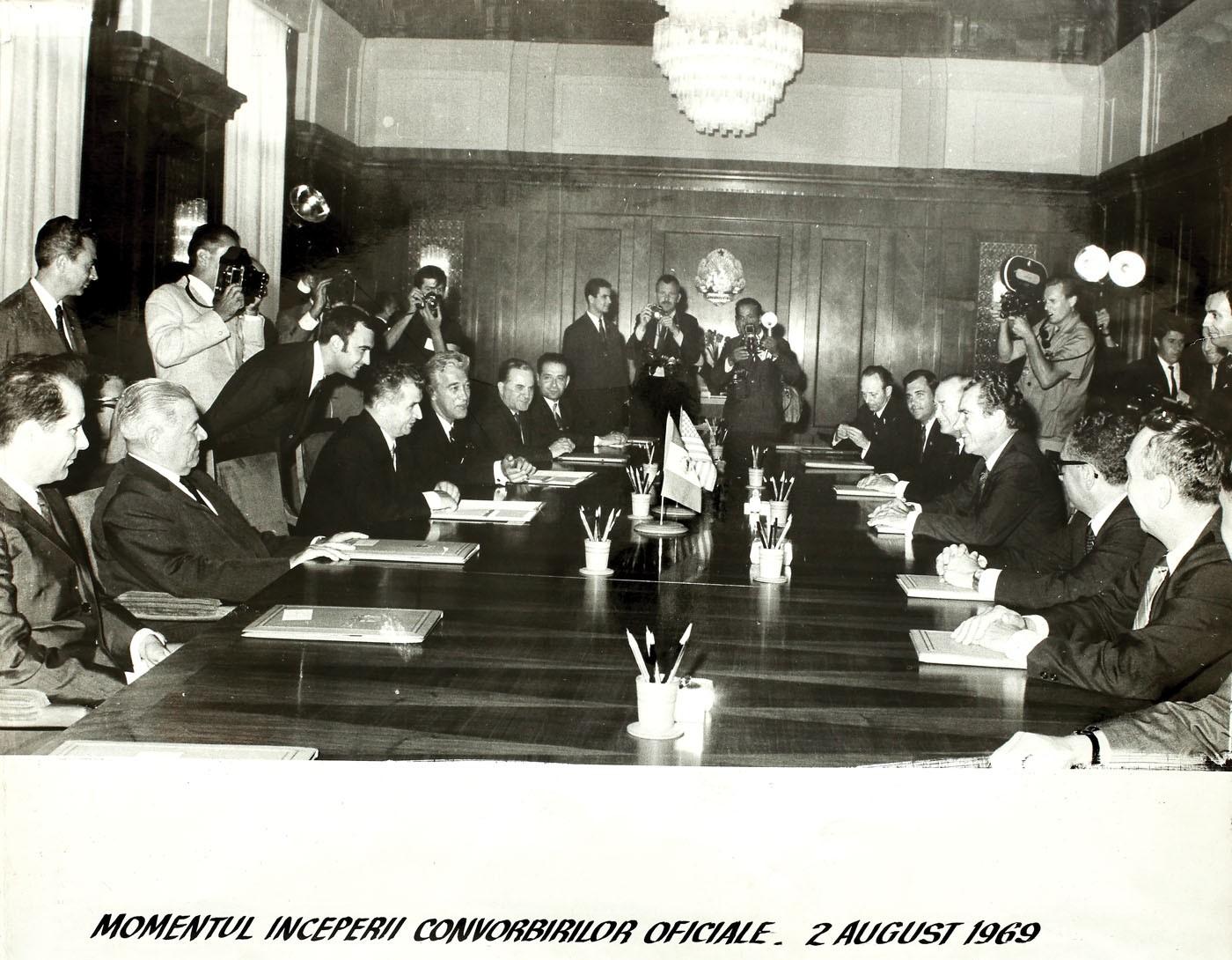
236. Patent for the sale of spirits, granted to the famous restaurant Capșa, 1926, rare collectible item
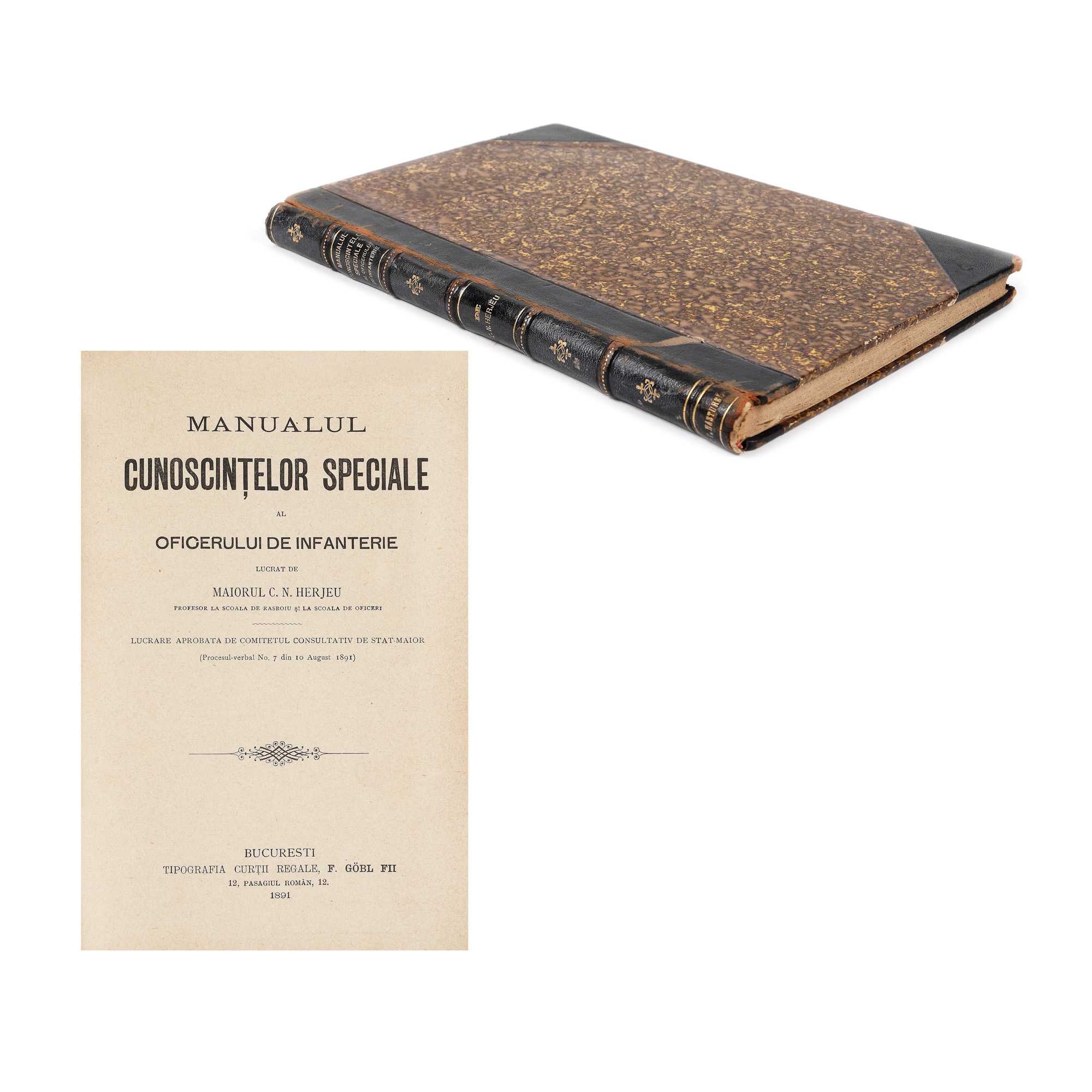
198. "The Infantry Officer's Special Knowledge Handbook," by Major C.N. Herjeu, Bucharest, 1891, part of the collection of P.V. Năsturel