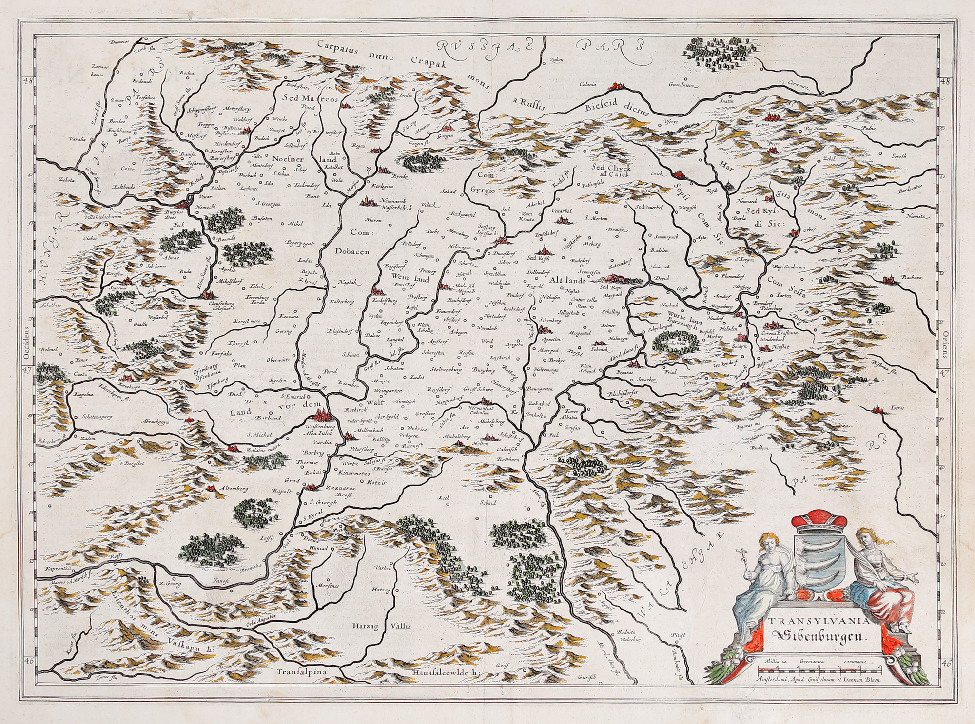
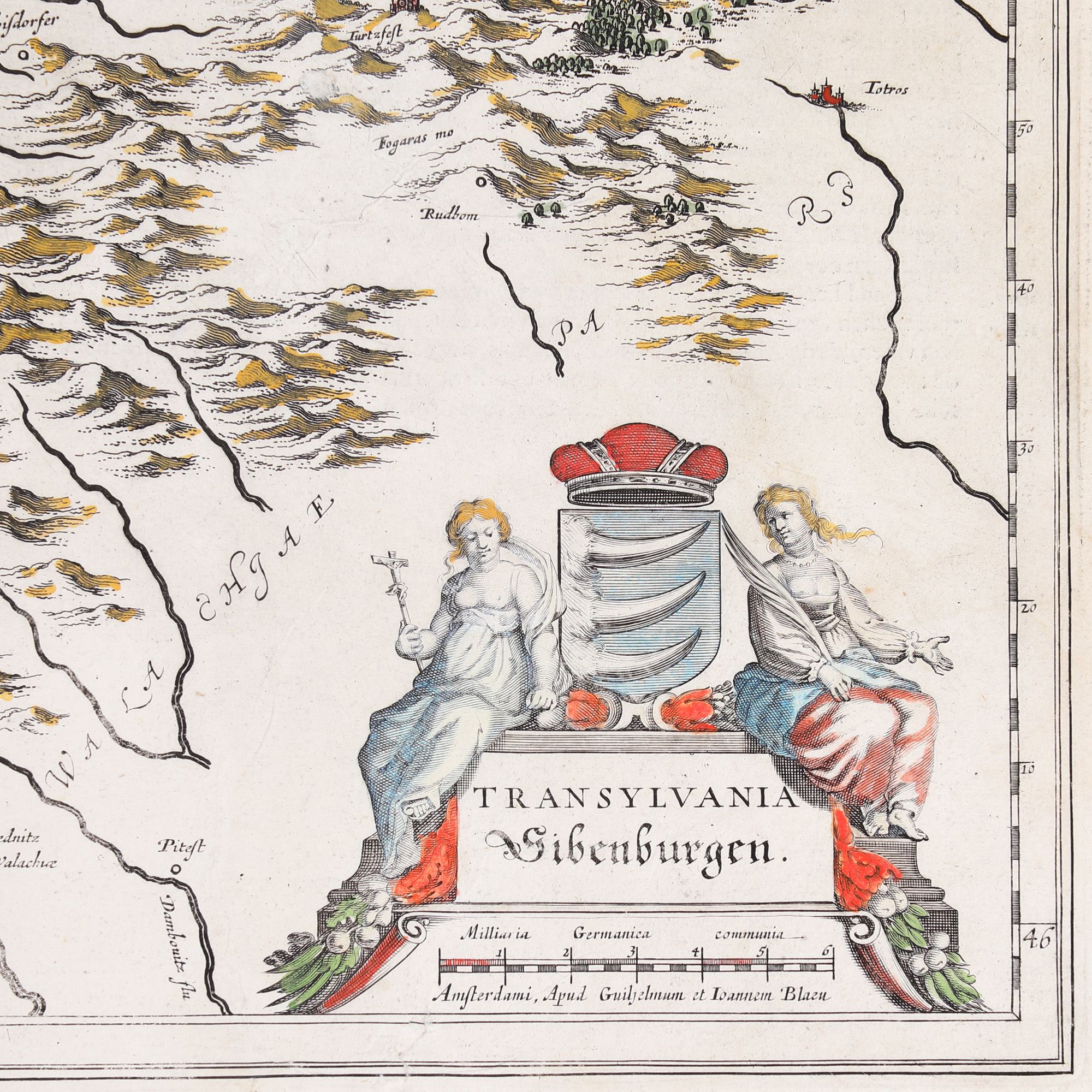
240. "Transylvania" map, by Willem Janszoon Blaeu, Amsterdam, 1636
Početna cijena
EUR 250
Prodano
EUR 400
Sesija
Uto., 19 srpnja 2022 19:00
Dimenzije
width 50 cm, height 38 cm
Opis
copper engraving hand-coloured
Informacije o istraživanju
Novus Atlas Edition
DODATNE INFORMACIJE
Za pojašnjenja u vezi s postupkom licitiranja, troškovima kupnje, uvjetima jamstva, plaćanja i preuzimanja osvojenog lota preporučujemo da pažljivo pročitate/ponovno pročitate Pravilnik o licitiranju.
Za dodatne informacije o lotu i aukciji kontaktirajte Odjel umjetničkih savjetnika.
Detalii
DODATNE INFORMACIJE
Za pojašnjenja u vezi s postupkom licitiranja, troškovima kupnje, uvjetima jamstva, plaćanja i preuzimanja osvojenog lota preporučujemo da pažljivo pročitate/ponovno pročitate Pravilnik o licitiranju.
Za dodatne informacije o lotu i aukciji kontaktirajte Odjel umjetničkih savjetnika.
Dimenzije
width 50 cm, height 38 cm
Opis
copper engraving hand-coloured
Informacije o istraživanju
Novus Atlas Edition
Alternativni lotovi