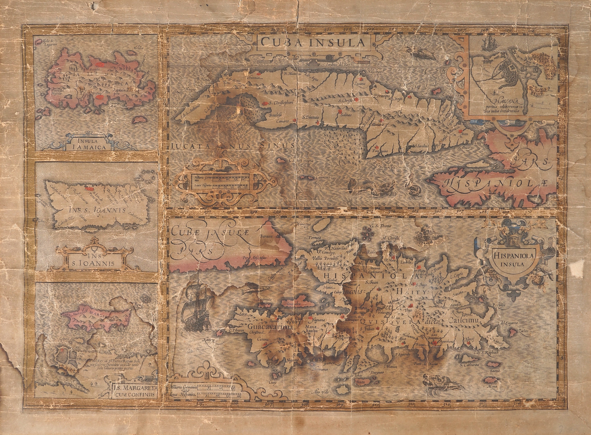
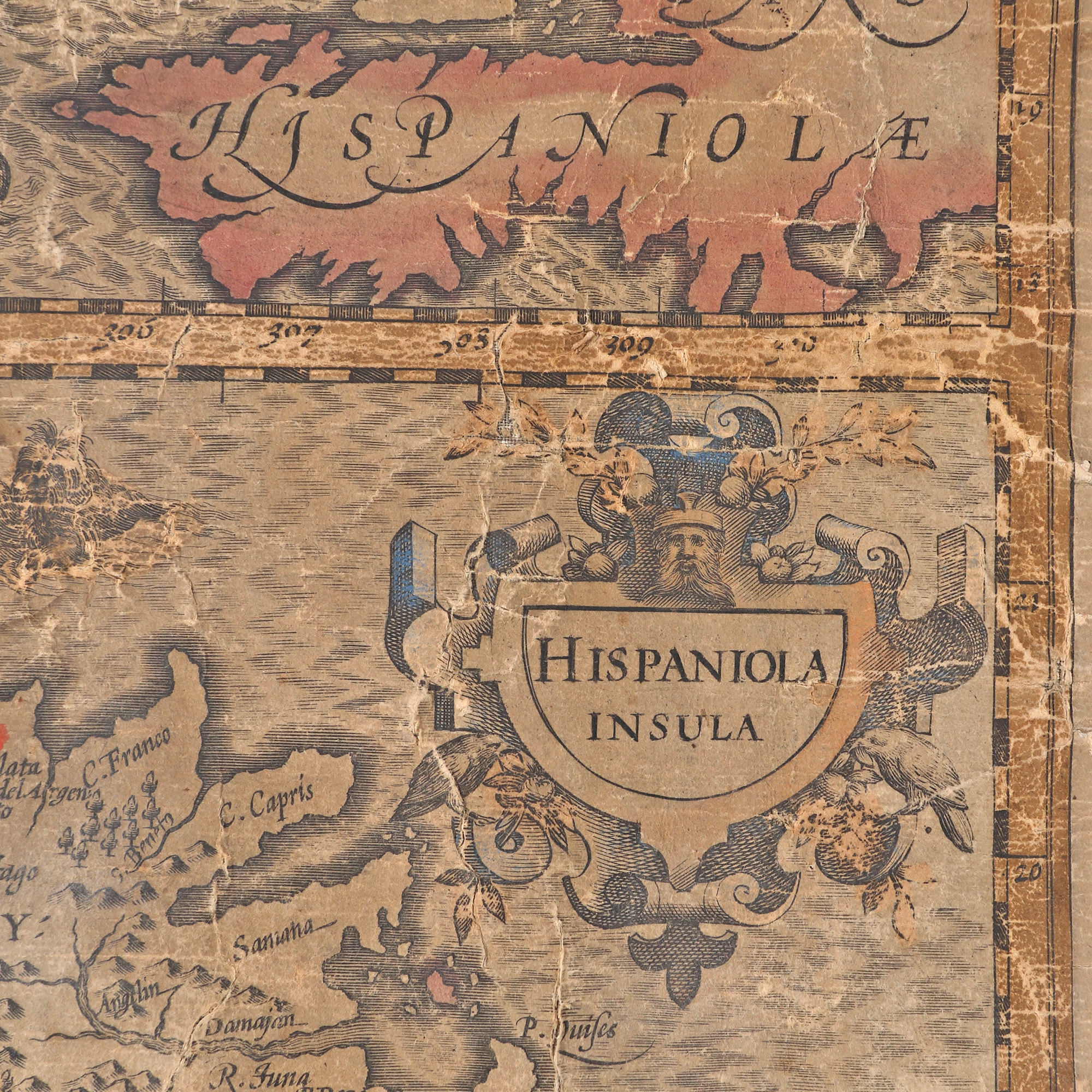
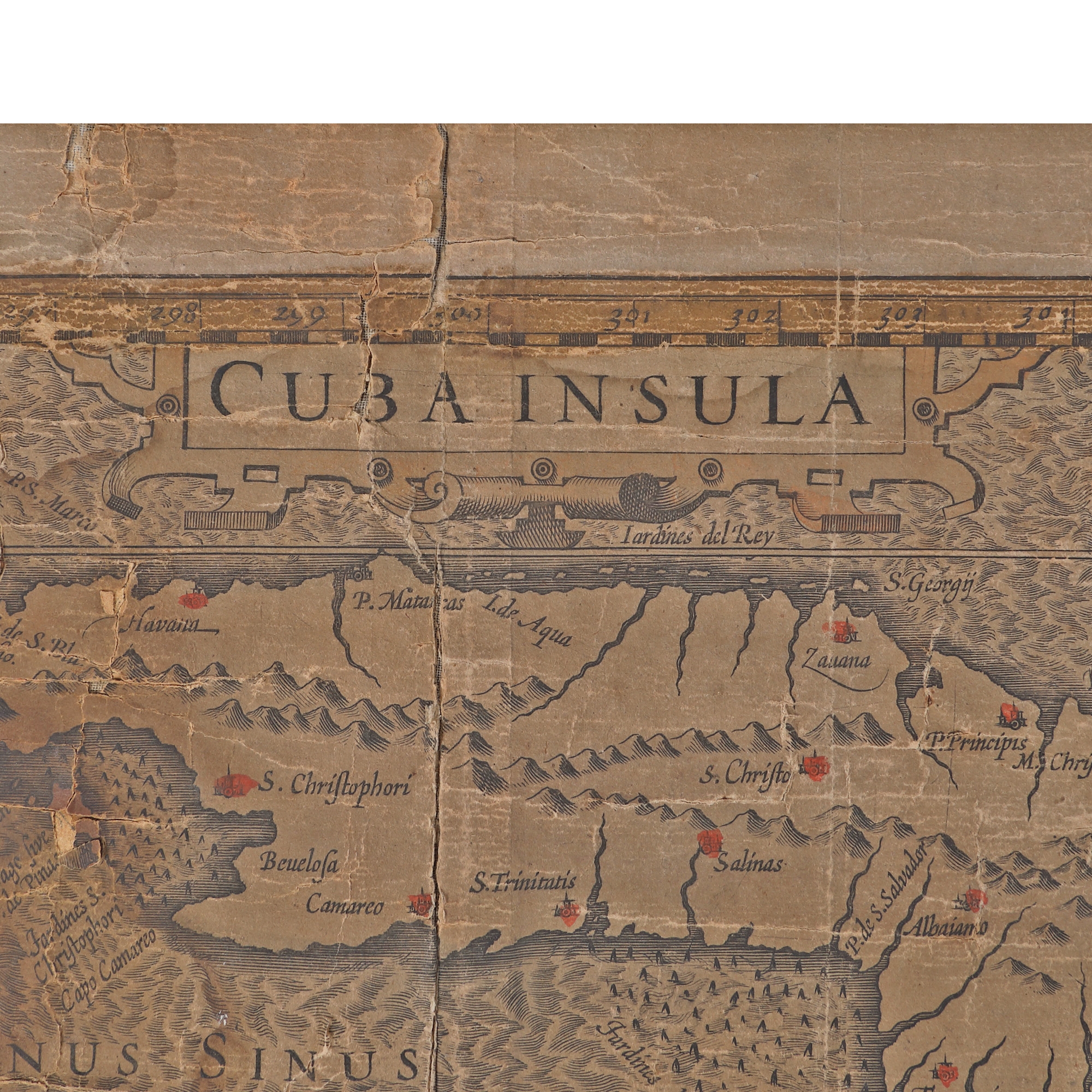
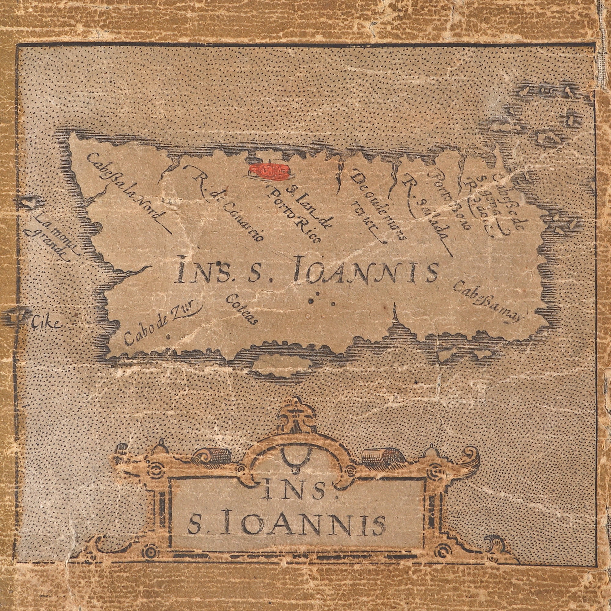
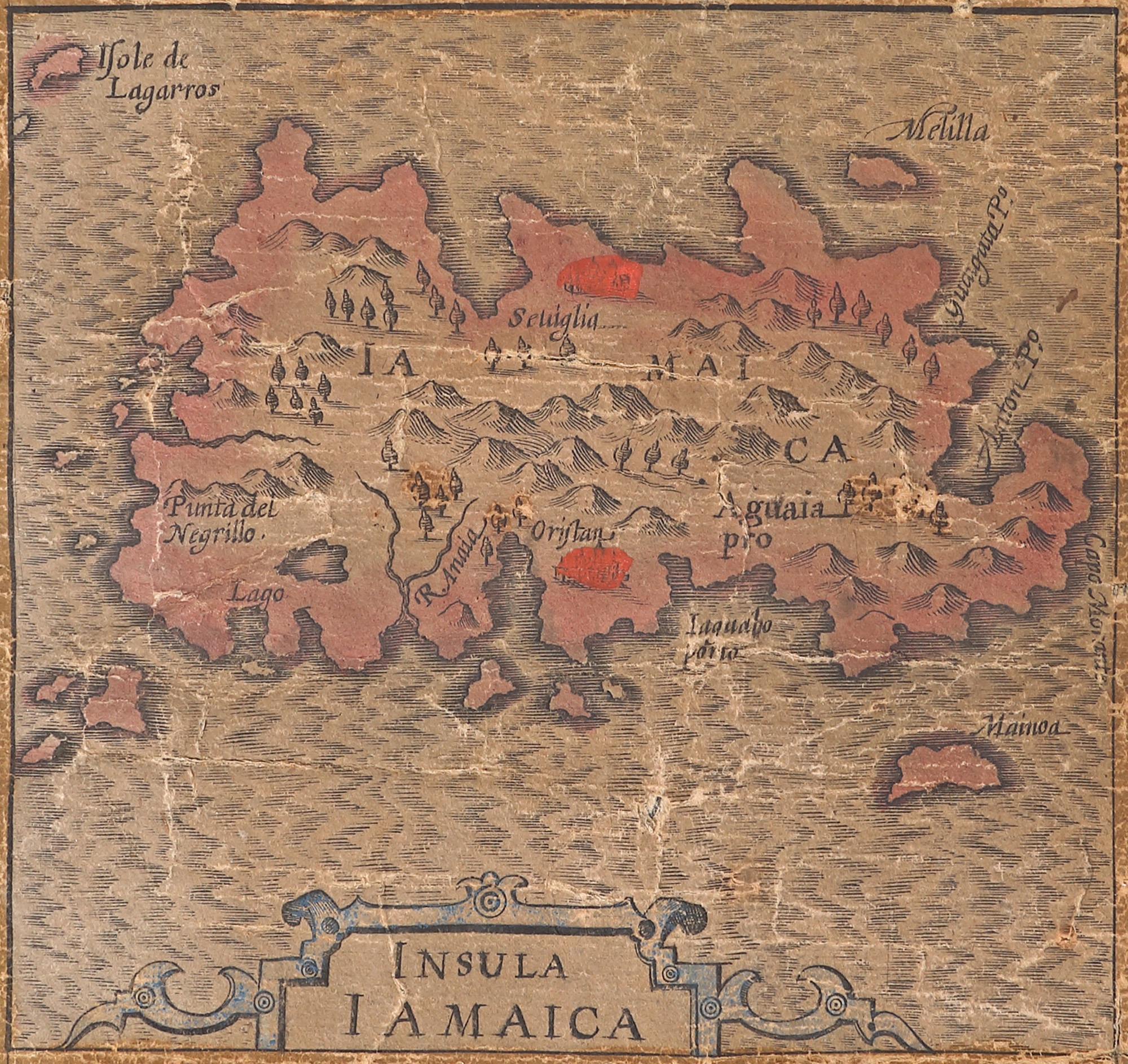
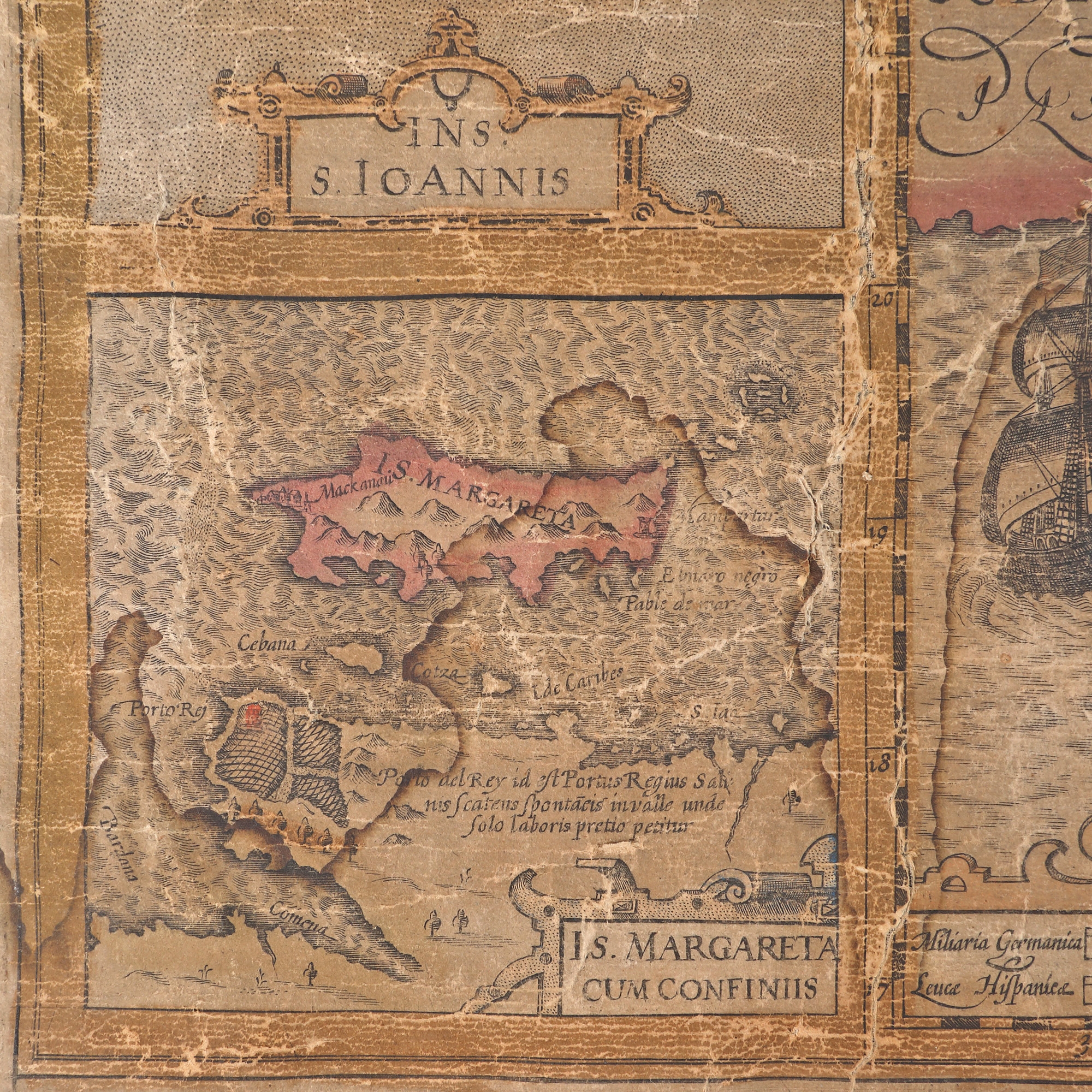
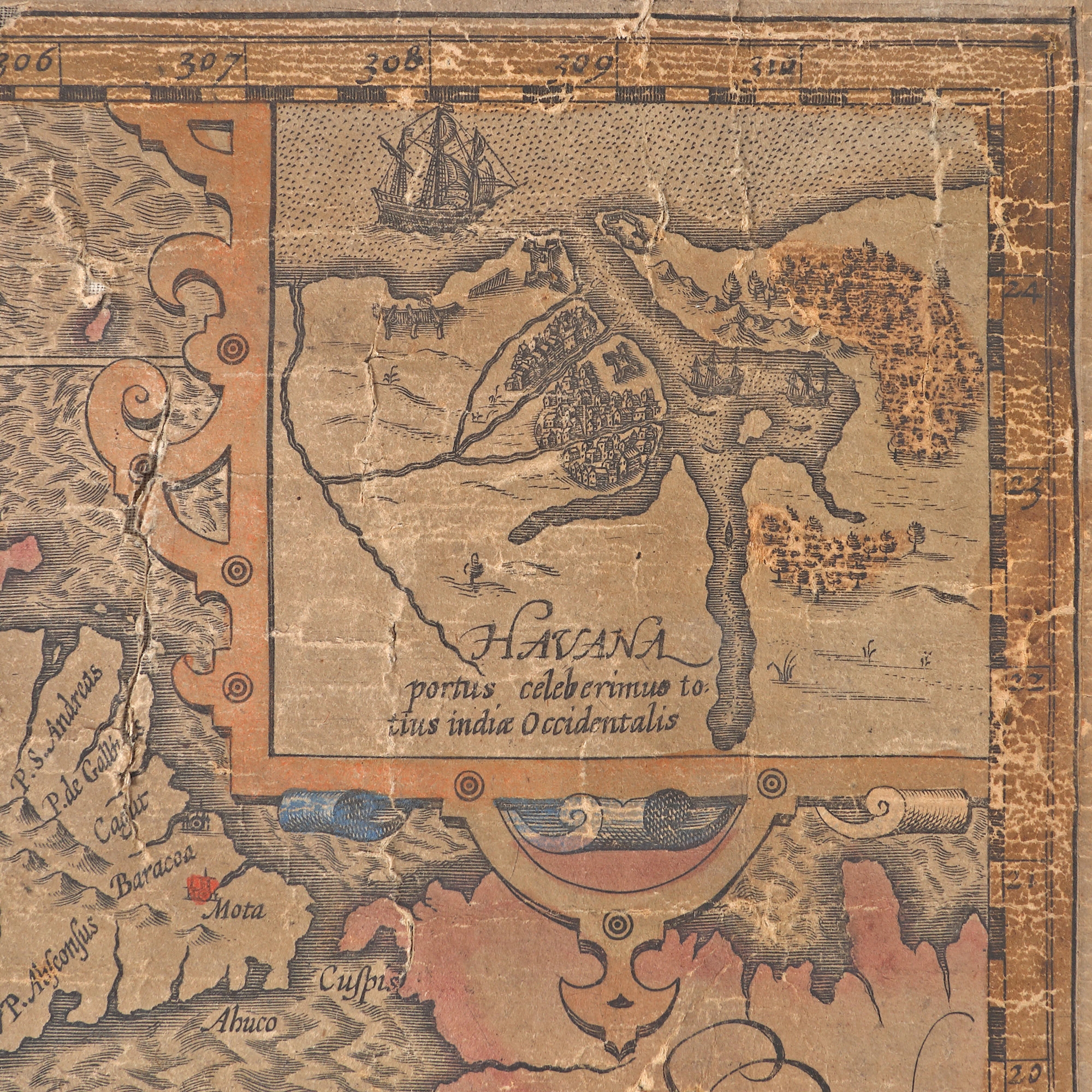
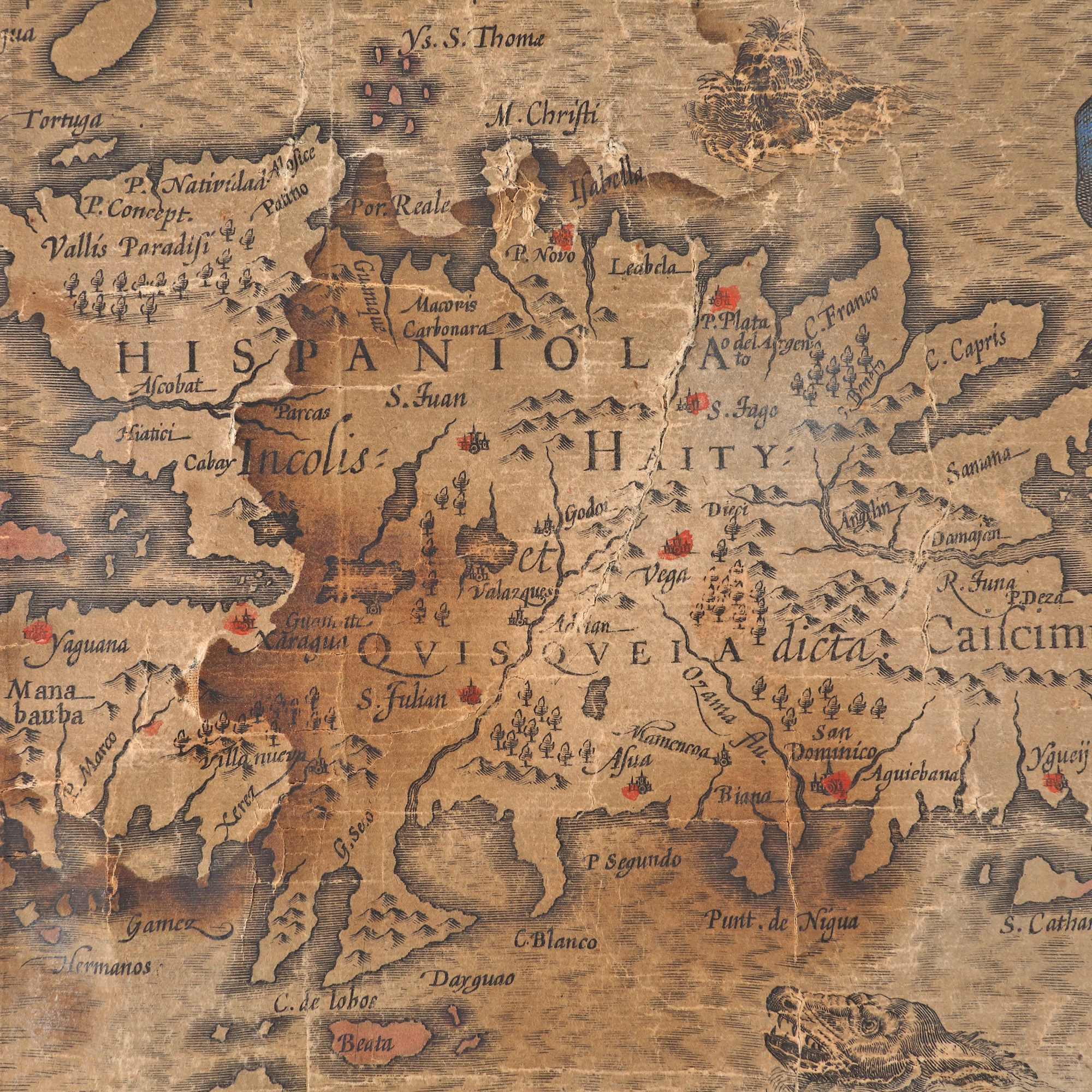
310. "Greater Antilles. The islands of Cuba, Hispaniola, Jamaica, St. John (Puerto Rico), Margaret (West Indies)" map by Gerardus Mercator, 1569, published by Hendrik Hondius II, Amsterdam, 1633
Prodajna cijena
EUR 450
Sesija
Pet., 31 ožujka 2023 12:00
Dimenzije
width 60 cm, height 44 cm
Opis
copper engraving, hand-coloured laid paper
DODATNE INFORMACIJE
Za pojašnjenja u vezi s postupkom licitiranja, troškovima kupnje, uvjetima jamstva, plaćanja i preuzimanja osvojenog lota preporučujemo da pažljivo pročitate/ponovno pročitate Pravilnik o licitiranju.
Za dodatne informacije o lotu i aukciji kontaktirajte Odjel umjetničkih savjetnika.
Detalii
DODATNE INFORMACIJE
Za pojašnjenja u vezi s postupkom licitiranja, troškovima kupnje, uvjetima jamstva, plaćanja i preuzimanja osvojenog lota preporučujemo da pažljivo pročitate/ponovno pročitate Pravilnik o licitiranju.
Za dodatne informacije o lotu i aukciji kontaktirajte Odjel umjetničkih savjetnika.
Dimenzije
width 60 cm, height 44 cm
Opis
copper engraving, hand-coloured laid paper
Alternativni lotovi
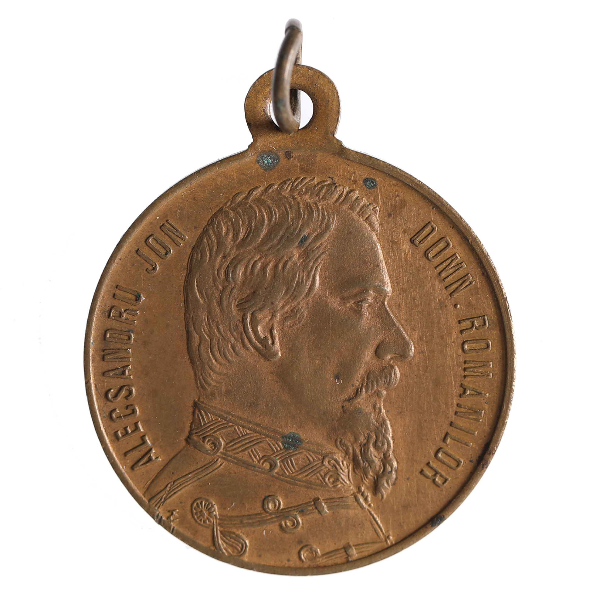
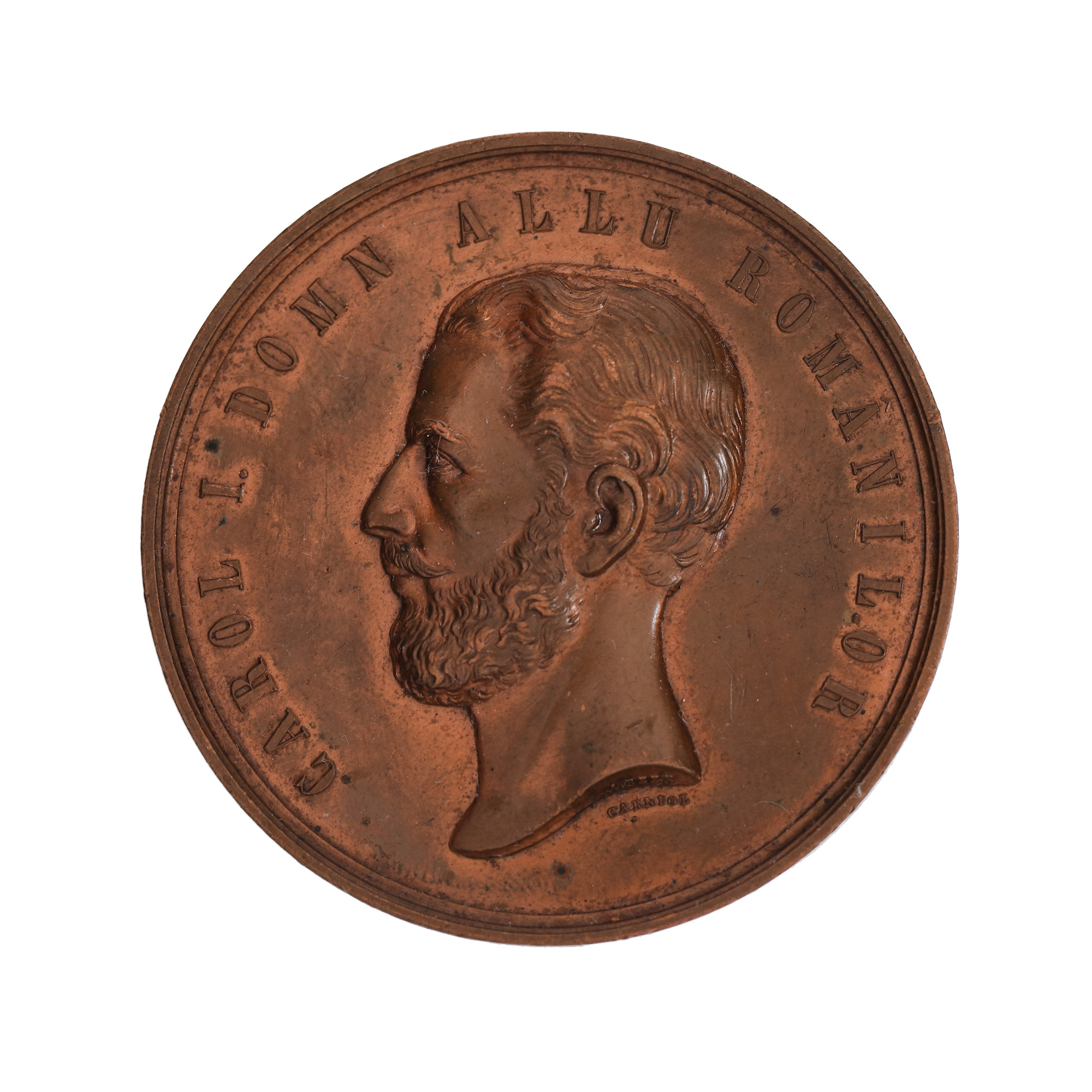
201. “Cuza Vodă" medal, issued on the occasion of the burial of the reigning prince in Ruginoasa in 1873
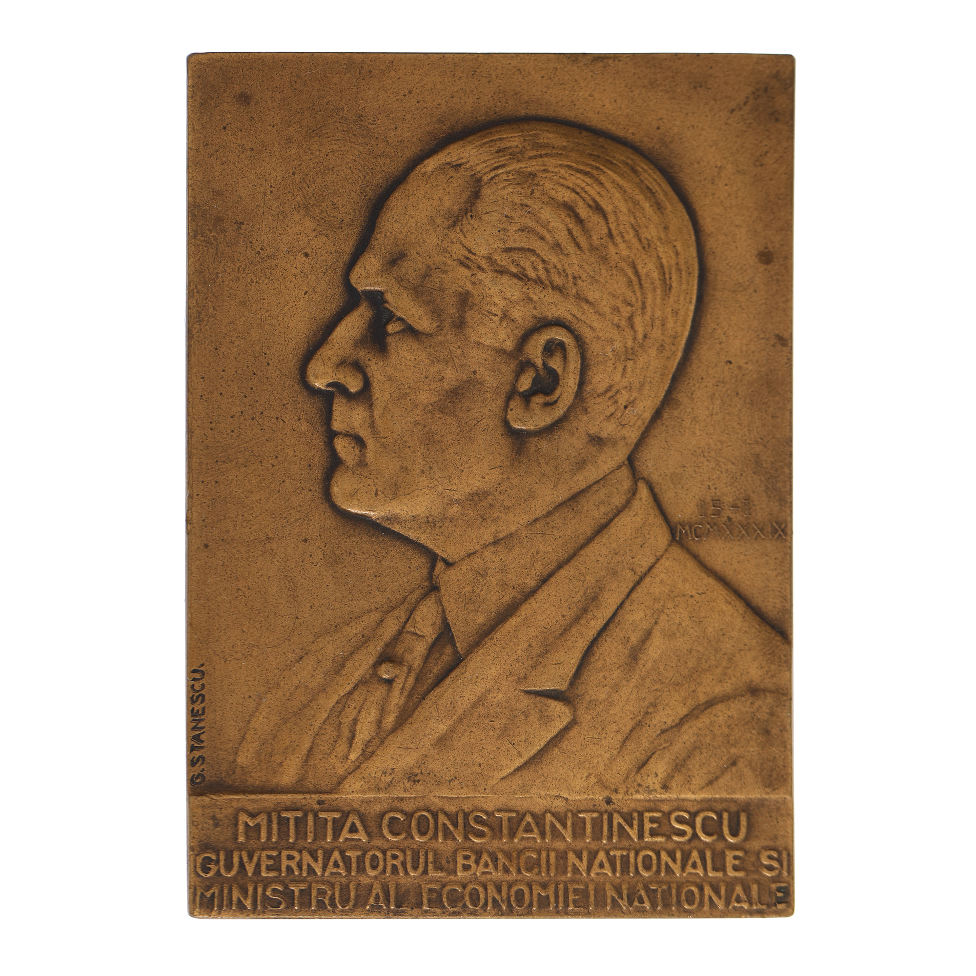
236. Plaque "Mitiță Constantinescu Governor of the National Bank and Minister of the National Economy", engraver Gheorghe Stănescu, 1939