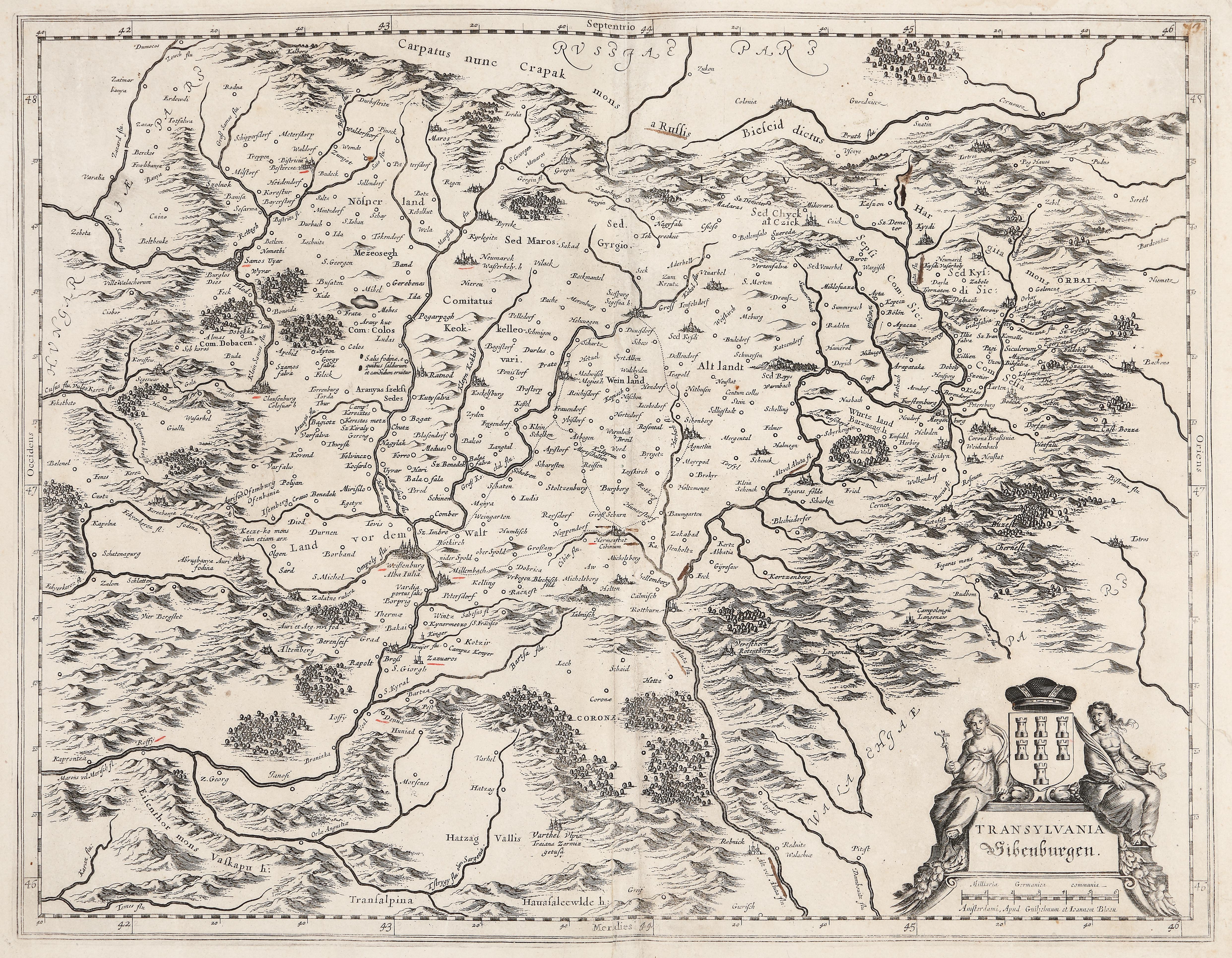
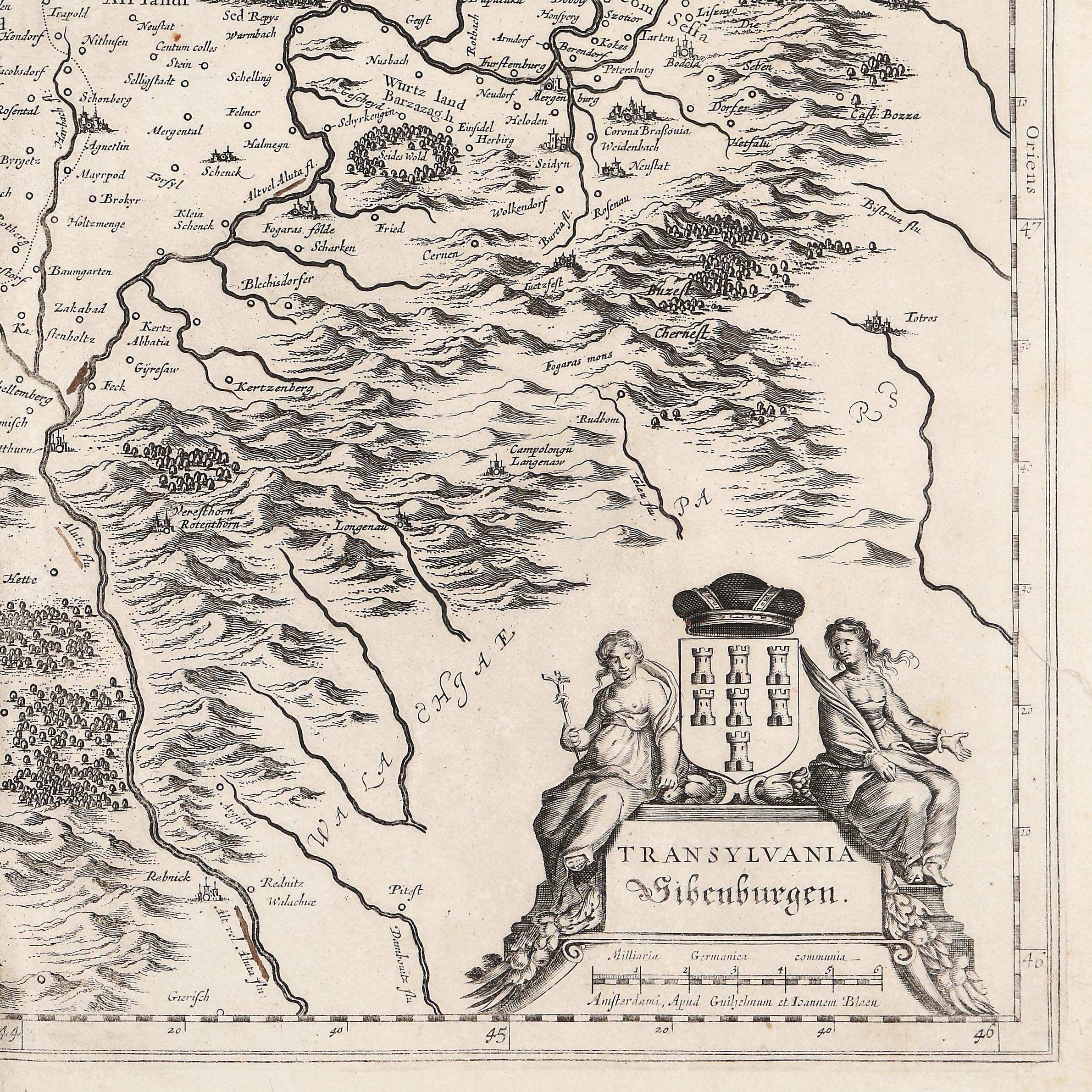
40. Map "Transylvania", by Willem Janszoon Blaeu, Amsterdam, approx. 1660, extremely rare collector's item
Početna cijena
EUR 250
Prodano
EUR 1.000
Sesija
Uto., 5 travnja 2022 19:00
Dimenzije
width 52 cm, height 41 cm
Opis
copper engraving, laid paper
DODATNE INFORMACIJE
Za pojašnjenja u vezi s postupkom licitiranja, troškovima kupnje, uvjetima jamstva, plaćanja i preuzimanja osvojenog lota preporučujemo da pažljivo pročitate/ponovno pročitate Pravilnik o licitiranju.
Za dodatne informacije o lotu i aukciji kontaktirajte Odjel umjetničkih savjetnika.
Detalii
DODATNE INFORMACIJE
Za pojašnjenja u vezi s postupkom licitiranja, troškovima kupnje, uvjetima jamstva, plaćanja i preuzimanja osvojenog lota preporučujemo da pažljivo pročitate/ponovno pročitate Pravilnik o licitiranju.
Za dodatne informacije o lotu i aukciji kontaktirajte Odjel umjetničkih savjetnika.
Dimenzije
width 52 cm, height 41 cm
Opis
copper engraving, laid paper
Alternativni lotovi
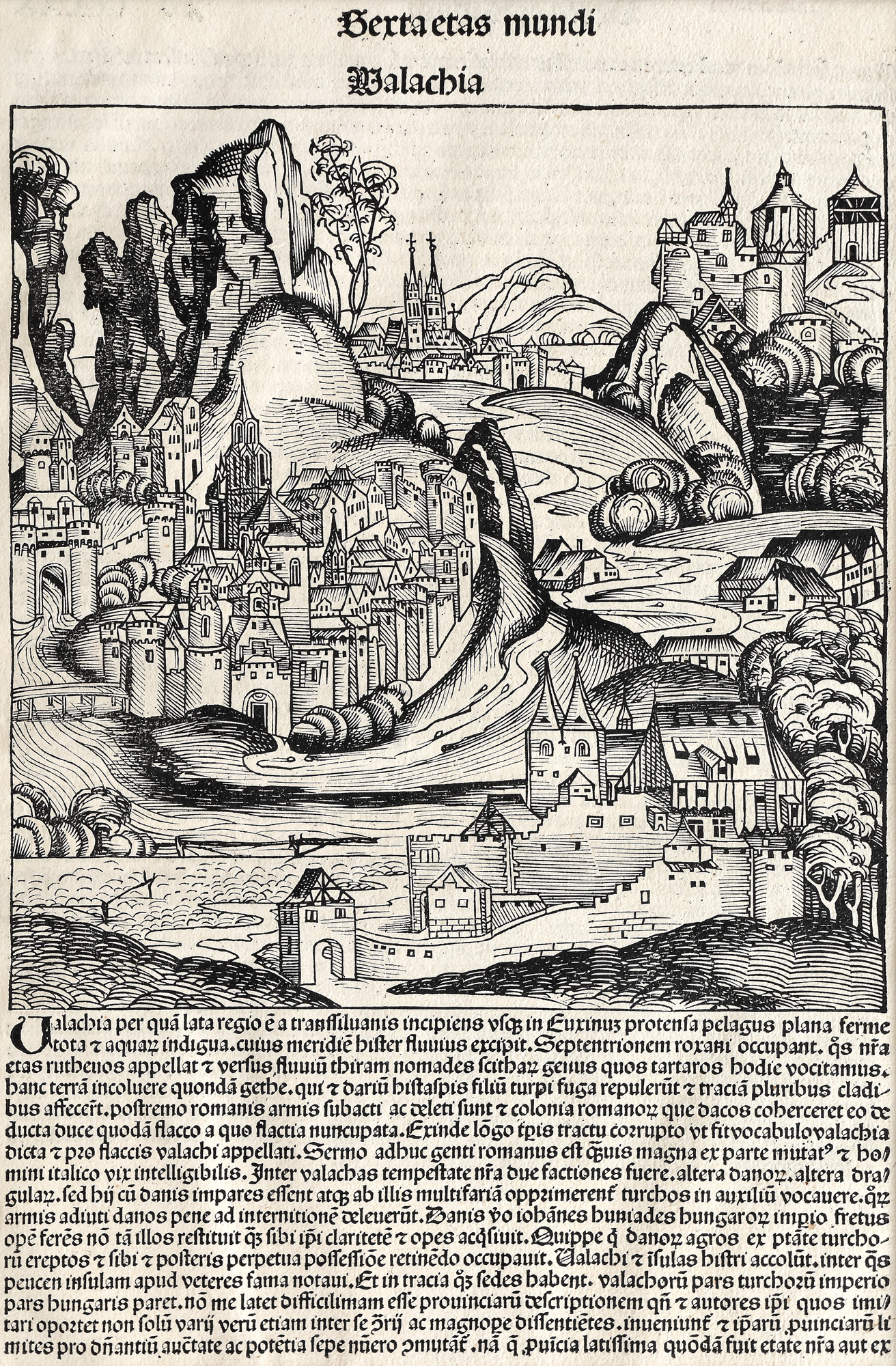
28. Incunabula leaf, "Wallachia", by Michael Wolgemut, Nürnberg, 1493
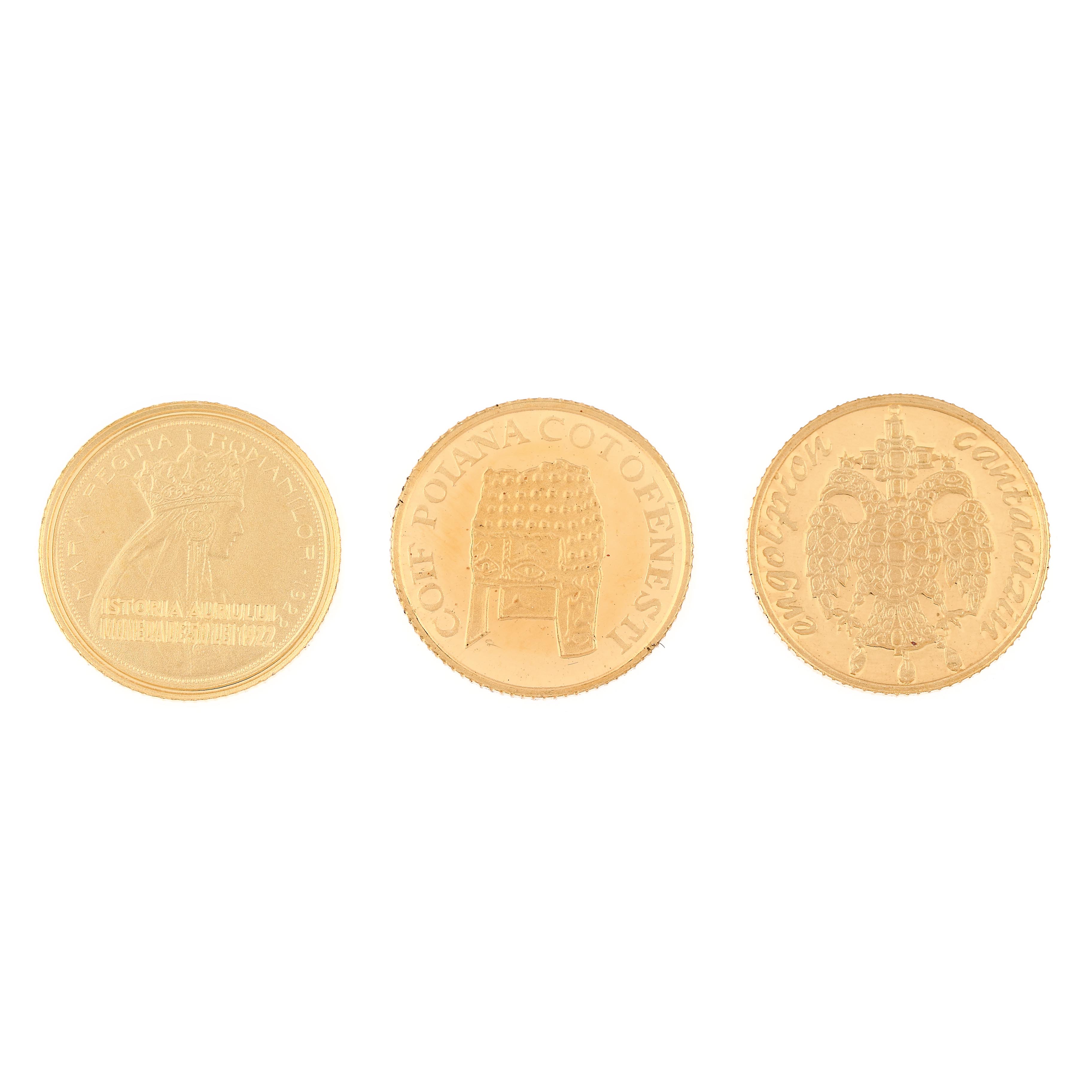
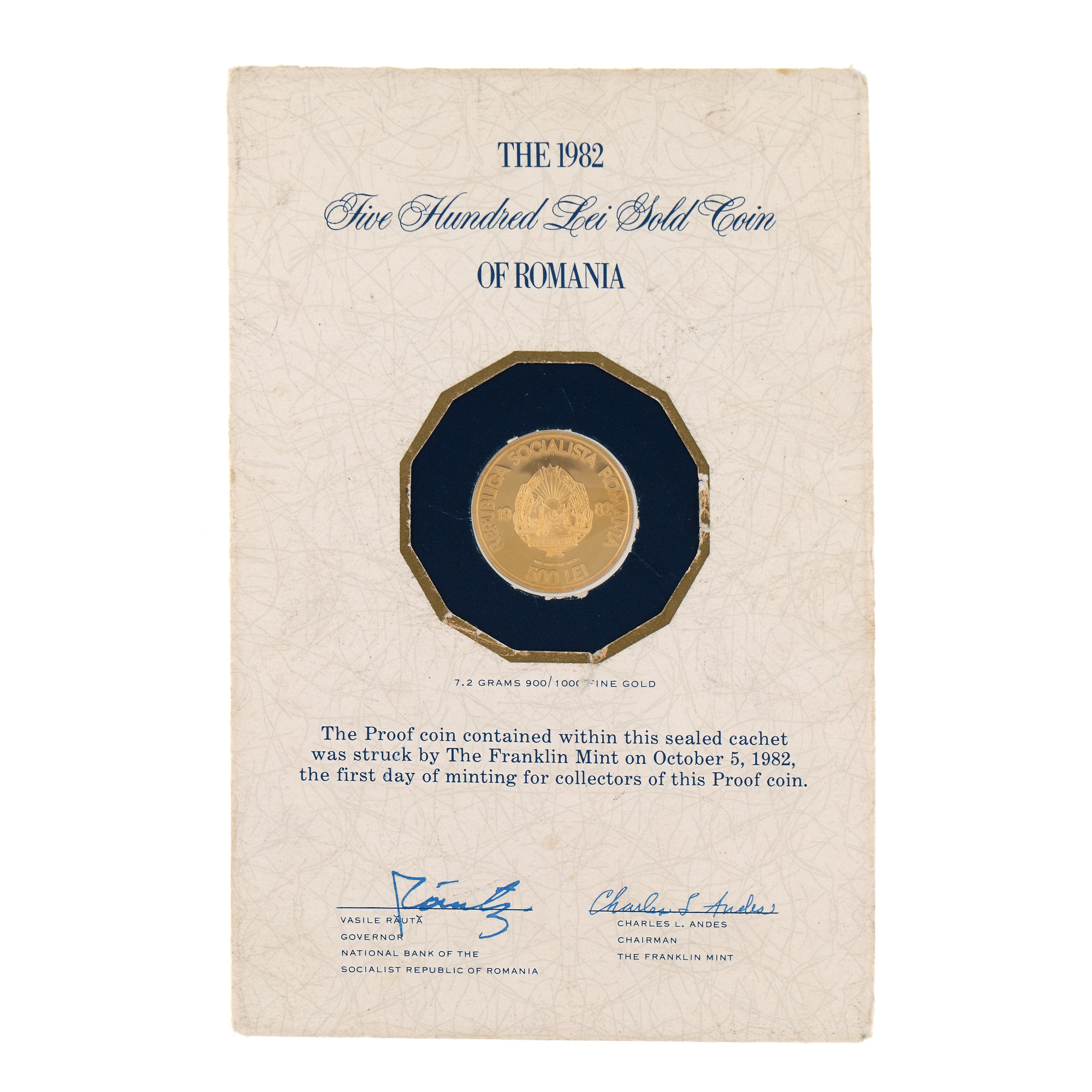
81. 3 gold coins, jubilee emissions issued by BNR – Gold History series

34. Map "Transylvania, Moldova, Wallachia and Bulgaria", by Matthäus Seutter, Augsburg, approx. 1735