

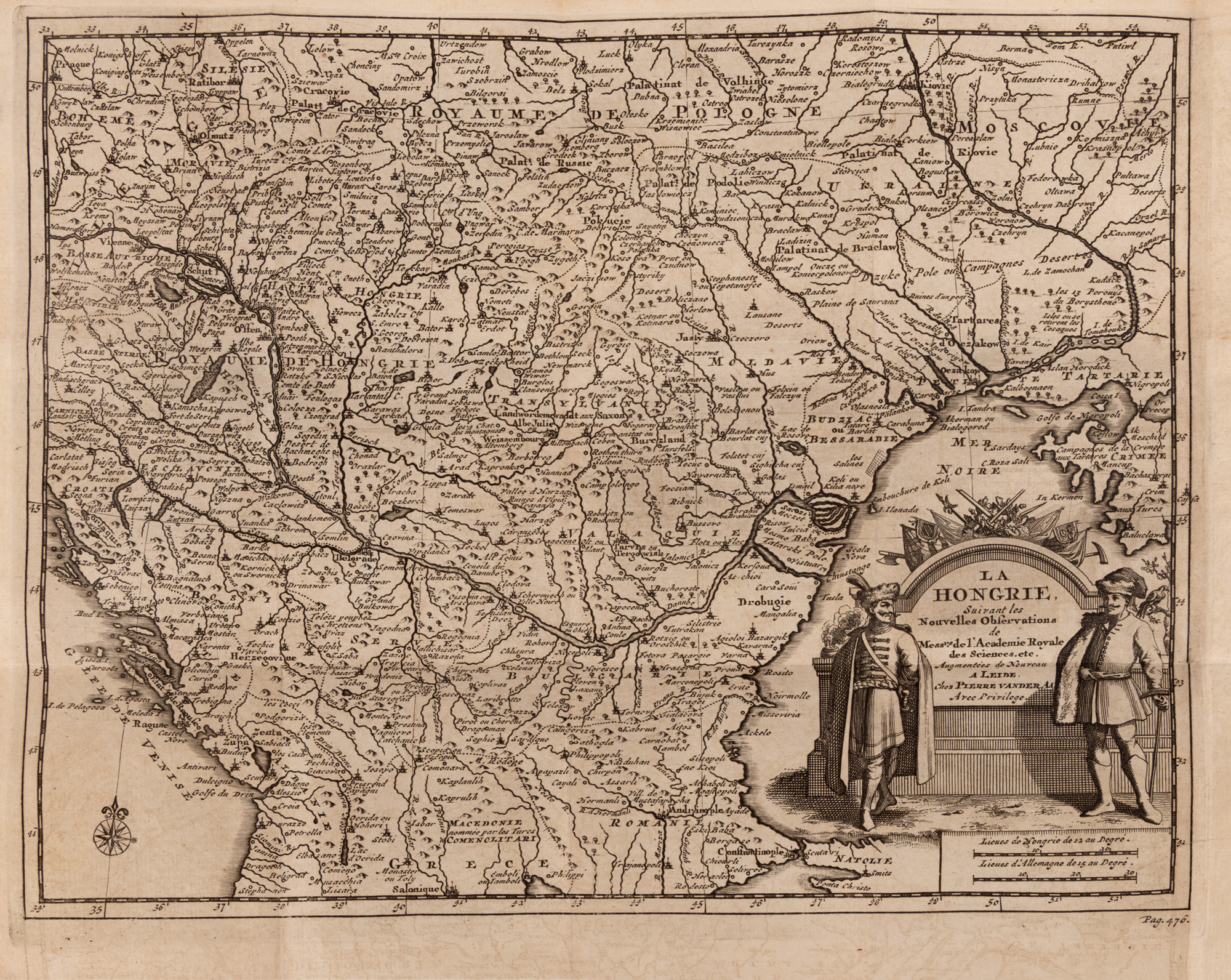
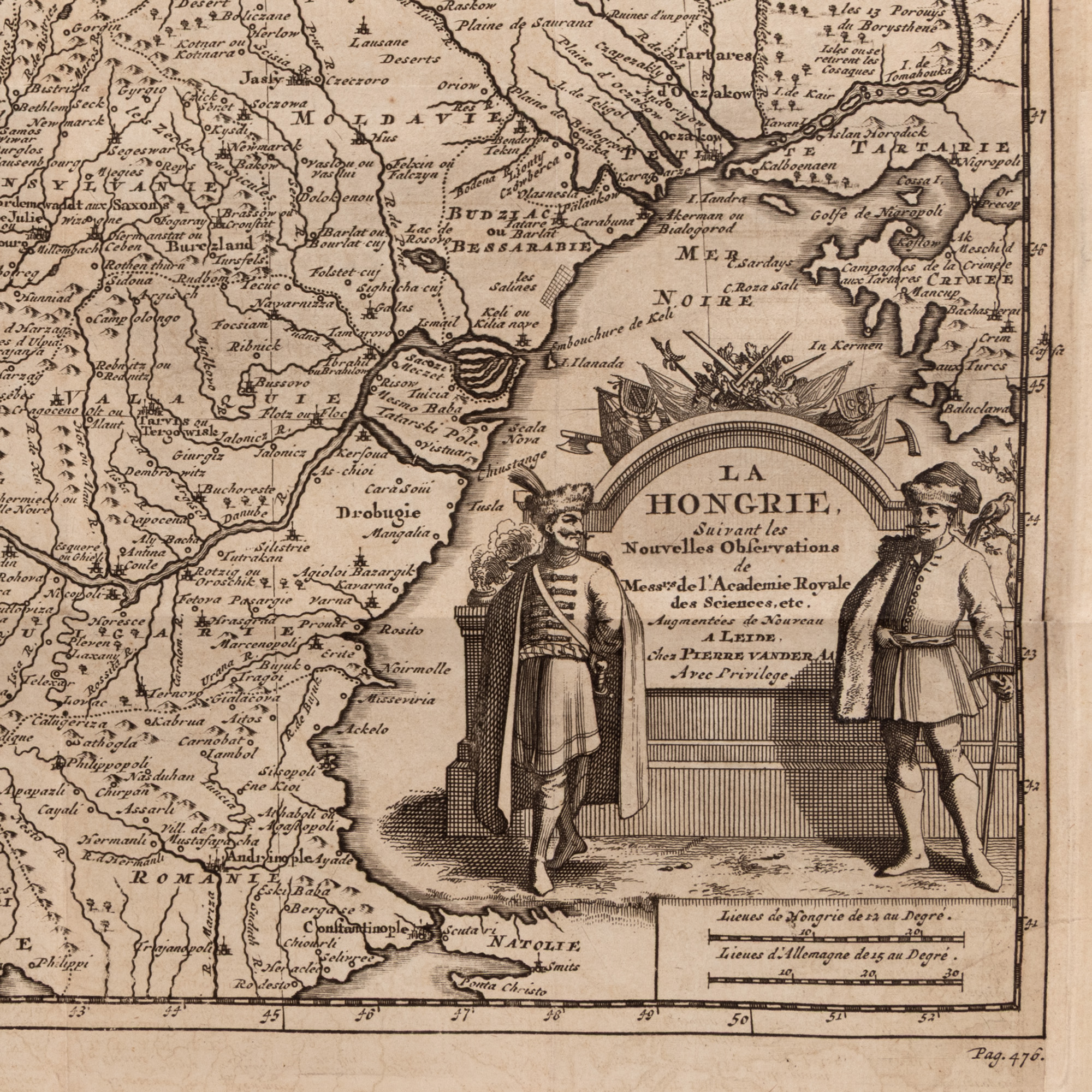
196. "Map 'Hungary', along with the Romanian Countries, by Pieter van der Aa, Leiden, circa 1714"
Početna cijena
EUR 200
Sesija
Sri., 1 srpnja 2026 19:00
0 Zile, 14 Ore, 9 Minute
VRIJEME PREOSTALO DO POČETKA AUKCIJE UŽIVO
Dimenzije
width 23.5 cm, height 24.5 cm
Opis
copper engraving, 23.50x24.50
DODATNE INFORMACIJE
Za pojašnjenja u vezi s postupkom licitiranja, troškovima kupnje, uvjetima jamstva, plaćanja i preuzimanja osvojenog lota preporučujemo da pažljivo pročitate/ponovno pročitate Pravilnik o licitiranju.
Za dodatne informacije o lotu i aukciji kontaktirajte Odjel umjetničkih savjetnika.
Detalii
DODATNE INFORMACIJE
Za pojašnjenja u vezi s postupkom licitiranja, troškovima kupnje, uvjetima jamstva, plaćanja i preuzimanja osvojenog lota preporučujemo da pažljivo pročitate/ponovno pročitate Pravilnik o licitiranju.
Za dodatne informacije o lotu i aukciji kontaktirajte Odjel umjetničkih savjetnika.
Dimenzije
width 23.5 cm, height 24.5 cm
Opis
copper engraving, 23.50x24.50
Alternativni lotovi
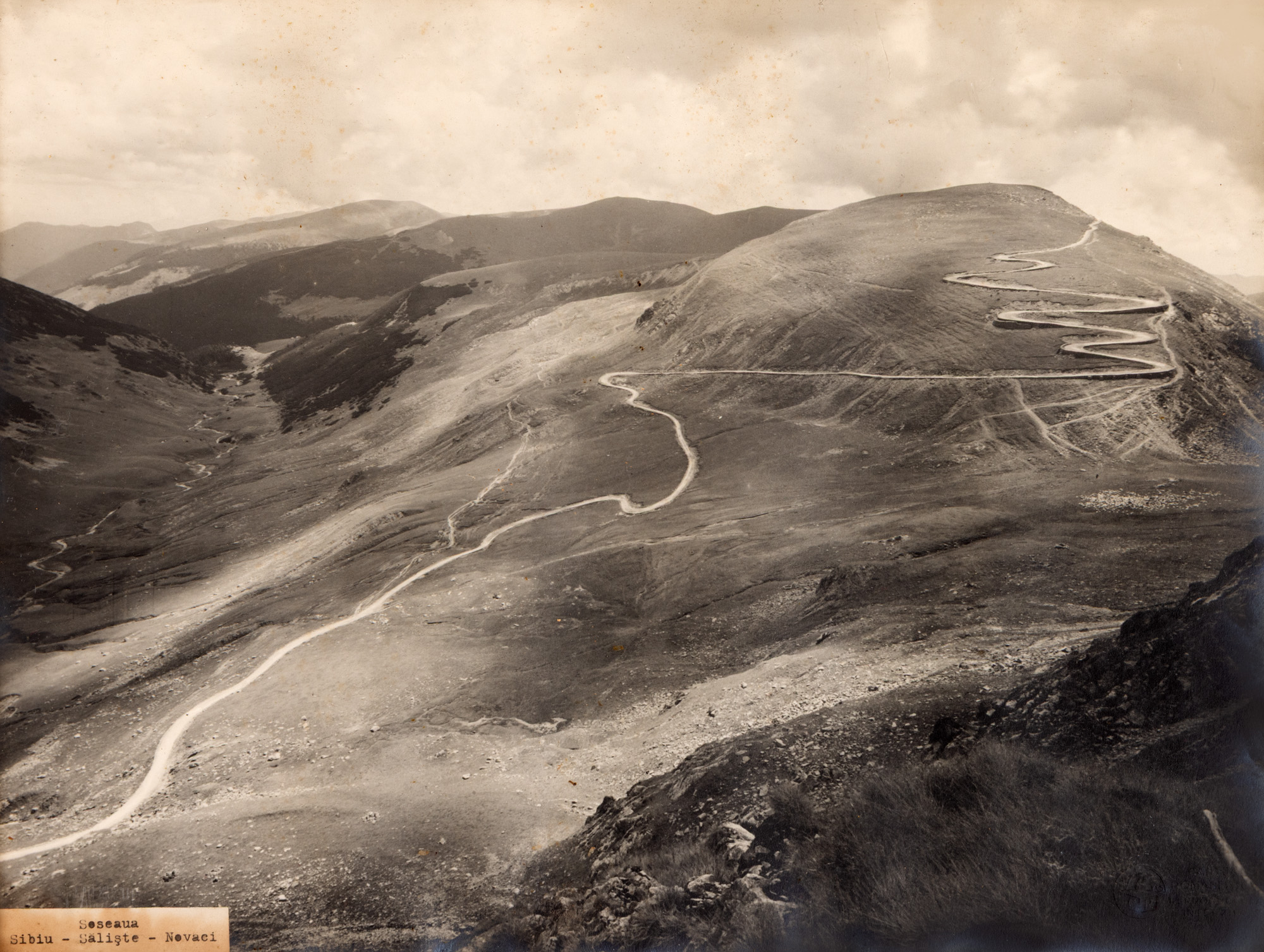
240. Photogravure illustrating the Sibiu-Săliște-Novaci road, by Alex Petit, photographic studio Cartea Românească, 1920s
0 Zile, 14 Ore, 9 Minute
VRIJEME PREOSTALO DO POČETKA AUKCIJE UŽIVO
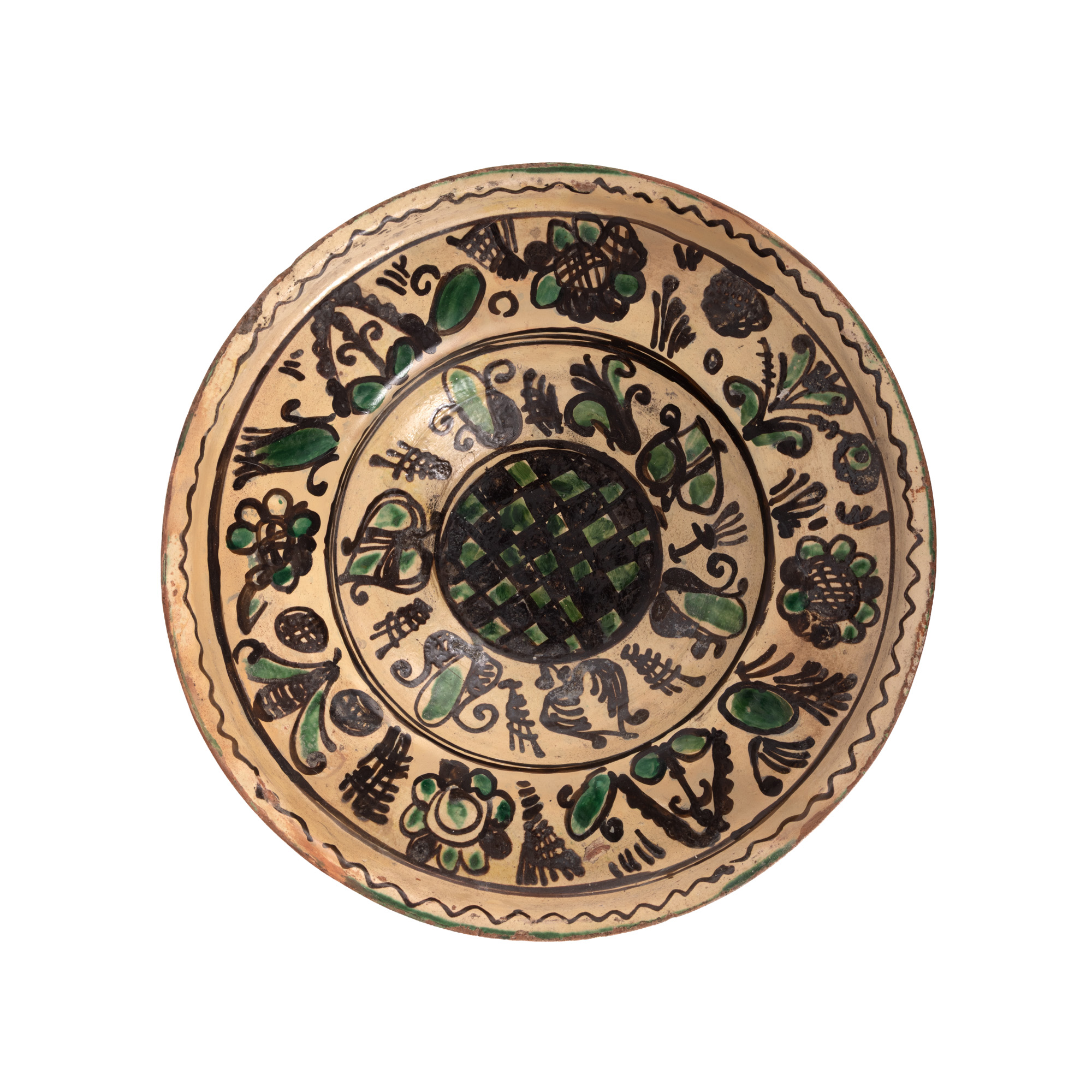
169. Large size plate, Țara Bârsei, 19th century
0 Zile, 14 Ore, 9 Minute
VRIJEME PREOSTALO DO POČETKA AUKCIJE UŽIVO
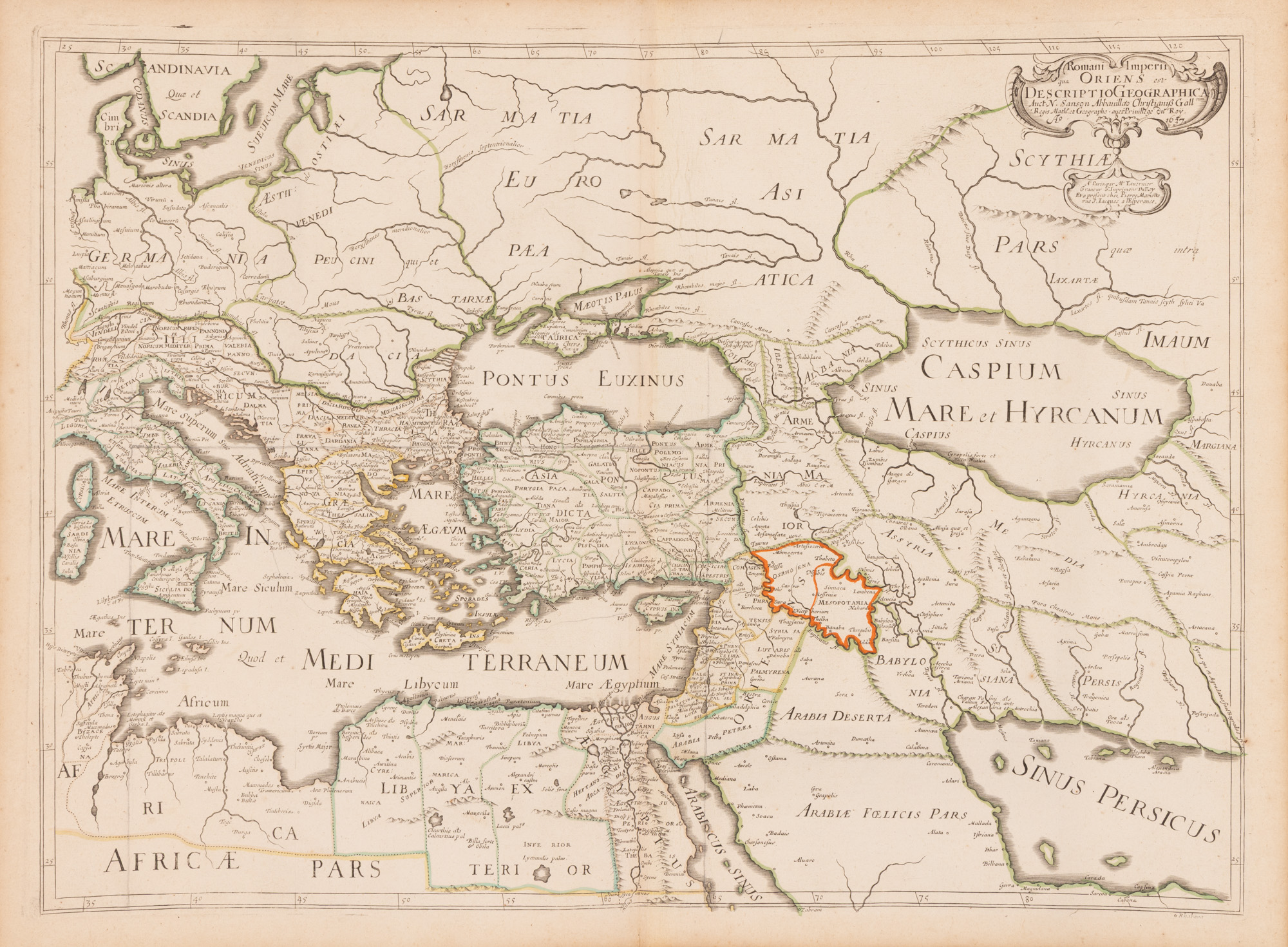
190. "Map 'Roman Empire, East (includes the Black Sea basin)', by Nicolas Sanson (considered the father of French cartography), Paris, 1637, rare collectible piece"
0 Zile, 14 Ore, 9 Minute
VRIJEME PREOSTALO DO POČETKA AUKCIJE UŽIVO
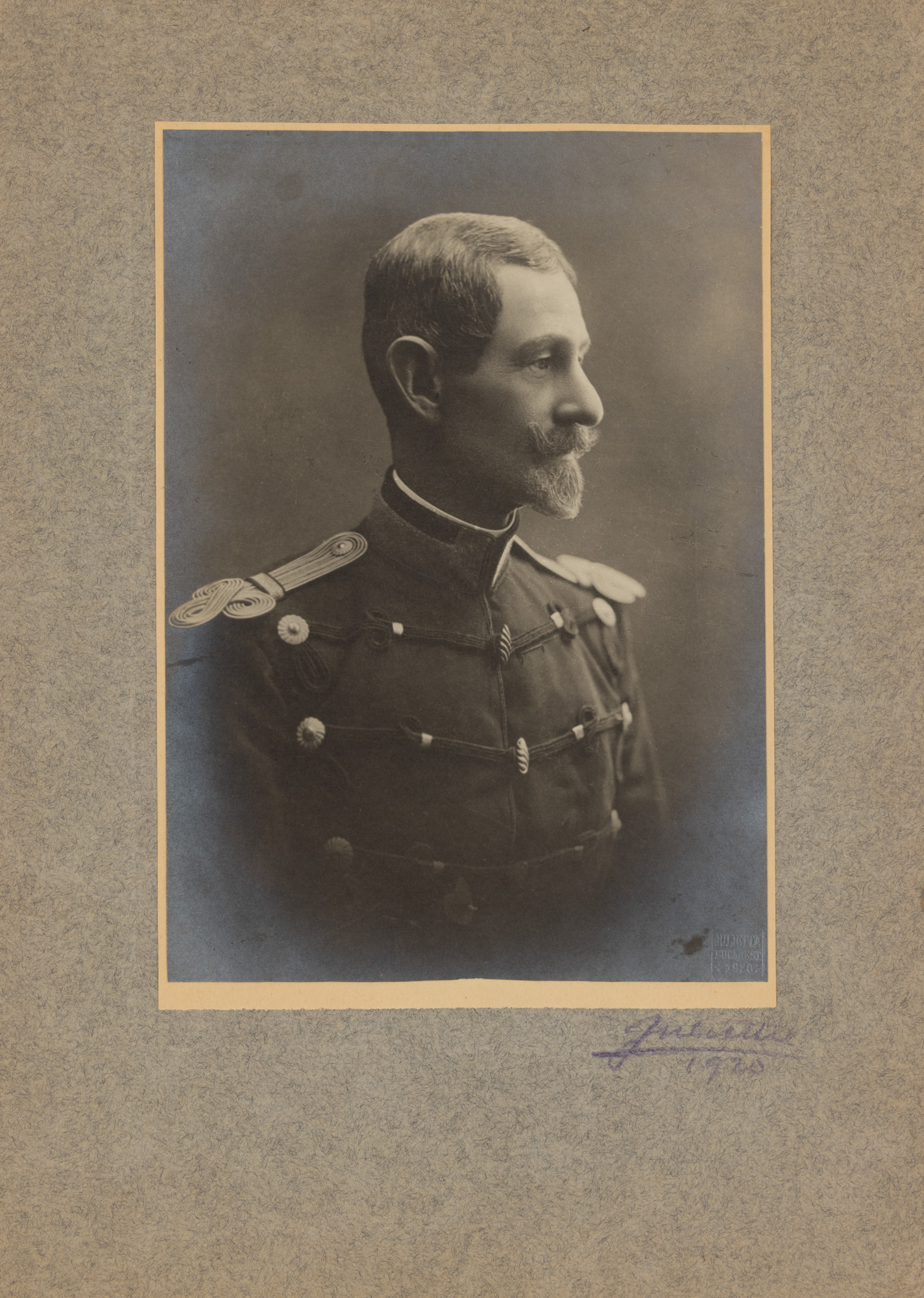
244. Photograph illustrating Marshal Alexandru Averescu, Julietta studio, Bucharest, 1920
0 Zile, 14 Ore, 9 Minute
VRIJEME PREOSTALO DO POČETKA AUKCIJE UŽIVO