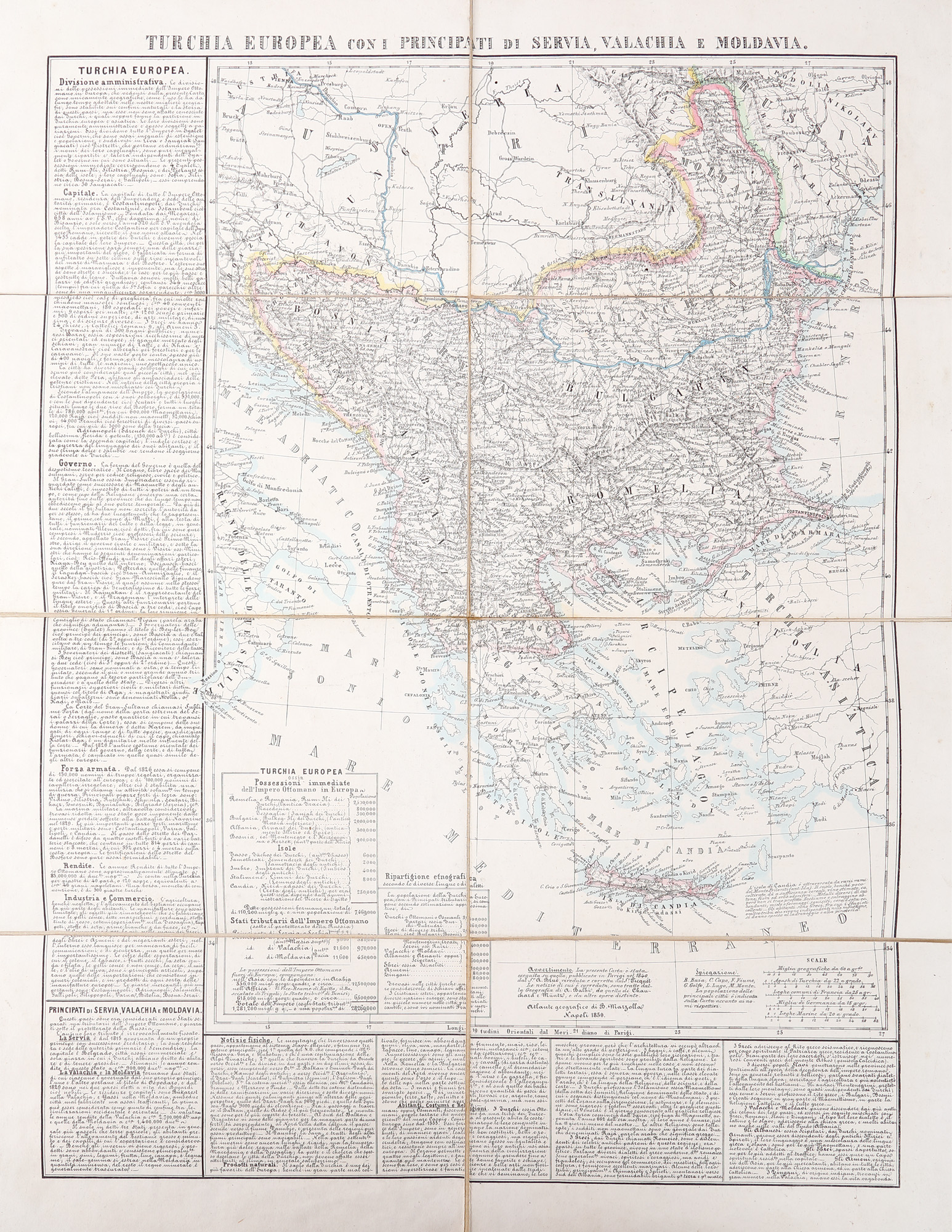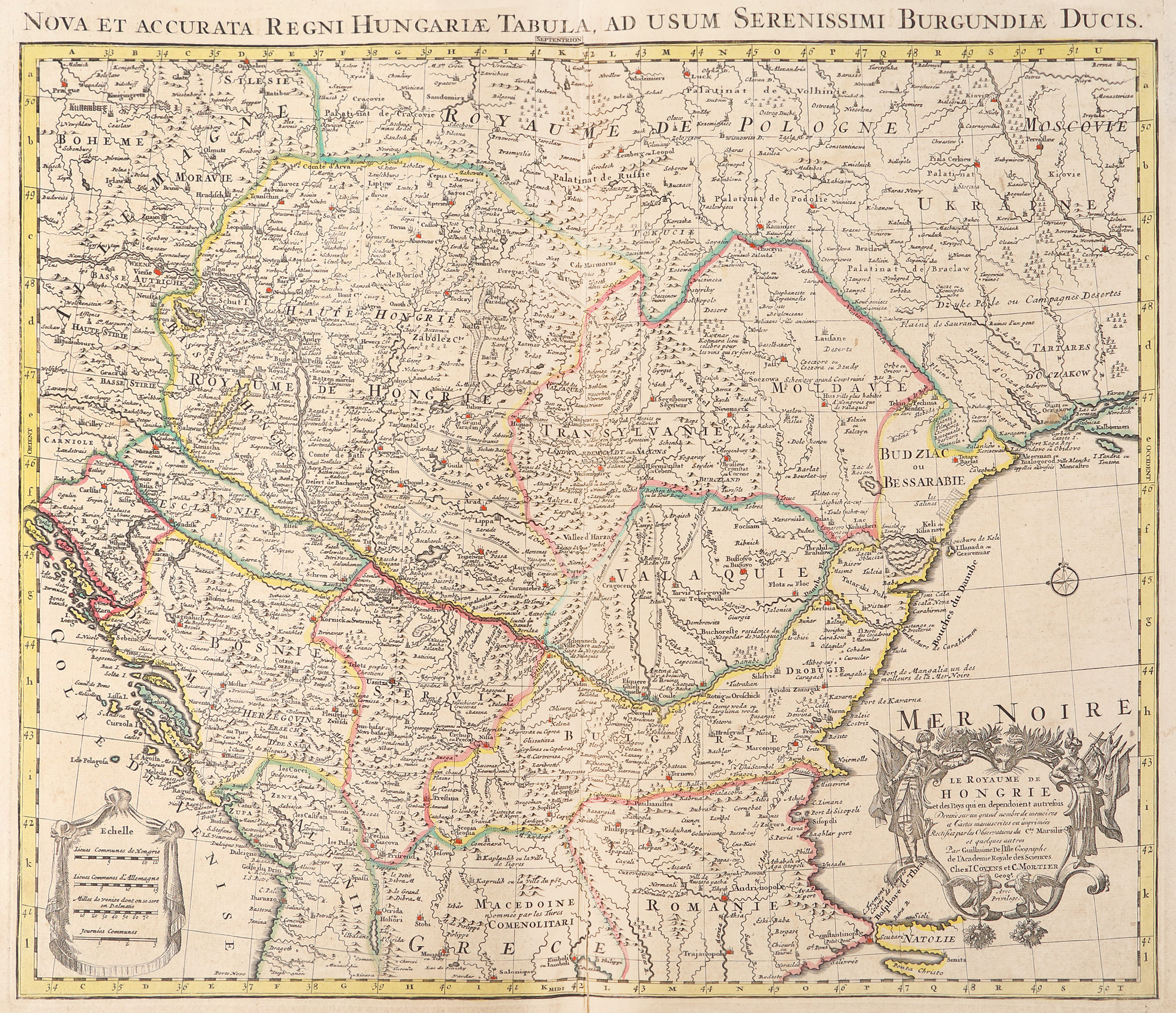
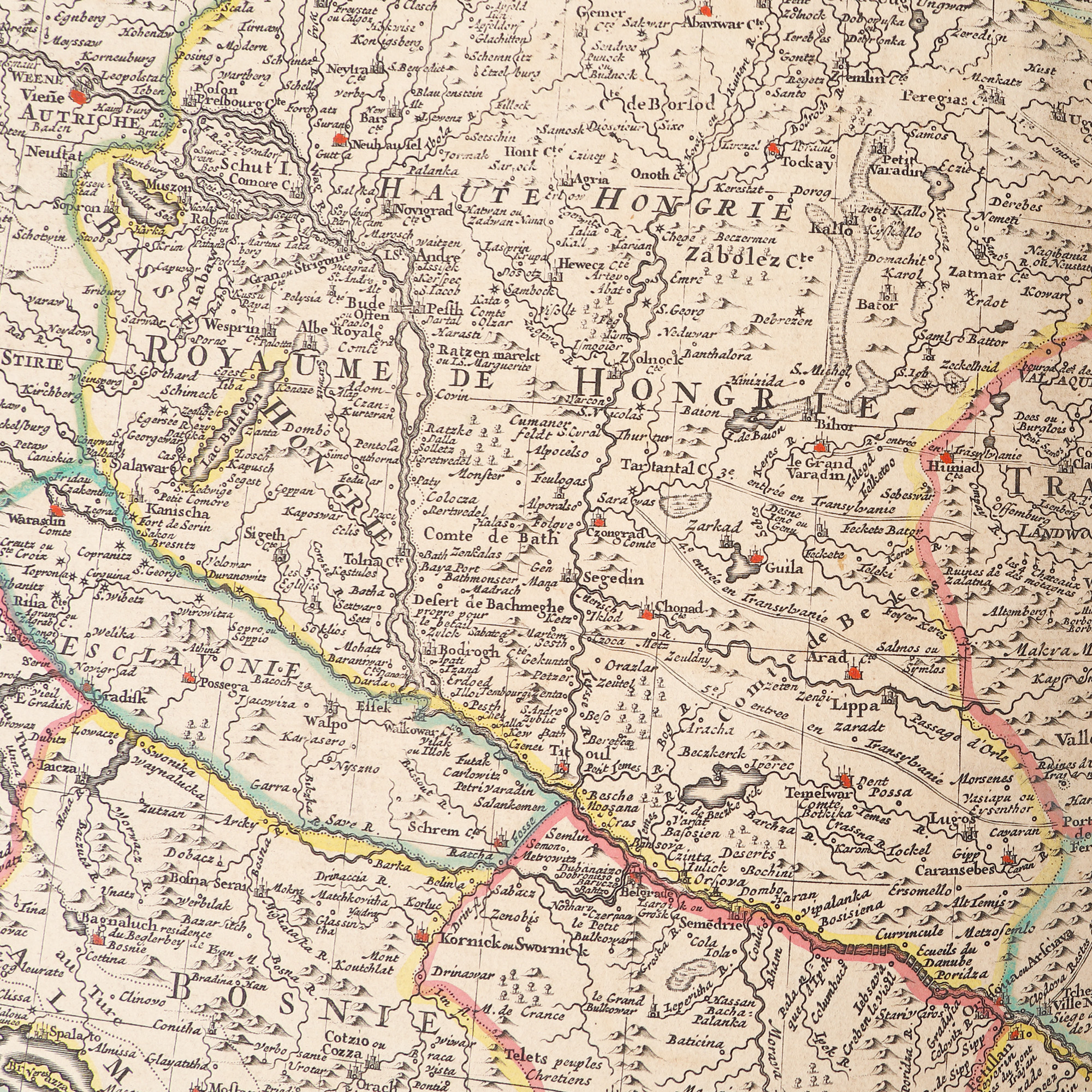
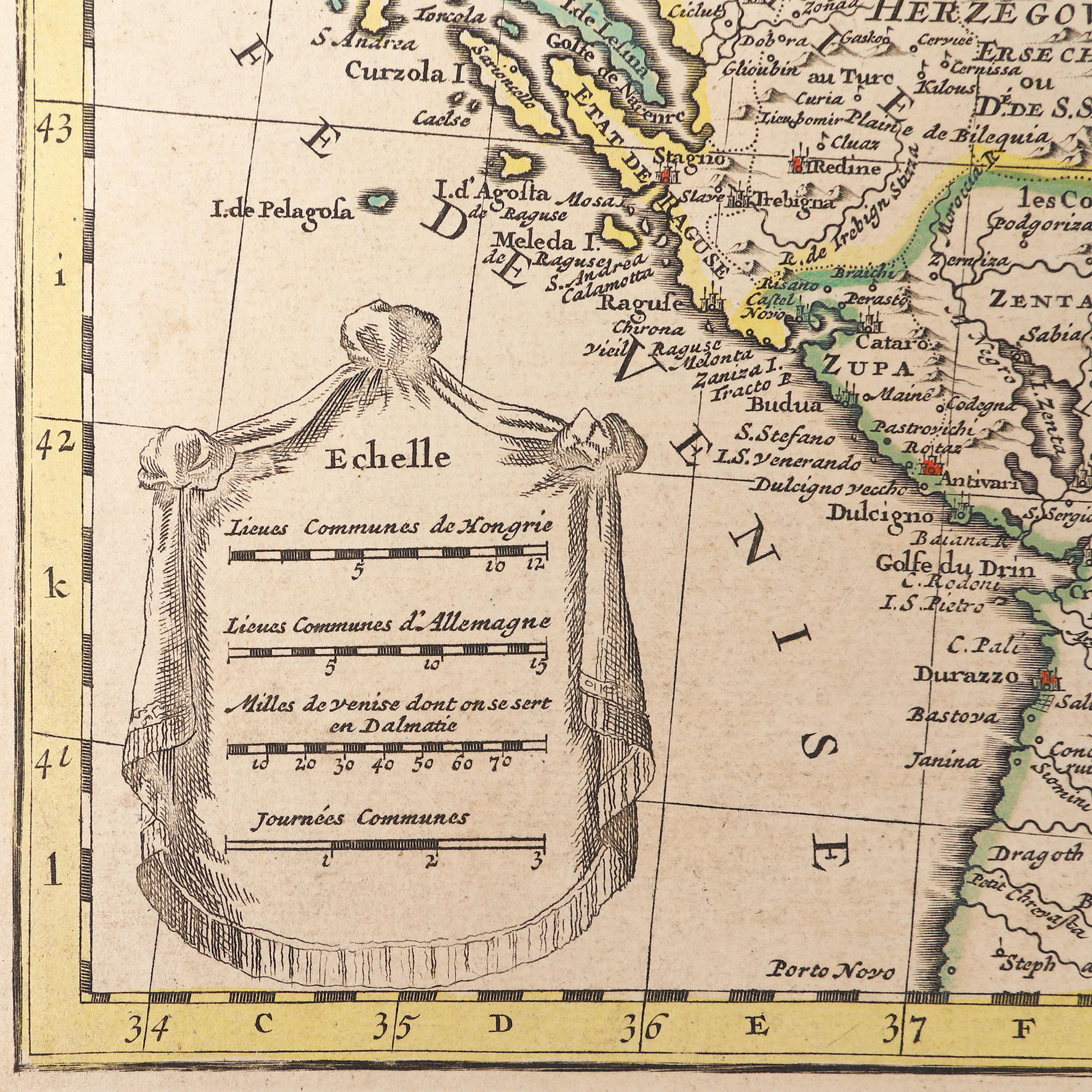
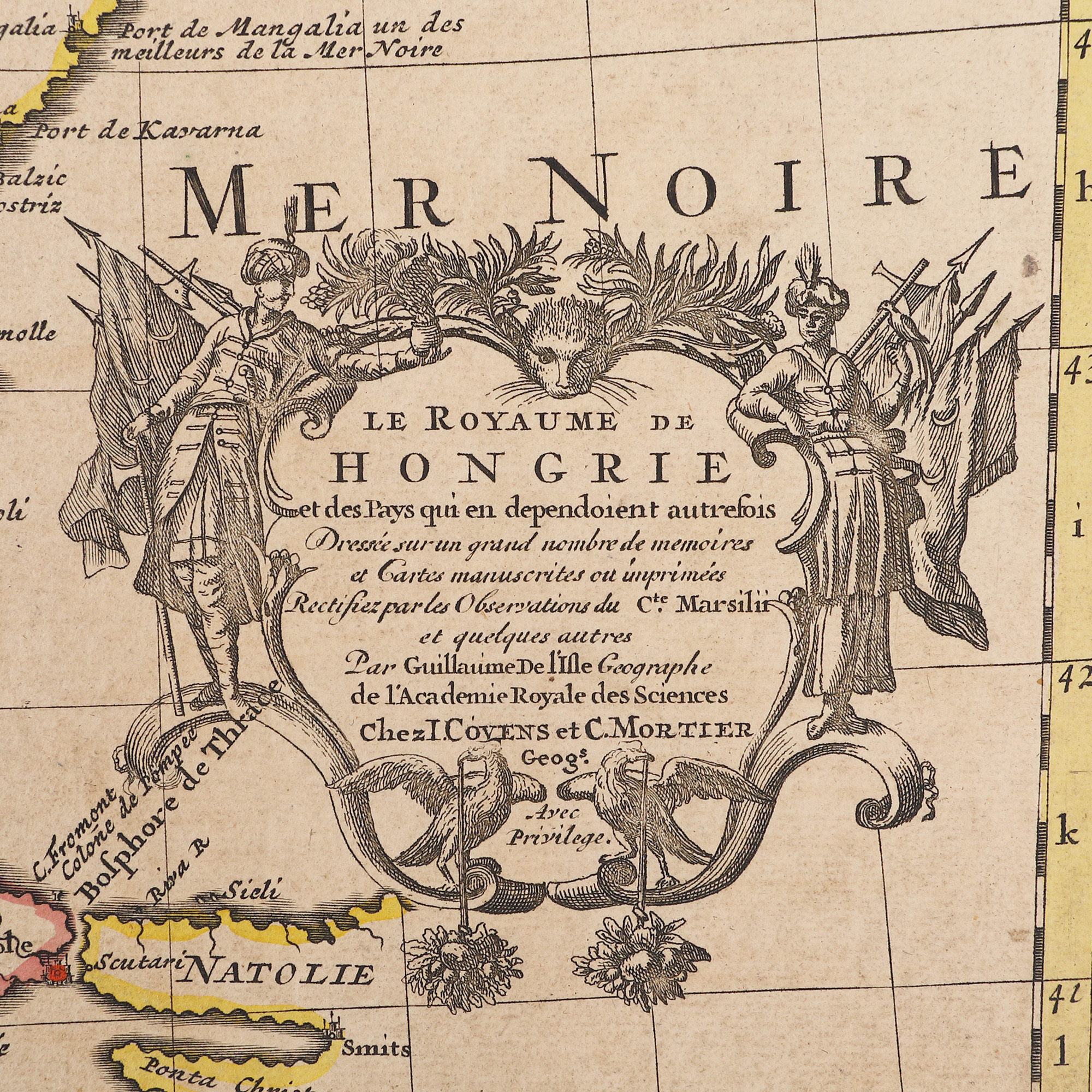
315. “Hungary” map, de Guillaume de l'Isle, Paris, 1703
Prodajna cijena
EUR 375
Sesija
Pet., 31 ožujka 2023 12:00
Opis
copper engraving, hand-coloured laid paper
DODATNE INFORMACIJE
Za pojašnjenja u vezi s postupkom licitiranja, troškovima kupnje, uvjetima jamstva, plaćanja i preuzimanja osvojenog lota preporučujemo da pažljivo pročitate/ponovno pročitate Pravilnik o licitiranju.
Za dodatne informacije o lotu i aukciji kontaktirajte Odjel umjetničkih savjetnika.
Detalii
DODATNE INFORMACIJE
Za pojašnjenja u vezi s postupkom licitiranja, troškovima kupnje, uvjetima jamstva, plaćanja i preuzimanja osvojenog lota preporučujemo da pažljivo pročitate/ponovno pročitate Pravilnik o licitiranju.
Za dodatne informacije o lotu i aukciji kontaktirajte Odjel umjetničkih savjetnika.
Opis
copper engraving, hand-coloured laid paper
Alternativni lotovi
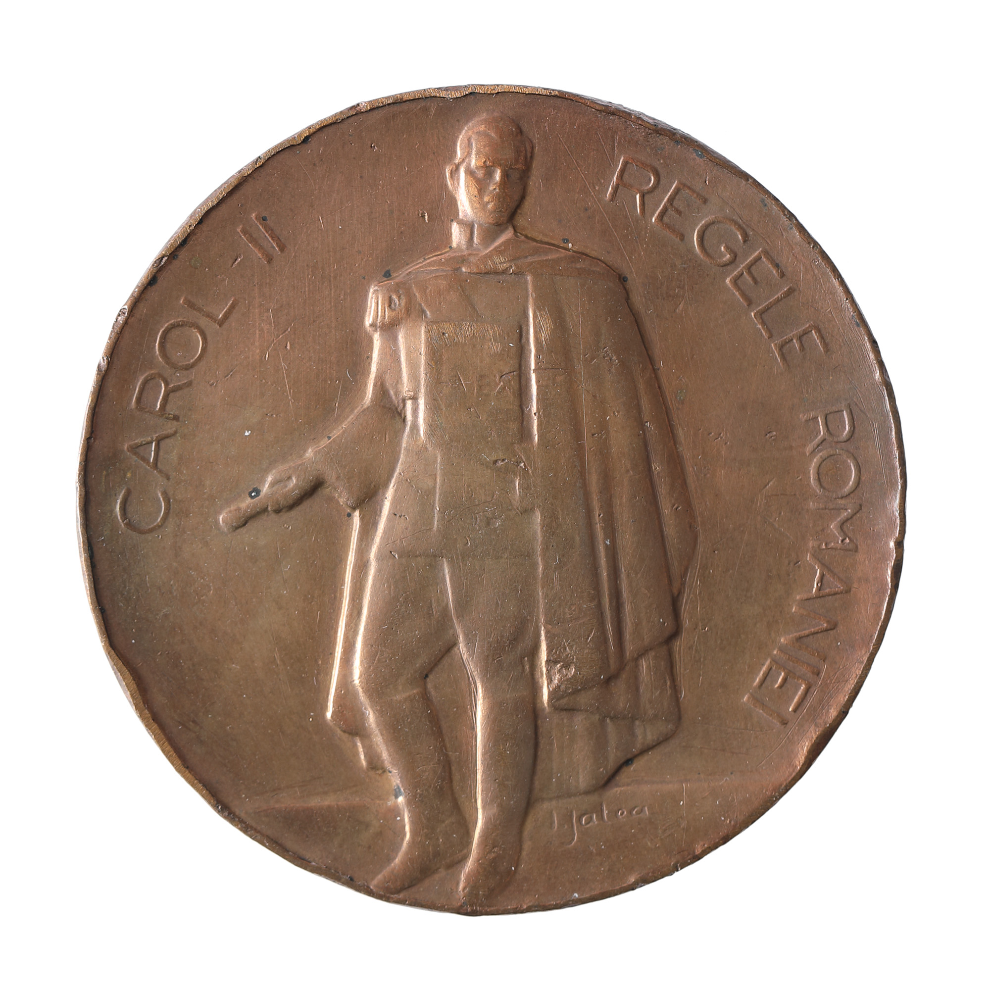
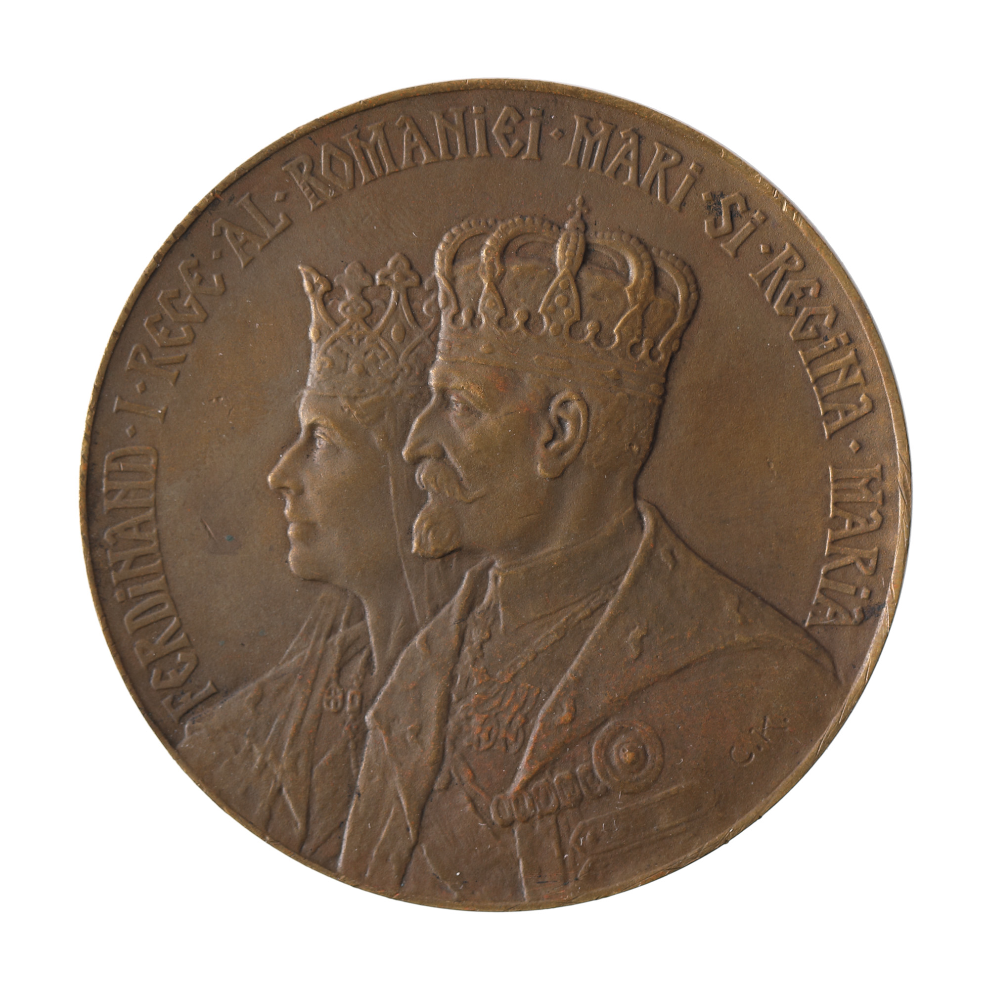
247. Medal "Tribute to King Carol II from the Senate of Romania", engraver Ion Jalea, 1939
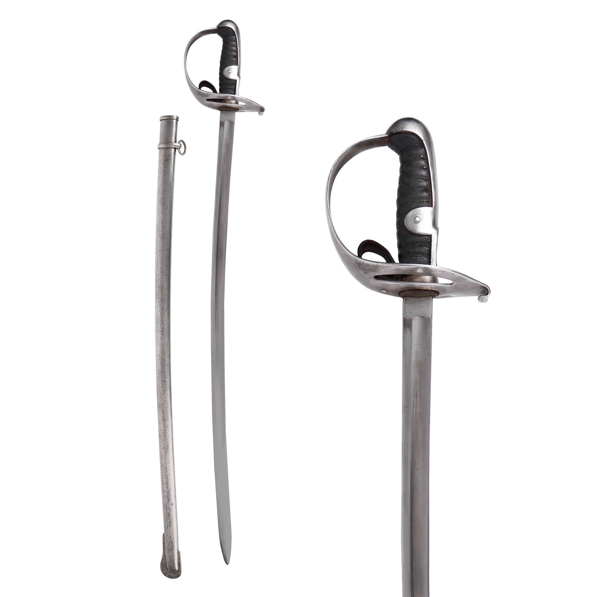
187. Cavalry officer's sabre with scabbard, late 19th century